Lemoore Station, California
Lemoore Station is a census-designated place (CDP) in Naval Air Station Lemoore, Kings County, California, United States. It is part of the Hanford–Corcoran Metropolitan Statistical Area. The population was 7,438 At the 2010 census.
Lemoore Station, California | |
|---|---|
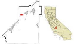 Location in Kings County and the U.S. state of California | |
 Lemoore Station, California Location in the United States | |
| Coordinates: 36°15′38″N 119°53′31″W | |
| Country | |
| State | |
| County | |
| Area | |
| • Total | 4.205 sq mi (10.892 km2) |
| • Land | 4.205 sq mi (10.892 km2) |
| • Water | 0 sq mi (0 km2) 0% |
| Elevation | 226 ft (69 m) |
| Population (2010) | |
| • Total | 7,438 |
| • Density | 1,800/sq mi (680/km2) |
| Time zone | UTC-8 (Pacific (PST)) |
| • Summer (DST) | UTC-7 (PDT) |
| ZIP code | 93245 |
| Area code(s) | 559 |
| FIPS code | 06-41166 |
| U.S. Geological Survey Geographic Names Information System: Lemoore Station, California | |
Geography
Lemoore Station is located at 36°15′38″N 119°53′31″W (36.260534, -119.891936).[2]
According to the United States Census Bureau, the CDP has a total area of 4.2 square miles (11 km2), all of it land.
Climate
According to the Köppen Climate Classification system, Lemoore Station has a semi-arid climate, abbreviated "BSk" on climate maps.[3]
Demographics
| Historical population | |||
|---|---|---|---|
| Census | Pop. | %± | |
| U.S. Decennial Census[4] | |||
2010
At the 2010 census Lemoore Station had a population of 7,438. The population density was 1,768.7 people per square mile (682.9/km²). The racial makeup of Lemoore Station was 4,883 (65.6%) White, 729 (9.8%) African American, 70 (0.9%) Native American, 560 (7.5%) Asian, 53 (0.7%) Pacific Islander, 418 (5.6%) from other races, and 725 (9.7%) from two or more races. Hispanic or Latino of any race were 1,445 persons (19.4%).[5]
The census reported that 5,495 people (73.9% of the population) lived in households, 1,923 (25.9%) lived in non-institutionalized group quarters, and 20 (0.3%) were institutionalized.
There were 1,585 households, 1,253 (79.1%) had children under the age of 18 living in them, 1,382 (87.2%) were opposite-sex married couples living together, 133 (8.4%) had a female householder with no husband present, 26 (1.6%) had a male householder with no wife present. There were 8 (0.5%) unmarried opposite-sex partnerships, and 11 (0.7%) same-sex married couples or partnerships. 37 households (2.3%) were one person and 1 (0.1%) had someone living alone who was 65 or older. The average household size was 3.47. There were 1,541 families (97.2% of households); the average family size was 3.52.
The age distribution was 2,407 people (32.4%) under the age of 18, 2,205 people (29.6%) aged 18 to 24, 2,682 people (36.1%) aged 25 to 44, 130 people (1.7%) aged 45 to 64, and 14 people (0.2%) who were 65 or older. The median age was 22.5 years. For every 100 females, there were 144.2 males. For every 100 females age 18 and over, there were 166.8 males.
There were 1,627 housing units at an average density of 386.9 per square mile, of the occupied units 5 (0.3%) were owner-occupied and 1,580 (99.7%) were rented.The homeowner vacancy rate was 0%; the rental vacancy rate was 2.1%. 19 people (0.3% of the population) lived in owner-occupied housing units and 5,476 people (73.6%) lived in rental housing units.
2000
At the 2000 census there were 5,749 people, 1,309 households, and 1,286 families in the CDP. The population density was 1,359.3 people per square mile (524.8/km²). There were 1,390 housing units at an average density of 328.6/sq mi (126.9/km²). The racial makeup of the CDP was 61.68% White, 10.96% African American, 1.30% Native American, 9.57% Asian, 0.77% Pacific Islander, 8.94% from other races, and 6.78% from two or more races. Hispanic or Latino of any race were 16.84%.[6]
Of the 1,309 households 80.1% had children under the age of 18 living with them, 92.2% were married couples living together, 3.7% had a female householder with no husband present, and 1.7% were non-families. 1.5% of households were one person and none had someone living alone who was 65 or older. The average household size was 3.56 and the average family size was 3.56.
The age distribution was 35.4% under the age of 18, 26.4% from 18 to 24, 36.7% from 25 to 44, 1.3% from 45 to 64, and 0.2% 65 or older. The median age was 22 years. For every 100 females, there were 138.6 males. For every 100 females age 18 and over, there were 158.3 males.
The median household income was $30,449 and the median family income was $30,407. Males had a median income of $21,035 versus $20,144 for females. The per capita income for the CDP was $12,682. About 5.7% of families and 6.3% of the population were below the poverty line, including 7.1% of those under age 18 and none of those age 65 or over.
Politics
In the state legislature, Lemoore Station is located in the 16th Senate District, which is represented by Republican Andy Vidak, and in the 32nd Assembly District, represented by Democrat Rudy Salas. Federally, Hanford is located in California's 21st congressional district and is represented by Republican David Valadao.
Lemoore Station is represented on the Kings County Board of Supervisors by Doug Verboon.
References
- U.S. Census Archived 2012-07-02 at the Wayback Machine
- "US Gazetteer files: 2010, 2000, and 1990". United States Census Bureau. 2011-02-12. Retrieved 2011-04-23.
- Climate Summary for Lemoore Station, California
- "Census of Population and Housing". Census.gov. Retrieved June 4, 2016.
- "2010 Census Interactive Population Search: CA - Lemoore Station CDP". U.S. Census Bureau. Archived from the original on July 15, 2014. Retrieved July 12, 2014.
- "U.S. Census website". United States Census Bureau. Retrieved 2008-01-31.
Municipalities and communities of Kings County, California, United States | ||
|---|---|---|
| Cities | 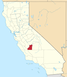 Kings County map | |
| CDPs | ||
| Unincorporated communities | ||
| Ghost towns | ||