Leite Lopes Airport
Dr. Leite Lopes–Ribeirão Preto State Airport (IATA: RAO, ICAO: SBRP) is the airport serving Ribeirão Preto, Brazil.
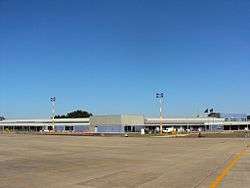
Dr. Leite Lopes–Ribeirão Preto State Airport Aeroporto Estadual Dr. Leite Lopes–Ribeirão Preto | |||||||||||
|---|---|---|---|---|---|---|---|---|---|---|---|
 | |||||||||||
| Summary | |||||||||||
| Airport type | Public | ||||||||||
| Operator | DAESP | ||||||||||
| Serves | Ribeirão Preto | ||||||||||
| Hub for | Passaredo Linhas Aéreas | ||||||||||
| Elevation AMSL | 550 m / 1,804 ft | ||||||||||
| Coordinates | 21°08′11″S 047°46′36″W | ||||||||||
| Website | DAESP RAO | ||||||||||
| Map | |||||||||||
 RAO Location in Brazil | |||||||||||
| Runways | |||||||||||
| |||||||||||
| Statistics (2016) | |||||||||||
| |||||||||||
It is operated by DAESP.
History
Dr. Leite Lopes State Airport was opened on April 2, 1939, and soon after, in 1940, the runway was extended for the first time.
In 1996 the whole airport complex received its major renovation in which the runway and adjoining taxiway were extended from 1,800m to 2,100m and a new larger apron was built.
In 2006 the width of the runway was enlarged to 45m and finally in July 2010 the renovation and enlargement of the terminal building was completed.[4]
Airlines and destinations
| Airlines | Destinations |
|---|---|
| Azul Brazilian Airlines | Campinas |
| LATAM Brasil | São Paulo–Congonhas |
| Voepass Linhas Aéreas | Rio de Janeiro–Santos Dumont, São Paulo–Guarulhos |
Access
The airport is located 10 km (6 mi) from downtown Ribeirão Preto.
See also
References
- "Estatísticas" (in Portuguese). DAESP. Retrieved 25 April 2017.
- "Aeroporto Estadual Dr. Leite Lopes–Ribeirão Preto" (in Portuguese). DAESP.
- "Lista de aeródromos públicos" (in Portuguese). ANAC.
- Castro, Danielle (20 January 2010). "Com mais passageiros" (in Portuguese). Gazeta de Ribeirão. Retrieved 4 September 2010.
External links
| Wikimedia Commons has media related to Leite Lopes Airport. |
- Airport information for SBRP at World Aero Data. Data current as of October 2006.Source: DAFIF.
- Airport information for SBRP at Great Circle Mapper. Source: DAFIF (effective October 2006).
- Current weather for SBRP at NOAA/NWS
- Accident history for RAO at Aviation Safety Network
- Dr. Leite Lopes Airport Photo Archive at airliners.net
This article is issued from Wikipedia. The text is licensed under Creative Commons - Attribution - Sharealike. Additional terms may apply for the media files.