Lecointe Island
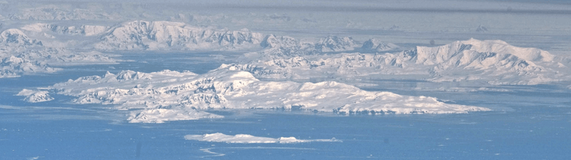
Lecointe Island is an elongated island, 7.27 km (4.52 mi) long between Cape Kaiser and Hvarchil Point, 2.2 km (1.4 mi) wide and 700 m (2,300 ft) high, separated from the east coast of Brabant Island by Pampa Passage, in the Palmer Archipelago, Antarctica.[1]
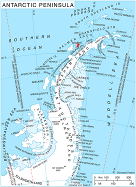 Location of Brabant Island | |
 Lecointe Island Location in Antarctica | |
| Geography | |
|---|---|
| Location | Antarctica |
| Coordinates | 64°14′38.93″S 62°3′10.23″W |
| Archipelago | Palmer Archipelago |
| Length | 7.27 km (4.517 mi) |
| Width | 2.2 km (1.37 mi) |
| Highest elevation | 700 m (2,300 ft) |
| Administration | |
| Administered under the Antarctic Treaty System | |
| Demographics | |
| Population | Uninhabited |
The island was first roughly surveyed by the Belgian Antarctic Expedition, 1897–99, which gave the name Cape Kaiser to its northern extremity. The island was surveyed and photographed by several British expeditions, 1955–58, and was named by the Falkland Islands Dependencies Survey for Georges Lecointe, second-in-command and surveyor of the Belgian expedition which was responsible for the first survey of Gerlache Strait.
It is also known as Isla Kaiser and Isla Alice.
Maps
- Antarctic Digital Database (ADD). Scale 1:250000 topographic map of Antarctica. Scientific Committee on Antarctic Research (SCAR). Since 1993, regularly upgraded and updated.
- British Antarctic Territory. Scale 1:200000 topographic map. DOS 610 Series, Sheet W 64 62. Directorate of Overseas Surveys, Tolworth, UK, 1980.
- Brabant Island to Argentine Islands. Scale 1:250000 topographic map. British Antarctic Survey, 2008.
See also
- Composite Antarctic Gazetteer
- List of Antarctic and sub-Antarctic islands
- List of Antarctic islands south of 60° S
- SCAR
- Territorial claims in Antarctica
External links
- Lecointe Island on USGS website
- Lecointe Island on SCAR website
- Lecointe Island area satellite image
- Lecointe Island Copernix satellite image
- Lecointe Island area map
References
- "Lecointe Island". Geographic Names Information System. United States Geological Survey. Retrieved 2015-06-22.
![]()