Brabant Island
Brabant Island is the second largest island of the Palmer Archipelago within the British Antarctic Territory, lying between Anvers Island and Liège Island. Brabant Island is 59 km (37 mi) long north-south, 30 km (19 mi) wide, and rises to 2,520 m (8,268 ft) in Mount Parry. The interior of the island is occupied by two mountain ranges, Solvay Mountains (Cook Summit, 1590 m) in its southern part and Stribog Mountains (summit Mount Parry) in its central and northern parts.
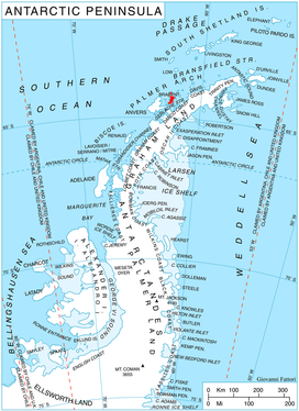 Location of Brabant Island (in red) | |
 Brabant Island Location in Antarctica | |
| Geography | |
|---|---|
| Location | Antarctica |
| Coordinates | 64°15′S 62°20′W |
| Archipelago | Palmer Archipelago |
| Area | 1,770 km2 (680 sq mi) |
| Length | 59 km (36.7 mi) |
| Width | 30 km (19 mi) |
| Highest elevation | 2,520 m (8,270 ft) |
| Highest point | Mount Parry |
| Administration | |
| Administered under the Antarctic Treaty System | |
| Demographics | |
| Population | Uninhabited |
It was named by the Belgian Antarctic Expedition (1897–1899) under Adrien de Gerlache, who named it after the Belgian Province of Brabant, in recognition of the support given to the expedition by its citizens.[1]
A paper summarizing the Joint Services expedition of 1984–1985 describes the island as "notoriously inhospitable" and states that there is evidence for only six visits between the discovery in 1898 and 1984.[2] Members of the expedition overwintered there in 1984–1985, and made the first ascent of Mount Parry.
Geology
The Brabant Island Tectonic Block includes up to 2000 m of basaltic-andesitic lavas and volcaniclastics, possibly corresponding to the Lower Cretaceous Antarctic Peninsula Volcanic Group of the Danco Coast. This group is intruded by a granodiorite sill and Early Eocene hypabyssal dykes. Late Tertiary to Pleistocene basaltic lavas uncomformably overlay this complex.[3]
Maps
- Antarctic Digital Database (ADD). Scale 1:250000 topographic map of Antarctica. Scientific Committee on Antarctic Research (SCAR). Since 1993, regularly upgraded and updated.
- British Antarctic Territory. Scale 1:200000 topographic map. DOS 610 Series, Sheet W 64 62. Directorate of Overseas Surveys, Tolworth, UK, 1980.
- Brabant Island to Argentine Islands. Scale 1:250000 topographic map. British Antarctic Survey, 2008.
Gallery
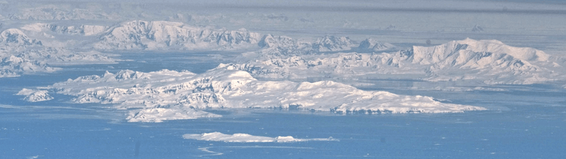 Brabant Island seen from northeast, with Hoseason Island and Liège Island in the foreground, and Anvers Island (on the right) and Antarctic Peninsula in the background.
See also
- Gerlache Strait Geology
- Composite Antarctic Gazetteer
- List of Antarctic and sub-Antarctic islands
- List of Antarctic islands south of 60° S
- SCAR
- Territorial claims in Antarctica
Further reading
References
- "Brabant Island". United States Gazetteer. Retrieved 2013-11-19.
- "Joint Services Expedition to Brabant Island, Antarctica, 1984/85". The Geographical Journal. JSTOR 634467. Missing or empty
|url=(help) - Birkenmajer, Krzysztof (1999). The Tectonic Structure of Gerlache Strait, West Antarctica, in Polish Polar Studies XXVI Polar Symposium (PDF). Lublin: Polish Polar Studies. pp. 45–50. Retrieved 3 January 2020.
External links
- Map of the area
- U.S. Geological Survey, Atlas of Antarctic Research
- (in Portuguese) Brazilian Antarctic Program
- Brabant Island on AADC website
- Brabant Island on NASA website
- current weather on Brabant Island
- views of Brabant Island on YouTube