Gerlache Strait
Gerlache Strait or de Gerlache Strait or Détroit de la Belgica is a channel/strait separating the Palmer Archipelago from the Antarctic Peninsula. The Belgian Antarctic Expedition, under Lt. Adrien de Gerlache, explored the strait in January and February 1898, naming it for the expedition ship Belgica. The name was later changed to honor the commander himself.

Geology
Four tectonic blocks are identifiable in the Gerlache Strait area, bounded by two systems of Tertiary strike-slip faults. The longitudinal faults include the SW-NE trending Neumayer Fault that extends from Peltier Channel across Wiencke Island, and then onwards most likely as the Gerlache Fault. The SW-NE trending Fournier Fault parallels the Gerlache Fault and divides Anvers Island. The transverse faults trend E-W and SE-NW across Wiencke Island and Brabant Island, and include the Schollaert Channel faults. The Danco Coast Block extends from Cape Willems to Wilhelmina Bay. The Brabant Island Block encompasses the southern portion of that island. The Neumayer Channel Block is bound by the Neumayer Fault and the Fournier Fault. The Anvers-Melchior Islands Block includes northwest Anvers Island and its offshore islands [[Melchior Islands]. Birkenmajer, Krzysztof (1999). The Tectonic Structure of Gerlache Strait, West Antarctica, in Polish Polar Studies XXVI Polar Symposium (PDF). Lublin: Polish Polar Studies. pp. 45–50. Retrieved 3 January 2020.</ref>
Gallery
 Iceberg in the Gerlache
.jpg) Iceberg
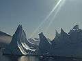
Iceberg Gerlache Strait
.jpg) Humpback whales in the strait
Humpback whales in the strait.jpg) Killer whale swimming
Killer whale swimming