Lawaan, Eastern Samar
Lawaan, officially the Municipality of Lawaan, is a 5th class municipality in the province of Eastern Samar, Philippines. According to the 2015 census, it has a population of 12,742 people.[3]
Lawaan | |
|---|---|
| Municipality of Lawaan | |
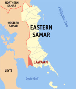 Map of Eastern Samar with Lawaan highlighted | |
| |
.svg.png) Lawaan Location within the Philippines | |
| Coordinates: 11°09′N 125°18′E | |
| Country | |
| Region | Eastern Visayas (Region VIII) |
| Province | Eastern Samar |
| District | Lone District |
| Barangays | 16 (see Barangays) |
| Government | |
| • Type | Sangguniang Bayan |
| • Mayor | Athene L. Mendros |
| • Vice Mayor | Ravi Parker G. Inciso |
| • Congressman | Maria Fe R. Abunda |
| • Municipal Council | Councilors
|
| • Electorate | 10,005 voters (2019) |
| Area | |
| • Total | 162.56 km2 (62.76 sq mi) |
| Elevation | 3.7 m (12.1 ft) |
| Population (2015 census)[3] | |
| • Total | 12,742 |
| • Density | 78/km2 (200/sq mi) |
| • Households | 3,007 |
| Economy | |
| • Income class | 5th municipal income class |
| • Poverty incidence | 38.7% (2015)[4] |
| • Revenue (₱) | 63,235,752.33 (2016) |
| Time zone | UTC+8 (PST) |
| ZIP code | 6813 |
| PSGC | |
| IDD : area code | +63 (0)55 |
| Climate type | tropical rainforest climate |
| Native languages | Waray Tagalog |
| Website | www |
History
An enterprising young couple by the names of Juan (Guingot) Gabrillo and his wife Etifania Halbay, together with their children, set sail one day in a small sailboat from Guiuan, in search of a greener pasture of an ideal place to settle. On their westward journey along the wooded coastline of Southern Samar, they reached a small island known as “Monbon” which was bordering the mouth of what is now the Lawa-an river. It was just in time to see that a severe storm was brewing from the western horizon. They decided to move inland, hastening towards the coastal jungle in their immediate front, to seek shelter behind the trunk of a towering tree which was clearly visible from the sea. It was behind that great tree that the frantic family was divinely protected from the roaring fury of the storm and a dire calamity was happily averted. When the typhoon subsided the next day the couple noticed that another tree of the same height and stature was also growing on the opposite bank of the river, twin sister to that of the other side - both so majestic and impressive in appearance, such that the branches up above completely overshadowed the river in-between.
After a hasty and meager breakfast of hot porridge, the small family looked askance of their surroundings and was deeply impressed by their new environment. The jungle growth even along the seashore bespoke fertility of the soil; the abundance of rattan and “hagnaya” vines was easy source of income and the shallow sea beside them was teeming with marine life of all kinds. All these offered suggestions that the place was ideal haven for habitation. So they abandoned their journey westward, instead, started building a makeshift hut at the foot of the same Lawa-an tree where they took refuge, at the same time, collecting whatever few belongings they could salvage from the wreckage of their boat. The days and weeks that followed were a series of trips inland by Juan Guingot - to cut rattan and hagnaya vines hereabouts or, perchance, he might find some edible fruits or root-crops nearby. Still further, he found unmistakable signs that the area was infested with wild life. The presence of these predators posed quite a problem to his intended plan of growing a vegetable farm; nevertheless, Guingot presently started his clearing (caingin) and the making of traps to capture some wild hogs or monkeys for food.
As was predictable in situations like this, Guingot reconstructed his sailboat, loaded it with rattan and hagnaya vines and sailed back to Guiuan where he sold his cargoes, telling the people and his friends along the way how he, with his family, was overtaken by a dreadful storm and escaped disaster behind the trunk of a giant Lawa-an tree. He emphasized to them the bright prospect of settling in the area partly as a token of gratitude and reverence to that haven of refuge - the enormous trunks of the twin Lawa-an trees; but most importantly, that the surrounding area was abundant and ideal for habitation. “Mamatay lak О-toy”, Juan Guingot would excitedly employ the slang and flavor of the Guiuan vernacular, “mamatay lak, dadi okoy ha Lawa-an (naming the place Lawa-an for the first time), ayaw pag-alang. Di ka mawawara hit doro-ongan kay kita gud iton hita-as nga kahoy ha dagat.” (Boy, when I die, stay here in Lawa-an, don’t hesitate. You will never get lost of the loading dock because the tall trees can be seen from the sea.) Indeed, there was no other point of reference more appealing to the settlers this outstanding landmark conspicuous from the sea.
That was how the present town of Lawa-an at first received its name. Ironically, five wide centuries have come and gone; people have lived and died along with generations in accordance with the short span of human life, but the name “LAWA-AN”, a former barrio of Balangiga, province of Eastern Samar, has remained, to this day, unchanged.[5]
Geography
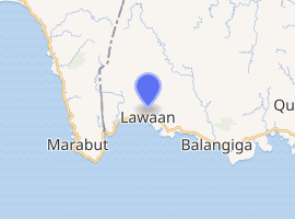
The town is strategically located in the central part of southern Samar Island. It is sandwiched between the town of Balangiga in the east and Marabut, Samar in the west. Barangay Bolusao, the town's largest settlement located right at the east-west Samar boundary, serves as the premier barangay of Eastern Samar for those people coming from Tacloban City or Province of Samar traversing Samar Circumferencial Road. Hence, being dubbed as 'The Gateway to Eastern Samar'.
Barangays
Lawaan is politically subdivided into 16 barangays. [2]
- Betaog
- Bolusao (largest by population and area)
- Guinob-an
- Maslog
- Barangay Poblacion 1
- Barangay Poblacion 2
- Barangay Poblacion 3
- Barangay Poblacion 4
- Barangay Poblacion 5
- Barangay Poblacion 6
- Barangay Poblacion 7
- Barangay Poblacion 8
- Barangay Poblacion 9
- Barangay Poblacion 10
- San Isidro
- Taguite
Demographics
| Population census of Lawaan | ||
|---|---|---|
| Year | Pop. | ±% p.a. |
| 1960 | 5,983 | — |
| 1970 | 7,479 | +2.25% |
| 1975 | 8,517 | +2.64% |
| 1980 | 7,275 | −3.10% |
| 1990 | 7,792 | +0.69% |
| 1995 | 9,725 | +4.24% |
| 2000 | 9,855 | +0.29% |
| 2007 | 10,645 | +1.07% |
| 2010 | 11,612 | +3.21% |
| 2015 | 12,742 | +1.78% |
| Source: Philippine Statistics Authority[3][6][7][8] | ||
The population of Lawaan in the 2015 census was 12,742 people,[3] with a density of 78 inhabitants per square kilometre or 200 inhabitants per square mile.
Climate
| Climate data for Lawaan, Eastern Samar | |||||||||||||
|---|---|---|---|---|---|---|---|---|---|---|---|---|---|
| Month | Jan | Feb | Mar | Apr | May | Jun | Jul | Aug | Sep | Oct | Nov | Dec | Year |
| Average high °C (°F) | 28 (82) |
29 (84) |
29 (84) |
30 (86) |
30 (86) |
30 (86) |
29 (84) |
29 (84) |
29 (84) |
29 (84) |
29 (84) |
29 (84) |
29 (84) |
| Average low °C (°F) | 22 (72) |
22 (72) |
22 (72) |
23 (73) |
25 (77) |
25 (77) |
25 (77) |
25 (77) |
25 (77) |
24 (75) |
24 (75) |
23 (73) |
24 (75) |
| Average precipitation mm (inches) | 78 (3.1) |
57 (2.2) |
84 (3.3) |
79 (3.1) |
118 (4.6) |
181 (7.1) |
178 (7.0) |
169 (6.7) |
172 (6.8) |
180 (7.1) |
174 (6.9) |
128 (5.0) |
1,598 (62.9) |
| Average rainy days | 16.7 | 13.8 | 17.3 | 18.5 | 23.2 | 26.5 | 27.1 | 26.0 | 26.4 | 27.5 | 24.6 | 21.0 | 268.6 |
| Source: Meteoblue [9] | |||||||||||||
Economy
Lawaan's main product is copra. Many families rely on coastal and deep-sea fishing as well as lowland and upland farming as means of livelihood. Others have spouses, children, parents or other relatives working in Tacloban City, Metro Manila or in other places within the Philippines or abroad either as professionals, contract workers or domestic helpers who regularly remit part of their earnings to their families back home. The single biggest employer of its local populace is the government.
Tourism
Lawaan is known for its spectacular waterfalls and thriving wildlife. Being a coastal town, it features an unobstructed amazing view of Leyte Gulf in its southern shores.
There are four waterfalls in the Bolusao watershed which lies within the SINP Buffer Zone. These falls are Amandaraga, Pange, Amanjuray, and Ban-Awan Falls. Amandaraga and Ban-awan Falls are the main source of the municipality's water system. Meanwhile, Amanjuray Falls is the alternate hydro-electric power source of Lawaan wherein a mini-hydro power plant is existent nearby.
Notable Lawaaños
- Freddie Abuda - retired professional basketball player, currently serving as an assistant coach to the San Beda Red Lions (NCAA).
References
- "Municipality". Quezon City, Philippines: Department of the Interior and Local Government. Retrieved 31 May 2013.
- "Province: Eastern Samar". PSGC Interactive. Quezon City, Philippines: Philippine Statistics Authority. Retrieved 12 November 2016.
- Census of Population (2015). "Region VIII (Eastern Visayas)". Total Population by Province, City, Municipality and Barangay. PSA. Retrieved 20 June 2016.
- "PSA releases the 2015 Municipal and City Level Poverty Estimates". Quezon City, Philippines. Retrieved 12 October 2019.
- Crispin G. Gavan. "History of Lawaan Eastern Samar and The Legends About Agtak". Retrieved October 30, 2018.
- Census of Population and Housing (2010). "Region VIII (Eastern Visayas)". Total Population by Province, City, Municipality and Barangay. NSO. Retrieved 29 June 2016.
- Censuses of Population (1903–2007). "Region VIII (Eastern Visayas)". Table 1. Population Enumerated in Various Censuses by Province/Highly Urbanized City: 1903 to 2007. NSO.
- "Province of Eastern Samar". Municipality Population Data. Local Water Utilities Administration Research Division. Retrieved 17 December 2016.
- "Lawaan, Eastern Samar : Average Temperatures and Rainfall". Meteoblue. Retrieved 31 December 2018.
External links
- Lawaan Profile at PhilAtlas.com
- Philippine Standard Geographic Code
- Philippine Census Information
- Local Governance Performance Management System
Places adjacent to Lawaan, Eastern Samar | |
|---|---|