Lake Point, Utah
Lake Point is an unincorporated community on the eastern edge of northern Tooele County, Utah, United States.[1] In November of 2020 the town of lake point will vote to incorporate in to a city.
Lake Point, Utah | |
|---|---|
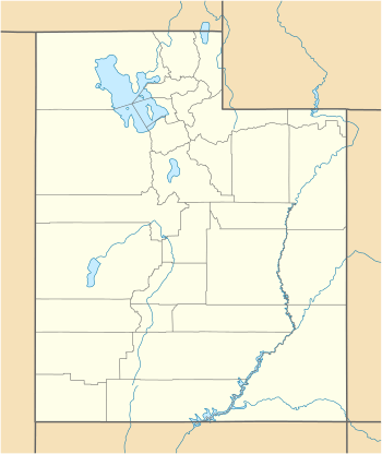 Lake Point Location of Lake Point within the State of Utah  Lake Point Lake Point (the United States) | |
| Coordinates: 40°40′51″N 112°15′47″W | |
| Country | United States |
| State | Utah |
| County | Tooele |
| Settled | 1854 |
| Elevation | 4,249 ft (1,295 m) |
| Time zone | UTC-7 (Mountain (MST)) |
| • Summer (DST) | UTC-6 (MDT) |
| Zip Code | 84074 |
| Area code(s) | 435 |
| GNIS feature ID | 1429437[1] |
Description
The community is located on the south shore of the Great Salt Lake and is served by Interstate 80 and Utah State Route 36. Lake Point is north of Tooele. The community was originally settled in 1854 under the name of E.T. City, in honor of Ezra T. Benson. It was renamed Lake Point in 1923.[2]
History
| Historical population | |||
|---|---|---|---|
| Census | Pop. | %± | |
| 1860 | 141 | — | |
| 1870 | 114 | −19.1% | |
| 1880 | 177 | 55.3% | |
| 1890 | 206 | 16.4% | |
| 1900 | 192 | −6.8% | |
| 1910 | 179 | −6.8% | |
| 1920 | 196 | 9.5% | |
| 1930 | 299 | 52.6% | |
| 1940 | 231 | −22.7% | |
| 1950 | 190 | −17.7% | |
| Source: U.S. Census Bureau[3] | |||
Lake Point sits on a passageway, a narrow strip of land between the sharply towering Oquirrh Mountains to the southeast, and the waters of the Great Salt Lake on the north. Early explorers, indigenous groups, and California-bound trekkers followed this route.[4] The Gushute Indian Tribe used the Tooele Valley for their yearly rendezvous.[5]:4
The US Army sent Captain Howard Stansbury to the area in 1849 to evaluate emigration trails and scout for possible passages for a transcontinental railroad. He had a small adobe house built near a prominent rock outcropping in the southwest part of the area, for the use of his herders who cared for his expedition's livestock; in subsequent years the rocks became known as "Adobe Rock".
Pioneers of The Church of Jesus Christ of Latter-day Saints who settled in the Tooele Valley were organized on April 24, 1850 into a branch of the Church by Ezra T. Benson (John Rowberry was called as president of the branch).
By mid-1854, E. T. City had been established in the area. One of the first settlers, Peter Maughan, dismantled his log cabin in Tooele and moved it to the new settlement in August 1854. Others built small houses along the north-south road during the next three years. However, by 1857, a three-year string of crop failures had caused most of the population to move away. Maughan moved his family to Cache Valley.
The first meetinghouse of the LDS branch was built in 1857, a small log building with a rough board floor, dirt roof, and two windows.
The branch's population was listed as 97 in 1868 ("and some gentile families"); by then the E.T. Irrigation Company had been formed, a canal delivered irrigation water from the Mill Pond, a regular mail run existed between E.T. City and Richville.
A railroad line was begun from the bustling mining area around Stockton to the south shore of the Great Salt Lake by 1870, connecting with a steamboat run from Corinne at the north end of the lake. An investor, Jeter Clinton, worked to transform the port into a recreation area, known as "Clinton Beach". In 1871 he had constructed a temporary building, Lake House, that provided showers and refreshments for tourists. In the fall Clinton replaced the structure with a hotel. However, few people took advantage of the facilities,[6] and in 1872 the steamboat service was halted.[7] However, the railway construction continued, and was completed in 1877.[5]:5
In 1892 the Clinton property was sold to the Buffalo Park Land Company, who envisioned a large resort on the area. They mapped streets, planted trees, imported buffalo, and began building cabins. However, the venture did not succeed, and the remaining buffalo became the nucleus of the buffalo herd on nearby Antelope Island.[5]:5
An LDS Church meetinghouse built of rock was completed in 1884. It was also used as an elementary school until 1894, when a separate schoolhouse was constructed.
The rock LDS chapel was replaced in November 1985 by a modern brick-faced building a half-mile south of the previous building.
See also
![]()
References
- "Lake Point". Geographic Names Information System. United States Geological Survey.
- Van Cott, John W. (1990). Utah Place Names: A Comprehensive Guide to the Origins of Geographic Names: A Compilation. Salt Lake City: University of Utah Press. p. 121. ISBN 978-0-87480-345-7. OCLC 797284427.
- "Census of Population and Housing". census.gov. United States Census Bureau. Archived from the original on February 8, 2006. Retrieved November 4, 2011.
- The ill-fated Donner Party used this route in 1846.
- Early History of the Lake Point Area, Lake Point Through The Years 1854-1986, Lake Point Ward, Stansbury Park Utah Stake, The Church of Jesus Christ of Latter-day Saints, published 1986.
- Advertisements in Salt Lake City newspapers read "spend a whole day on the south shore, to visit the caves and grottoes near Lake Point, enjoy surf bathing, and hunting...."
- The Steamboat Era Was Glamorous But Brief, utah.gov
External links
![]()
Municipalities and communities of Tooele County, Utah, United States | ||
|---|---|---|
| Cities | 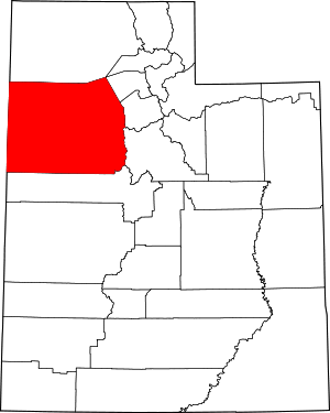 Map of Utah highlighting Tooele County | |
| Towns | ||
| CDPs | ||
| Unincorporated communities | ||
| Ghost towns | ||
| Indian reservations | ||
| Footnotes | ‡This populated place also has portions in an adjacent county or counties | |
| Authority control |
|
|---|