Lac-Alfred, Quebec
Lac-Alfred is an unorganized territory in the Bas-Saint-Laurent region of Quebec, Canada.
Lac-Alfred | |
|---|---|
Unorganized territory | |
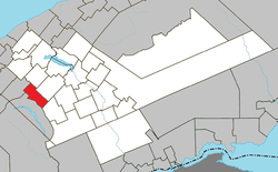 Location within La Matapédia RCM. | |
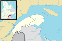 Lac-Alfred Location in eastern Quebec. | |
| Coordinates: 48°25′N 67°48′W[1] | |
| Country | |
| Province | |
| Region | Bas-Saint-Laurent |
| RCM | La Matapédia |
| Constituted | January 1, 1986 |
| Government | |
| • Federal riding | Haute-Gaspésie—La Mitis—Matane—Matapédia |
| • Prov. riding | Matane-Matapédia |
| Area | |
| • Total | 76.40 km2 (29.50 sq mi) |
| • Land | 77.21 km2 (29.81 sq mi) |
| There is an apparent contradiction between two authoritative sources | |
| Population (2011)[3] | |
| • Total | 0 |
| • Density | 0.0/km2 (0/sq mi) |
| • Pop 2006-2011 | |
| • Dwellings | 0 |
| Time zone | UTC-5 (EST) |
| • Summer (DST) | UTC-4 (EDT) |
| Highways | No major routes |
Situated in the Matapédia Valley, it is named after the small Lake Alfred[note 1] in the northwestern part of the territory. The lake rests at the foot of Mont Saint-Pierre, which reaches 906 metres (2,972 ft)[4][note 2] and is also known as Montagne du Radar (Radar Mountain) or Montagne de la Tour (Tower Mountain) due to an old fire tower or lookout that was built upon it.[5]
The territory is used extensively for logging.
References
- Reference number 149683 of the Commission de toponymie du Québec (in French)
- "Lac-Alfred". Répertoire des municipalités (in French). Ministère des Affaires municipales, des Régions et de l'Occupation du territoire. Retrieved 2012-01-30.
- "Lac-Alfred census profile". 2011 Census data. Statistics Canada. Retrieved 2012-01-30.
- "Mont Saint-Pierre". Peakbagger. Retrieved 9 July 2014.
- "Mont Saint-Pierre" (in French). Commission de toponymie du Québec. Retrieved 2012-01-30.
Adjacent Municipal Subdivisions | |
|---|---|
| Cities & Towns | |
|---|---|
| Municipalities | |
| Parishes | |
| Villages | |
| Unorganized territories | |
| |
This article is issued from Wikipedia. The text is licensed under Creative Commons - Attribution - Sharealike. Additional terms may apply for the media files.