Kotlovka District
Kotlovka District (Russian: райо́н Котловка) is an administrative district (raion) of South-Western Administrative Okrug, and one of the 125 raions of Moscow, Russia.[4] The area of the district is 3.865 square kilometers (1.492 sq mi).[1] Population: 54,200 (2017 est.).
Kotlovka District | |
|---|---|
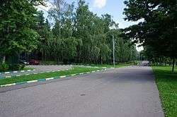 Sosenki Park, Kotlovka District | |
.png) Flag .png) Coat of arms | |
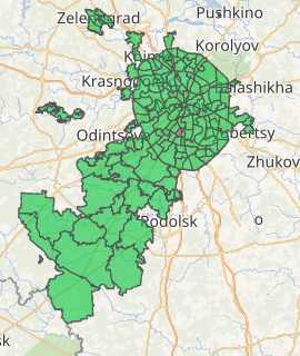
Location of Kotlovka District on the map of Moscow | |
| Coordinates: 55°40′27″N 37°35′55″E | |
| Country | Russia |
| Federal subject | Moscow |
| Area | |
| • Total | 3.94 km2 (1.52 sq mi) |
| Population | |
| • Estimate (2018)[2] | 65,811 |
| Time zone | UTC+3 (MSK |
| OKTMO ID | 45903000 |
| Website | http://kotlovka.mos.ru/ |
See also
References
Notes
- "General Information" (in Russian). Kotlovka District. Retrieved March 27, 2018.
- "26. Численность постоянного населения Российской Федерации по муниципальным образованиям на 1 января 2018 года". Federal State Statistics Service. Retrieved 23 January 2019.
- "Об исчислении времени". Официальный интернет-портал правовой информации (in Russian). 3 June 2011. Retrieved 19 January 2019.
- Государственный комитет Российской Федерации по статистике. Комитет Российской Федерации по стандартизации, метрологии и сертификации. №ОК 019-95 1 января 1997 г. «Общероссийский классификатор объектов административно-территориального деления. Код 45», в ред. изменения №278/2015 от 1 января 2016 г.. (State Statistics Committee of the Russian Federation. Committee of the Russian Federation on Standardization, Metrology, and Certification. #OK 019-95 January 1, 1997 Russian Classification of Objects of Administrative Division (OKATO). Code 45, as amended by the Amendment #278/2015 of January 1, 2016. ).
Sources
| Central Administrative Okrug |  | |
|---|---|---|
| Northern Administrative Okrug | ||
| North-Eastern Administrative Okrug | ||
| Eastern Administrative Okrug | ||
| South-Eastern Administrative Okrug | ||
| Southern Administrative Okrug | ||
| South-Western Administrative Okrug | ||
| Western Administrative Okrug | ||
| North-Western Administrative Okrug | ||
| Zelenogradsky Administrative Okrug | ||
| Novomoskovsky Administrative Okrug |
| |
| Troitsky Administrative Okrug |
| |
This article is issued from Wikipedia. The text is licensed under Creative Commons - Attribution - Sharealike. Additional terms may apply for the media files.