Koratla
Koratla municipality (also Korulta) is a town and also revenue division located in the Jagtial district in the Indian state of Telangana.[4][5] It is a second largest town in Jagtial district.It is the headquarters of Koratla constituency.[6]
Koratla Korutla | |
|---|---|
| Nickname(s): Second Shirdi | |
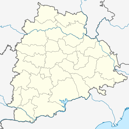 Koratla Location in Telangana, India  Koratla Koratla (India) | |
| Coordinates: 18.8215°N 78.7119°E | |
| Country | |
| State | Telangana |
| District | Jagtial |
| Region | Deccan |
| Government | |
| • Body | Municipality |
| Area | |
| • Total | 22.96 km2 (8.86 sq mi) |
| Elevation | 287 m (942 ft) |
| Population (2011 and According to local census of (2018))[3] | |
| • Total | 66,504 (80,000) |
| Languages | |
| • Official | Telugu, Urdu, English |
| Time zone | UTC+5:30 (IST) |
| PIN | 505326 |
| Telephone code | 08725 |
| Vehicle registration | TS21 |
| Website | telangana |
Geography
Koratla Municipality covers an area of 22.79 square kilometers (8.8 square miles), at an elevation of 287 meters (942 ft).[2][3]
History
It is believed that Korutla has its name during Nizam's era, previously known as Koravattu.The great story of korutla was revealed by old stone inscription (shilashasanam), written in 1042-1068 A.D was found in the holy pond (koneru) of korutla. As per the writings and opinions of people here, korutla has got thousands of years of history. 100 decades ago it was ruled by great kings of Jainas, Kalyanis, Chalukyas, Vemulawada Chalukyas and Rastrakutas.
In the era of Jaina's it was called "Koravattu". As the days were passing, it changed to "Koravatlu", "Koratlu", and finally changed to present name Korutla. In Telugu it is written as Korutla, but in English it is written both as "Korutla" and "Koratla". Another belief is that the people (Munulu and Rushulu), belong to the tribe of "Koravattu", used to live here and performed their devotional activities in this place
Demographics
As of 2011 Indian census, Koratla had an estimated population of 66,504 But approximately in 2018 the population is 85,000. The gender split is 50 percent male, 50 percent female. The Literacy rate is 60 percent—approximately equal to the national average of 59.5 percent. Male literacy is 69 percent, and female literacy is 51 percent. 14% of the population is under six years old.[7]
Koratla Vagu Syphon
This Syphon is second one in Asia. It is situated in Nagulapet of Koratla. This Siphon was built by Engineer Sri P.S.Ramakrishna Raju under Pochampad Project.
Historical Temples
- Sri Mahadevaswamy Temple: This temple is said to be constructed thousands of years ago
- Sri Shirdi Sai Baba temple: Koratla is said to be Second Shirdi because of the statue size is large after Statue of Sai Baba in Shirdi.This temple is situated in the entrance of town from Jagtial
- Sri Venkateshwara Swamy Temple: Recently in 2019 a bird neither eagle nor owl gave darshan in the form of Garuda Swamy in Koratla.It is Situated in Jawahar Colony,Koratla
- Sri Asta Lakshmi temple: This temple is situated in Adarsha Nagar Colony,Koratla
- Sri Ayyappa Swamy Temple: It is situated in Allamaih Gutta Colony,Koratla.In Koratla every year 27 December Ayyappa Jatara is Celebrated
- Sri Siddi Vinayaka Temple: This temple is situated near Sri Venkateshwara Temple in Jawahar Colony, Kortla. Here it is believed that Statue drunk milk in olden days
Government and politics
Koratla Municipality was constituted in 1988 and is classified as a second-grade municipality with 33 election wards. Koratla is the headquarters of its own assembly constituency. The jurisdiction of the civic body is spread over an area of 22.96 km2 (8.86 sq mi).
Transportation
It has TSRTC bus stand. [KRTL] The buses travel to Hyderabad, Karimnagar, Nizamabad, Tirupati, etc.
It has Railway Connectivity i.e., Peddapalli-Nizamabad section. Connectivity to Mumbai , Visakhapatnam , Delhi , Chennai. Korutla Railway Station .Station code[KRLA]
The trains are: (77259/60) Karimnagar-Nizamabad-Karimnagar DEMU Passenger, (57601/02) Kacheguda-Karimnagar-Kacheguda Passenger and (11205/06) Mumbai LTT-Karimnagar-Mumbai LTT.
Entertainment
There are two Theatre halls: Kinnera A/C Theatre and Lakshmi A/C Deluxe Theatre.
References
- "Urban Local Body Information" (PDF). Directorate of Town and Country Planning. Government of Telangana. Archived from the original (PDF) on 15 June 2016. Retrieved 28 June 2016.
- "Maps, Weather, and Airports for Koratla, India". fallingrain.com.
- "District Census Handbook – Karimnagar" (PDF). Census of India. pp. 12, 50. Retrieved 9 June 2016.
- India Today Web Desk. "Indian states with highest population".
- "District Administration – Formation/Reorganization of District, Revenue Divisions and Mandals in Jagitial District – Final Notification - Orders – Issued" (PDF). Jagtial District. Retrieved 25 July 2017.
- Assembly Elections 2018. "Koratla Election Result".
- "Census of India 2001: Data from the 2001 Census, including cities, villages and towns (Provisional)". Census Commission of India. Archived from the original on 16 June 2004. Retrieved 1 November 2008.