Luxettipet
Luxettipet or Lakshettipet is a census town in Mancherial district of the Indian state of Telangana. Located on tha north bank of godavari river. And it is municipality and the headquarters of Luxettipet mandal. It is located in Luxettipet mandal of Mancherial revenue division.[1]
Luxettipet Lakshettipet | |
|---|---|
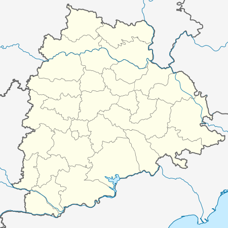
 Luxettipet Location in Telangana, India  Luxettipet Luxettipet (India) | |
| Coordinates: 18.8667°N 79.2167°E | |
| Country | |
| State | Telangana |
| District | Mancherial |
| Founded by | Edlabad(Nizam's) |
| Named for | Laxmi shetty |
| Government | |
| • Type | Municipal council |
| • Body | Municipality |
| Area | |
| • Total | 15 km2 (6 sq mi) |
| Elevation | 145 m (476 ft) |
| Population (2014)[1] | |
| • Total | 26,024 |
| • Rank | auto |
| • Density | 1,700/km2 (4,500/sq mi) |
| Languages | |
| • Official | Telugu, Urdu |
| Time zone | UTC+5:30 (IST) |
| PIN | 504215 |
| Telephone code | 08739 |
| Vehicle registration | TS-19 |
| Website | luxettipetmuncipality |
Administrative Divisions
There are 21 Villages in Luxettipet.[2]
| Sl.No. | Name of the Mandal | Villages in the Mandal |
| 1 | Luxettipet | Luxettipet |
| 2 | Dowdepalle | |
| 3 | Patha Kommugudem | |
| 4 | Talamalla | |
| 5 | Challampet | |
| 6 | Balraopet | |
| 7 | Jendavenkatapur | |
| 8 | Rangapet | |
| 9 | Chandram | |
| 10 | Venkataraopet | |
| 11 | Ellaram | |
| 12 | Kothur | |
| 13 | Utukur | |
| 14 | Modela | |
| 15 | Itkyal | |
| 16 | Lingapur | |
| 17 | Thimmapur | |
| 18 | Laxmipur | |
| 19 | Pothepalle | |
| 20 | Gullakota | |
| 21 | Mittapally |
Place to Visit
- jagannatha temple and Shiva temple Brahmin street
- Gudem SatyaNarayana Swamy Temple and Ayyappa Swamy Temple
- DharmaPuri Narsimha Swamy Temple located in Dharmapuri (about 20 km)
- Chinnaiah-Peddaiah Devasthanam
- CSI Church
- godavari river (yellampally barrage)
- gundala water falls
- kotilingala on godavari river boating
- luxettipet godavari pushkara ghat
Geography
Lakshettipet is located at 18.8667°N 79.2167°E on bank of Godavari river, Mancherial District. It has an average elevation of 145 meters (479 ft).[3]
References
- "District Census Handbook – Karimnagar" (PDF). Census of India. pp. 13, 30. Retrieved 10 June 2016.
- "Schedule - II Reorganization Of Mandals In Mancherial District". districtsinfo.com/. Retrieved 10 March 2017.
- "Maps, Weather, and Airports for Lakshettipet, India".
This article is issued from Wikipedia. The text is licensed under Creative Commons - Attribution - Sharealike. Additional terms may apply for the media files.