Golaghmuli Valley
Golaghmuli Valley (Urdu: وادی پھنڈر) or Koh-i-Ghizer (Urdu: کوہ غذر) or Valley of Martyrs (Urdu: وادی شہداء) or Shandur Valley (Urdu: وادی شندور) is a high mountainous valley in Upper Ghizer of Gilgit-Baltistan Pakistan. This valley is situated in the east of Chitral and north of Swat. Golaghmuli Valley is separated from the Chitral and Swat by high mountain passes. To reach Golaghmuli Valley, a person must take the Gilgit-Chitral road west from Gilgit, and then continue his journey straight by Gupis. After Gupis, one continues northwest to reach the Yasin Valley and the straight road goes to Golaghmuli Valley.
Golaghmuli Valley وادئ گولاغمولی Koh-i-Ghizer Teru Shandur Valley | |
|---|---|
.jpg) Phander Valley | |
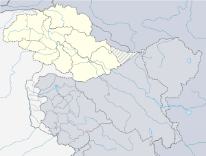 Golaghmuli Valley Location in Jammu and Kashmir | |
| Coordinates: 36°09′26″N 72°44′17″E | |
| Country | |
| State | |
| District | Ghizer District |
| Cities | Phaner |
| Elevation | 3,030 m (9,940 ft) |
| Postal code | 15300 |
| Area code(s) | 15300 |
| Rivers | Ghizer River |
| Website | www |
History
Golaghmuli Valley is a big part of Tehsil Phander, a new Tehsil of Ghizer District. It was formerly a part of Tehsil Gupis. In the government of PPP, it was decided to make Golaghmuli, a new Tehsil of Ghizer. But the government of PML (N) gave it the whole power of a Tehsil. Phander was originally ruled by Governor Gupis, Raja Hussain Ali Khan Maqpoon. The Rajas of Gupis were great warriors and fought against the Sikhs and the Dogras of on the freedom movement of Gilgit-Baltistan, but this house eventually lost power and the ownership of Koh-i-Ghizer at the time of FCR.
Golaghmuli Valley was of strategic importance because it leads to a high mountain pass, to Laspur Valley in Chitral via Shandur Top, and then to Mastuj. Another gateway is the passage of Dadaili Pass in Handarap Nallah, which leads to Swat District.
Villages
Golaghmuli Valley and Golaghmuli Valley are located in the west of District Ghizer. It includes the villages of Pingal, Rawat, Shamaran, Chashi, Golaghmuli, Golaghmuli, Golaghtori, Terich, Handarap, Handarap Nallah including Lake, Herkush, Teru, Karim Abad, Hilthi, Barset and a wide area of Khukush Nallah including Shandur.
Administratively, Tehsil Golaghmuli is a newly Tehsil and is under the jurisdiction of GB-La 30. Golaghmuli Village is the headquarter of the Tehsil Golaghmuli, however, Golaghmuli is also a populated village in this Tehsil.
Language
The people of Golaghmuli Valley speak the Khowar language, which is the native language. However people also know how to speak Shina, Urdu, and Englishas well.
Religion
Islam is the only religion followed over here. People belong to Isma'ili and Sunni sects. 65% of total population belong to Ismaili Islam and the rest belong to Sunni Islam.
Climate
The climate of Golaghmuli Valley is considered to be a local steppe climate. During the year, there is a rainfall which takes place during January to the end of March. This climate is considered to be BSK according to the Köppen-Geiger climate classification. The average annual temperature in Golaghmuli Valley is 19.6 °C. About 429 mm of precipitation falls annually.
| Climate data for Tehsil Golaghmuli | |||||||||||||
|---|---|---|---|---|---|---|---|---|---|---|---|---|---|
| Month | Jan | Feb | Mar | Apr | May | Jun | Jul | Aug | Sep | Oct | Nov | Dec | Year |
| Average high °C (°F) | 8.3 (46.9) |
9.5 (49.1) |
14.9 (58.8) |
21.0 (69.8) |
25.6 (78.1) |
31.8 (89.2) |
32.8 (91.0) |
32.0 (89.6) |
28.7 (83.7) |
23.7 (74.7) |
17.4 (63.3) |
10.9 (51.6) |
32.8 (91.0) |
| Daily mean °C (°F) | 4.1 (39.4) |
5.0 (41.0) |
9.8 (49.6) |
15.3 (59.5) |
19.4 (66.9) |
24.9 (76.8) |
26.1 (79.0) |
25.4 (77.7) |
21.9 (71.4) |
17.0 (62.6) |
11.5 (52.7) |
6.5 (43.7) |
26.1 (79.0) |
| Average low °C (°F) | 0.0 (32.0) |
0.6 (33.1) |
4.8 (40.6) |
9.7 (49.5) |
13.3 (55.9) |
18.0 (64.4) |
19.5 (67.1) |
18.8 (65.8) |
15.2 (59.4) |
10.3 (50.5) |
5.6 (42.1) |
2.1 (35.8) |
11.4 (52.5) |
| Average precipitation mm (inches) | 69 (2.7) |
99 (3.9) |
146 (5.7) |
139 (5.5) |
69 (2.7) |
22 (0.9) |
52 (2.0) |
56 (2.2) |
40 (1.6) |
31 (1.2) |
26 (1.0) |
51 (2.0) |
800 (31.4) |
| Source: Climate-Data.org[1] | |||||||||||||
Tribes
There is a number of ethnicity living in Golaghmuli Valley. There is a number of tribes living here as under;
- Kakakhel (tribe)
- Chorotay
- Masafay
- Shukhaye
- Shumuray
- Rabakhanay
- Shamshiray
- Mukhay
- Khonay
- Zhikanay
- Masholay
Passes
Golaghmuli Valley is in a highly mountainous place. It is situated along with the border of Swat and Chitral. The Shandur Pass connects Golaghmuli Valley with Chitral, while the Dadarili (Dadaili) Pass connects Golaghmuli Valley to Swat. Another pass to Swat District is nearby Khukush Langar (Baha) Lake, which is called Naghlacho Dahar. There is another pass, which is "Chumarkhan Ann", which connects Barset to Mestuj Chapali. Along with Chumarkhan Ann, Ghotbar Ann is situated, which connect Barset with Harchin. All these passes are easy for the tourists and hikers to shorten their journey.
Lakes
Golaghmuli Valley has a number of lakes including;
- Khukush Langar (Baha) Lake[2]
- Shandur Lake[3]
- Handarap Lake
- Golaghmuli Lake
- Golaghtori Lake 1
- Golaghtori Lake 2
- Shahi Mall Lake
- Barich Lake
References
- http://www.accuweather.com/en/ir/shandul/511646/weather-forecast/511646
- http://myGolaghmuli.com/baha-lake-ghizer-gilgit-baltistan-pakistan/
- "Archived copy". Archived from the original on 2015-11-19. Retrieved 2015-11-18.CS1 maint: archived copy as title (link)