Ko Kha District
Ko Kha (Thai: เกาะคา, pronounced [kɔ̀ʔ kʰāː]) is a district (amphoe) in the central part of Lampang Province, northern Thailand.

Wat Phra That Lampang Luang
Ko Kha เกาะคา | |
|---|---|
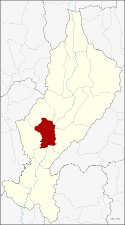 District location in Lampang Province | |
| Coordinates: 18°11′30″N 99°23′44″E | |
| Country | Thailand |
| Province | Lampang |
| Seat | Tha Pha |
| Area | |
| • Total | 551.2 km2 (212.8 sq mi) |
| Population (2005) | |
| • Total | 63,870 |
| • Density | 115.9/km2 (300/sq mi) |
| Time zone | UTC+7 (ICT) |
| Postal code | 52130 |
| Geocode | 5203 |
Geography
Neighboring districts are (from the south clockwise): Sop Prap, Soem Ngam, Hang Chat, Mueang Lampang, Mae Tha of Lampang Province.
The Khun Tan Range rises in the west and the Phi Pan Nam Range in the east of the district.
History
In 1917 the district was renamed from Sop Yao (สบยาว) to Ko Kha.[1]
Administration
The district is divided into nine subdistricts (tambons), which are further subdivided into 73 villages (mubans). Ko Kha is a township (thesaban tambon) which covers parts of tambons Ko Kha, Sala, and Tha Pha. There are a further nine tambon administrative organizations (TAO).
| No. | Name | Thai name | Villages | Pop. | |
|---|---|---|---|---|---|
| 1. | Lampang Luang | ลำปางหลวง | 12 | 9,965 | |
| 2. | Na Kaeo | นาแก้ว | 8 | 10,092 | |
| 3. | Lai Hin | ไหล่หิน | 6 | 5,657 | |
| 4. | Wang Phrao | วังพร้าว | 7 | 7,242 | |
| 5. | Sala | ศาลา | 7 | 8,732 | |
| 6. | Ko Kha | เกาะคา | 8 | 4,352 | |
| 7. | Na Saeng | นาแส่ง | 7 | 4,999 | |
| 8. | Tha Pha | ท่าผา | 9 | 7,423 | |
| 9. | Mai Phatthana | ใหม่พัฒนา | 9 | 5,408 |
References
- ประกาศกระทรวงมหาดไทย เรื่อง เปลี่ยนชื่ออำเภอ (PDF). Royal Gazette (in Thai). 34 (0 ก): 40–68. April 29, 1917.
This article is issued from Wikipedia. The text is licensed under Creative Commons - Attribution - Sharealike. Additional terms may apply for the media files.