Kingwood Township, New Jersey
Kingwood Township is a township in Hunterdon County, New Jersey, United States, located on the Hunterdon Plateau. As of the 2010 United States Census, the township's population was 3,845,[9][10][11] reflecting an increase of 63 (+1.7%) from the 3,782 counted in the 2000 Census, which had in turn increased by 457 (+13.7%) from the 3,325 counted in the 1990 Census.[20]
Kingwood Township, New Jersey | |
|---|---|
| Township of Kingwood | |
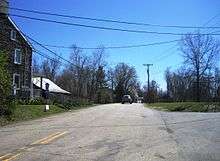
 Along Route 12 in Kingwood Township | |
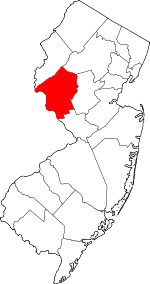
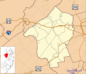
 Map of Kingwood Township in Hunterdon County. Inset: Location of Hunterdon County highlighted in the State of New Jersey. | |
 Census Bureau map of Kingwood Township, New Jersey | |
 Kingwood Township Location in Hunterdon County 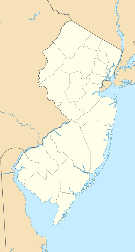 Kingwood Township Location in New Jersey  Kingwood Township Location in the United States | |
| Coordinates: 40.494704°N 75.019461°W[1][2] | |
| Country | |
| State | |
| County | Hunterdon |
| Established | 1746 |
| Incorporated | February 21, 1798 |
| Government | |
| • Type | Township |
| • Body | Township Committee |
| • Mayor | Thomas Ciacciarelli (R, term ends December 31, 2020)[5][6] |
| • Municipal clerk | Cynthia Keller[7] |
| Area | |
| • Total | 35.774 sq mi (92.655 km2) |
| • Land | 35.158 sq mi (91.060 km2) |
| • Water | 0.616 sq mi (1.594 km2) 1.72% |
| Area rank | 67th of 566 in state 4th of 26 in county[1] |
| Elevation | 469 ft (143 m) |
| Population | |
| • Total | 3,845 |
| • Estimate (2019)[12] | 3,741 |
| • Rank | 419th of 566 in state 14th of 26 in county[13] |
| • Density | 109.4/sq mi (42.2/km2) |
| • Density rank | 538th of 566 in state 26th of 26 in county[13] |
| Time zone | UTC−05:00 (Eastern (EST)) |
| • Summer (DST) | UTC−04:00 (Eastern (EDT)) |
| ZIP Code | |
| Area code(s) | 908[16] |
| FIPS code | 3401937065[1][17][18] |
| GNIS feature ID | 0882183[1][19] |
| Website | www |
History
Kingwood Township is one of the westernmost townships of Hunterdon County. Kingwood was originally established around 1746 when it was created from Bethlehem Township, though the exact details are uncertain.[21] Kingwood was incorporated by Act of the New Jersey Legislature on February 21, 1798, as one of New Jersey's initial group of 104 townships. Portions of the township were taken to form Franklin Township on April 7, 1845. Frenchtown borough acquired portions of the township in 1876.[22]
Kingwood Township was the home of Daniel Bray, the local captain who rounded up the boats for George Washington's crossing of the Delaware River during the Revolutionary War.[21] The portion of Route 29 that runs through the township along its western edge is named for him.[23]
In late 1981, Dick Siano became the first Libertarian Party candidate to win a partisan election outside of Alaska by winning a committee seat in the township. In the November election, he and the Democratic tied in the general election placing the incumbent Republican mayor in third place. Siano won the runoff election held on December 22.[24][25]
Geography
According to the United States Census Bureau, the township had a total area of 35.774 square miles (92.655 km2), including 35.158 square miles (91.060 km2) of land and 0.616 square mile (1.594 km2) of water (1.72%).[1][2]
The township borders the municipalities of Alexandria Township, Delaware Township, Franklin Township and Frenchtown in Hunterdon County; and the communities of Plumstead Township and Tinicum Township in Bucks County, across the Delaware River in Pennsylvania.[26][27][28] Most of the township lies on the Hunterdon Plateau, a geologic plateau averaging 300–500 feet (90–150 m) in elevation though approaching the Delaware River, the elevation drops sharply to about 100 feet (30 m) at the banks of the river.[29] Exposed rock can be seen on portions of Route 29 in the township between the River and the plateau.
Unincorporated communities, localities and place names located partially or completely within the township include Baptistown, Barbertown, Byram, Idell, Milltown, Point Breeze, Treasure Island, Tumble and Tumble Falls.[30]
Frenchtown Solar is a group of three photovoltaic arrays owned by Consolidated Edison that forms one of the largest solar farms in the state, covering 110 acres (44.5 ha) with a total of 68,500 solar panels and a 20.1 megawatt generating capacity. Two arrays are located just outside Baptistown on Route 12.[31] The third and largest is to the south off County Route 519.[32]
Demographics
| Historical population | |||
|---|---|---|---|
| Census | Pop. | %± | |
| 1790 | 2,446 | — | |
| 1810 | 2,606 | — | |
| 1820 | 2,786 | 6.9% | |
| 1830 | 2,898 | 4.0% | |
| 1840 | 2,947 | 1.7% | |
| 1850 | 1,799 | * | −39.0% |
| 1860 | 2,148 | 19.4% | |
| 1870 | 1,942 | −9.6% | |
| 1880 | 1,694 | −12.8% | |
| 1890 | 1,424 | −15.9% | |
| 1900 | 1,304 | −8.4% | |
| 1910 | 1,265 | −3.0% | |
| 1920 | 1,160 | −8.3% | |
| 1930 | 1,218 | 5.0% | |
| 1940 | 1,253 | 2.9% | |
| 1950 | 1,320 | 5.3% | |
| 1960 | 1,841 | 39.5% | |
| 1970 | 2,294 | 24.6% | |
| 1980 | 2,772 | 20.8% | |
| 1990 | 3,325 | 19.9% | |
| 2000 | 3,782 | 13.7% | |
| 2010 | 3,845 | 1.7% | |
| Est. 2019 | 3,741 | [12][33] | −2.7% |
| Population sources: 1790-1920[34] 1840[35] 1850-1870[36] 1850[37] 1870[38] 1880-1890[39] 1890-1910[40] 1910-1930[41] 1930-1990[42] 2000[43][44] 2010[9][10][11] * = Lost territory in previous decade.[22] | |||
Census 2010
The 2010 United States Census counted 3,845 people, 1,446 households, and 1,103.298 families in the township. The population density was 109.4 per square mile (42.2/km2). There were 1,569 housing units at an average density of 44.6 per square mile (17.2/km2). The racial makeup of the township was 96.51% (3,711) White, 0.65% (25) Black or African American, 0.03% (1) Native American, 1.09% (42) Asian, 0.00% (0) Pacific Islander, 0.52% (20) from other races, and 1.20% (46) from two or more races. Hispanic or Latino of any race were 2.39% (92) of the population.[9]
The 1,446 households accounted 32.2% with children under the age of 18 living with them; 64.2% were married couples living together; 8.0% had a female householder with no husband present, and 23.7% were non-families. Of all households, 18.1% were made up of individuals, and 6.5% had someone living alone who was 65 years of age or older. The average household size was 2.66 and the average family size was 3.04.[9]
In the township, the population age was spread out with 23.1% under the age of 18, 6.0% from 18 to 24, 20.8% from 25 to 44, 37.3% from 45 to 64, and 12.9% who were 65 years of age or older. The median age was 45.1 years. For every 100 females, the population had 103.0 males. For every 100 females ages 18 and older there were 99.1 males.[9]
The Census Bureau's 2006-2010 American Community Survey showed that (in 2010 inflation-adjusted dollars) median household income was $94,951 (with a margin of error of +/- $8,656) and the median family income was $101,722 (+/- $3,508). Males had a median income of $62,636 (+/- $11,644) versus $39,704 (+/- $5,890) for females. The per capita income for the borough was $38,977 (+/- $4,174). About 2.7% of families and 3.2% of the population were below the poverty line, including 6.1% of those under age 18 and none of those age 65 or over.[45]
Census 2000
As of the 2000 United States Census[17] there were 3,782 people, 1,340 households, and 1,042 families residing in the township. The population density was 107.4 people per square mile (41.4/km²). There were 1,422 housing units at an average density of 40.4 per square mile (15.6/km²). The racial makeup of the township was 97.62% White, 0.61% African American, 0.08% Native American, 0.77% Asian, 0.19% from other races, and 0.74% from two or more races. Hispanic or Latino of any race were 1.85% of the population.[43][44]
There were 1,340 households out of which 38.9% had children under the age of 18 living with them, 68.9% were married couples living together, 6.0% had a female householder with no husband present, and 22.2% were non-families. 17.6% of all households were made up of individuals and 6.9% had someone living alone who was 65 years of age or older. The average household size was 2.82 and the average family size was 3.21.[43][44]
In the township the population was spread out with 27.3% under the age of 18, 4.8% from 18 to 24, 31.6% from 25 to 44, 25.7% from 45 to 64, and 10.5% who were 65 years of age or older. The median age was 39 years. For every 100 females, there were 102.0 males. For every 100 females age 18 and over, there were 99.3 males.[43][44]
The median income for a household in the township was $71,551, and the median income for a family was $81,642. Males had a median income of $54,107 versus $31,326 for females. The per capita income for the township was $30,219. About 2.3% of families and 2.9% of the population were below the poverty line, including 4.1% of those under age 18 and none of those age 65 or over.[43][44]
Government
Local government
Kingwood Township operates under the Township form of New Jersey municipal government, one of 141 municipalities statewide that use this form.[46] The three-member Township Committee is elected directly by the voters at-large in partisan elections to serve three-year terms of office on a staggered basis, with one seat coming up for election each year as part of the November general election in a three-year cycle.[3][47] The Mayor is elected by the Committee from among its members and serves a one-year term, as does the Deputy Mayor. The Mayor serves as the Chairperson of the Committee and votes as an equal member, but has no other special powers.[5][48]
As of 2020, members of the Kingwood Township Committee are Mayor Thomas Ciacciarelli (R, term on committee ends December 31, 2022; term as mayor ends 2020), Deputy Mayor Richard Dodds (R, term on committee ends 2021; term as deputy mayor ends 2020) and Maureen Syrnick (R, 2020).[5][49][50][51][52][53][54]
Federal, state and county representation
Kingwood Township is located in the 7th Congressional District[55] and is part of New Jersey's 23rd state legislative district.[10][56][57] Prior to the 2010 Census, Kingwood Township had been part of the 12th Congressional District, a change made by the New Jersey Redistricting Commission that took effect in January 2013, based on the results of the November 2012 general elections.[58]
For the 116th United States Congress. New Jersey's Seventh Congressional District is represented by Tom Malinowski (D, Ringoes).[59] New Jersey is represented in the United States Senate by Democrats Cory Booker (Newark, term ends 2021)[60] and Bob Menendez (Paramus, term ends 2025).[61][62]
For the 2018–2019 session (Senate, General Assembly), the 23rd Legislative District of the New Jersey Legislature is represented in the State Senate by Michael J. Doherty (R, Washington Township, Warren County) and in the General Assembly by John DiMaio (R, Hackettstown) and Erik Peterson (R, Franklin Township, Hunterdon County).[63][64]
Hunterdon County is governed by a five-member Board of Chosen Freeholders, who serve three-year terms of office at-large on a staggered basis, with either one or two seats up for election each year on a partisan basis as part of the November general election. At an annual reorganization meeting held each January, the freeholders select one member to serve as the board's Director and another to serve as Deputy Director.[65] As of 2015, Hunterdon County's Freeholders are Freeholder Director John King (R; Raritan Township, 2015),[66] Freeholder Deputy Director Suzanne Lagay (R; Holland Township, 2016),[67] J. Matthew Holt (R; Clinton Town, 2015),[68] John E. Lanza (R; Flemington, 2016)[69] and Robert G. Walton (R; Hampton, 2017).[70][71] Constitutional officers elected on a countywide basis are County Clerk Mary H. Melfi (R; Flemington, 2017),[72] Sheriff Fredrick W. Brown (R; Alexandria Township, 2016)[73] and Surrogate Susan J. Hoffman (R; Kingwood Township, 2018).[74][75][76]
Politics
In the 2012 presidential election, Republican Mitt Romney received 62.5% of the vote (1,282 cast), ahead of Democrat Barack Obama with 36.1% (741 votes), and other candidates with 1.3% (27 votes), among the 2,066 ballots cast by the township's 2,797 registered voters (16 ballots were spoiled), for a turnout of 73.9%.[77][78]
In the 2013 gubernatorial election, Republican Chris Christie received 77.9% of the vote (1,006 cast), ahead of Democrat Barbara Buono with 19.3% (250 votes), and other candidates with 2.8% (36 votes), among the 1,313 ballots cast by the township's 2,751 registered voters (21 ballots were spoiled), for a turnout of 47.7%.[79][80]
Education
The Kingwood Township School District serves public school students ranging from pre-kindergarten through eighth grade at Kingwood Township School.[81][82] As of the 2018–19 school year, the district, comprising one school, had an enrollment of 328 students and 33.2 classroom teachers (on an FTE basis), for a student–teacher ratio of 9.9:1.[83]
Students in public school for ninth through twelfth grades attend Delaware Valley Regional High School,[84] together with students from Alexandria Township, Frenchtown, Holland Township and Milford borough.[85][86][87][88] As of the 2018–19 school year, the high school had an enrollment of 721 students and 68.4 classroom teachers (on an FTE basis), for a student–teacher ratio of 10.5:1.[89] Seats on the high school district's nine-member board of education are allocated based on the population of the constituent municipalities, with two seats assigned to Kingwood Township.[90]
Eighth grade students from all of Hunterdon County are eligible to apply to attend the high school programs offered by the Hunterdon County Vocational School District, a county-wide vocational school district that offers career and technical education at its campuses in Raritan Township and at programs sited at local high schools, with no tuition charged to students for attendance.[91]
Transportation
_east_west_of_Hunterdon_County_Route_519_(Kingwood_Road)_in_Kingwood_Township%2C_Hunterdon_County%2C_New_Jersey.jpg)
As of May 2010, the township had a total of 80.44 miles (129.46 km) of roadways, of which 55.02 miles (88.55 km) were maintained by the municipality, 12.54 miles (20.18 km) by Hunterdon County and 12.88 miles (20.73 km) by the New Jersey Department of Transportation.[92]
The two state routes that pass through are Route 12[93] and Route 29.[23] The only major county road that goes through is CR 519.[94]
No limited access roads traverse Kingwood; the closest one is Interstate 78 in neighboring Franklin Township.
Points of interest


The Old Stone Church was built in 1837 and is now owned by the First Unitarian Universalist Fellowship of Hunterdon County. It was added to the National Register of Historic Places in 2018.[95]
The Oak Summit Cemetery, across Oak Summit Road from the Old Stone Church, was established in 1754 and is now owned by the Prospect Hill Cemetery Association.[96]
The Oak Summit School, a one-room schoolhouse, was established in 1849 and used until 1953. It is located next to the Old Stone Church.[96]
Notable people
People who were born in, residents of, or otherwise closely associated with Kingwood Township include:
- George Opdyke (1805-1880), Mayor of New York City.[97]
- John Runk (1791–1872), represented New Jersey's 3rd congressional district in the United States House of Representatives from 1845–1847.[98]
- Kurt Wiese (1887-1974), author and children's book illustrator, including The Five Chinese Brothers and the English translation of Bambi, A Life in the Woods, the novel upon which the film Bambi was based.[99]
References
- 2010 Census Gazetteer Files: New Jersey County Subdivisions, United States Census Bureau. Accessed May 21, 2015.
- US Gazetteer files: 2010, 2000, and 1990 , United States Census Bureau. Accessed September 4, 2014.
- 2012 New Jersey Legislative District Data Book, Rutgers University Edward J. Bloustein School of Planning and Public Policy, March 2013, p. 103.
- Kingwood Township Committee, Kingwood Township. Accessed July 13, 2013.
- Kingwood Township Committee, Kingwood Township. Accessed May 5, 2020.
- 2020 New Jersey Mayors Directory, New Jersey Department of Community Affairs. Accessed February 1, 2020. As of date accessed, Ciacciarelli is listed with a term-end year of 2022, which is the end of his three-year committee term, not his one-year mayoral term.
- Municipal Directory, Kingwood Township. Accessed May 5, 2020.
- U.S. Geological Survey Geographic Names Information System: Township of Kingwood, Geographic Names Information System. Accessed March 7, 2013.
- DP-1 - Profile of General Population and Housing Characteristics: 2010 for Kingwood township, Hunterdon County, New Jersey Archived 2020-02-12 at Archive.today, United States Census Bureau. Accessed November 14, 2012.
- Municipalities Sorted by 2011-2020 Legislative District, New Jersey Department of State. Accessed February 1, 2020.
- Profile of General Demographic Characteristics: 2010 for Kingwood township Archived 2015-06-02 at the Wayback Machine, New Jersey Department of Labor and Workforce Development. Accessed November 14, 2012.
- Annual Estimates of the Resident Population for Minor Civil Divisions in New Jersey: April 1, 2010 to July 1, 2019, United States Census Bureau. Accessed May 21, 2020.
- GCT-PH1 Population, Housing Units, Area, and Density: 2010 - State -- County Subdivision from the 2010 Census Summary File 1 for New Jersey Archived 2020-02-12 at Archive.today, United States Census Bureau. Accessed November 14, 2012.
- Look Up a ZIP Code for Baptistown, NJ, United States Postal Service. Accessed November 14, 2012.
- Zip Codes, State of New Jersey. Accessed September 12, 2013.
- Area Code Lookup - NPA NXX for Kingwood, NJ, Area-Codes.com. Accessed February 4, 2015.
- U.S. Census website , United States Census Bureau. Accessed September 4, 2014.
- Geographic codes for New Jersey, Missouri Census Data Center. Accessed September 1, 2019.
- US Board on Geographic Names, United States Geological Survey. Accessed September 4, 2014.
- Table 7. Population for the Counties and Municipalities in New Jersey: 1990, 2000 and 2010, New Jersey Department of Labor and Workforce Development, February 2011. Accessed November 14, 2012.
- Farnham, Barbara Alexander. Kingwood History - Excerpt from Kingwood Township of Yesteryear, Kingwood Township. Accessed November 19, 2019.
- Snyder, John P. The Story of New Jersey's Civil Boundaries: 1606-1968, Bureau of Geology and Topography; Trenton, New Jersey; 1969. p. 156. Accessed October 26, 2012.
- Route 29 Straight Line Diagram, New Jersey Department of Transportation, updated July 2014. Accessed November 19, 2019.
- "Siano Ties!" (PDF). New Jersey Libertarian Party. December 1981. Archived from the original on August 20, 2014. Retrieved October 12, 2015.
- "Libertarian victory", Pittsburgh Post-Gazette, December 31, 1981. Accessed November 19, 2019.
- Areas touching Kingwood Township, MapIt. Accessed February 25, 2020.
- Map of County Municipalities, Hunterdon County, New Jersey. Accessed November 15, 2019.
- New Jersey Municipal Boundaries, New Jersey Department of Transportation. Accessed November 15, 2019.
- Hordon, Robert M. Ground Water Study of the Argillite Formation in Kingwood Township, Hunterdon County, New Jersey, pp. 2-3. Kingwood Township, November 5, 1985. Accessed November 19, 2019.
- Locality Search, State of New Jersey. Accessed December 31, 2014.
- Fasanello, Teresa. "2 solar arrays rising in Kingwood along Route 12", Hunterdon County Democrat, August 2, 2011. Accessed April 21, 2015.
- Rojas, Cristina. "Kingwood gives preliminary OK to solar field on Route 519", Hunterdon County Democrat', October 19, 2011. Accessed April 21, 2015.
- Census Estimates for New Jersey April 1, 2010 to July 1, 2019, United States Census Bureau. Accessed May 21, 2020.
- Compendium of censuses 1726-1905: together with the tabulated returns of 1905, New Jersey Department of State, 1906. Accessed July 13, 2013.
- Bowen, Francis. American Almanac and Repository of Useful Knowledge for the Year 1843, p. 231, David H. Williams, 1842. Accessed July 13, 2013.
- Raum, John O. The History of New Jersey: From Its Earliest Settlement to the Present Time, Volume 1, p. 267, J. E. Potter and company, 1877. Accessed July 13, 2013. "Kingwood township was formed in 1798. In 1850 the population was 1,799; in 1860, 2,148; and in 1870, exclusive of the borough of Frenchtown, it was 1,942."
- Debow, James Dunwoody Brownson. The Seventh Census of the United States: 1850, p. 139. R. Armstrong, 1853. Accessed July 13, 2013.
- Staff. A compendium of the ninth census, 1870, p. 260. United States Census Bureau, 1872. Accessed July 13, 2013.
- Porter, Robert Percival. Preliminary Results as Contained in the Eleventh Census Bulletins: Volume III - 51 to 75, p. 98. United States Census Bureau, 1890. Accessed November 14, 2012.
- Thirteenth Census of the United States, 1910: Population by Counties and Minor Civil Divisions, 1910, 1900, 1890, United States Census Bureau, p. 337. Accessed November 14, 2012.
- Fifteenth Census of the United States : 1930 - Population Volume I, United States Census Bureau, p. 716. Accessed November 14, 2012.
- Table 6. New Jersey Resident Population by Municipality: 1930 - 1990, New Jersey Department of Labor and Workforce Development. Accessed June 28, 2015.
- Census 2000 Profiles of Demographic / Social / Economic / Housing Characteristics for Kingwood township, Hunterdon County, New Jersey Archived 2004-01-15 at the Wayback Machine, United States Census Bureau. Accessed November 14, 2012.
- DP-1: Profile of General Demographic Characteristics: 2000 - Census 2000 Summary File 1 (SF 1) 100-Percent Data for Kingwood township, Hunterdon County, New Jersey Archived 2020-02-12 at Archive.today, United States Census Bureau. Accessed November 14, 2012.
- DP03: Selected Economic Characteristics from the 2006-2010 American Community Survey 5-Year Estimates for Kingwood township, Hunterdon County, New Jersey Archived 2020-02-12 at Archive.today, United States Census Bureau. Accessed November 15, 2012.
- Inventory of Municipal Forms of Government in New Jersey, Rutgers University Center for Government Studies, July 1, 2011. Accessed November 18, 2019.
- "Forms of Municipal Government in New Jersey", p. 7. Rutgers University Center for Government Studies. Accessed June 3, 2015.
- History of the Township Form of Government, Kingwood Township. Accessed May 5, 2020. "Under the current township government laws as they apply to Kingwood Township, three Committee members are elected at-large in partisan elections to serve staggered three-year terms. The Mayor is elected by the Committee and serves a one-year term, as does the Deputy Mayor. The Mayor serves as the Chairperson of the Committee and votes as an equal member, but has no other special powers under our adoption of the township form of government."
- 2020 Municipal User Friendly Budget, Kingwood Township. Accessed May 5, 2020.
- 2020 County and Municipal Directory, Hunterdon County, New Jersey. Accessed May 5, 2020.
- Township of Kingwood, Hunterdon County, New Jersey. Accessed May 5, 2020.
- Hunterdon County District Canvass November 5, 2019, General Election, Hunterdon County, New Jersey, updated November 14, 2019. Accessed January 1, 2020.
- District Canvass November 6, 2018 Official Results, Hunterdon County, New Jersey, updated November 14, 2018. Accessed January 1, 2019.
- District Canvass November 7, 2017 Official Results, Hunterdon County, New Jersey, updated November 9, 2017. Accessed January 1, 2018.
- Plan Components Report, New Jersey Redistricting Commission, December 23, 2011. Accessed February 1, 2020.
- 2019 New Jersey Citizen's Guide to Government, New Jersey League of Women Voters. Accessed October 30, 2019.
- Districts by Number for 2011-2020, New Jersey Legislature. Accessed January 6, 2013.
- 2011 New Jersey Citizen's Guide to Government Archived 2013-06-04 at the Wayback Machine, p. 59, New Jersey League of Women Voters. Accessed May 22, 2015.
- Directory of Representatives: New Jersey, United States House of Representatives. Accessed June 1, 2020.
- About Cory Booker, United States Senate. Accessed January 26, 2015. "He now owns a home and lives in Newark's Central Ward community."
- Biography of Bob Menendez, United States Senate, January 26, 2015. "He currently lives in Paramus and has two children, Alicia and Robert."
- Senators of the 116th Congress from New Jersey. United States Senate. Accessed April 17, 2019. "Booker, Cory A. - (D - NJ) Class II; Menendez, Robert - (D - NJ) Class I"
- Legislative Roster 2018-2019 Session, New Jersey Legislature. Accessed January 22, 2018.
- District 23 Legislators, New Jersey Legislature. Accessed January 22, 2018.
- About the Board, Hunterdon County, New Jersey. Accessed January 8, 2015.
- John King, Hunterdon County, New Jersey. Accessed January 8, 2015.
- Suzanne Lagay, Hunterdon County, New Jersey. Accessed January 8, 2015.
- J. Matthew Holt, Hunterdon County, New Jersey. Accessed January 8, 2015.
- John E. Lanza, Hunterdon County, New Jersey. Accessed January 8, 2015.
- Robert G. Walton, Hunterdon County, New Jersey. Accessed January 8, 2015.
- Hunterdon County Board of Chosen Freeholders, Hunterdon County, New Jersey. Accessed January 8, 2015.
- Hunterdon County Clerk Mary H. Melfi, Hunterdon County, New Jersey. Accessed January 8, 2015.
- Frederick W. Brown; Hunterdon County Sheriff, Hunterdon County, New Jersey. Accessed January 8, 2015.
- Surrogate Susan J. Hoffman, Hunterdon County, New Jersey. Accessed January 8, 2015.
- 2014 Elected Officials, Hunterdon County, New Jersey. Accessed January 8, 2015.
- 2014 County and Municipal Guide ... Hunterdon County Now, Hunterdon County, New Jersey. Accessed January 8, 2015.
- "Presidential General Election Results - November 6, 2012 - Hunterdon County" (PDF). New Jersey Department of Elections. March 15, 2013. Retrieved December 24, 2014.
- "Number of Registered Voters and Ballots Cast - November 6, 2012 - General Election Results - Hunterdon County" (PDF). New Jersey Department of Elections. March 15, 2013. Retrieved December 24, 2014.
- "Governor - Hunterdon County" (PDF). New Jersey Department of Elections. January 29, 2014. Retrieved December 24, 2014.
- "Number of Registered Voters and Ballots Cast - November 5, 2013 - General Election Results - Hunterdon County" (PDF). New Jersey Department of Elections. January 29, 2014. Retrieved December 24, 2014.
- Kingwood Township Board of Education Bylaw 0110 - Identification, Kingwood Township School District. Accessed May 5, 2020. "Purpose: The Board of Education exists for the purpose of providing a thorough and efficient system of free public education in grades Pre-Kindergarten through eight in the Kingwood Township School District. Composition: The Kingwood Township School District is comprised of all the area within the municipal boundaries of Kingwood Township."
- 2019-2020 Public School Directory, Hunterdon County Department of Education. Accessed November 17, 2019.
- District information for Kingwood Township School District, National Center for Education Statistics. Accessed April 1, 2020.
- About Us, Kingwood Township School District. Accessed May 5, 2020. "Located in a beautiful rural area of Hunterdon County, the Kingwood Township School District is a preschool through eighth grade school district that served approximately 335 students during the 2015-2016 school year. The district sends its students to the Delaware Valley Regional High School District for grades 9 through 12."
- Delaware Valley Regional Board of Education District Policy 0110 - Identification, Delaware Valley Regional High School. Accessed May 5, 2020. "Purpose: The Board of Education exists for the purpose of providing a thorough and efficient system of free public education in grades nine through twelve in the Delaware Valley Regional High School District. Composition: The Delaware Valley Regional High School District is comprised of all the area within the municipal boundaries of Alexandria Township, Frenchtown Borough, Holland Township, Kingwood Township, and Milford Borough."
- Delaware Valley Regional School District 2016 Report Card Narrative, New Jersey Department of Education. Accessed May 5, 2020. "The Delaware Valley Regional High School District can be found in the heart of pastoral and beautiful Hunterdon County, New Jersey. The District serves students in grades nine through twelve who reside in the five municipalities that comprise our region: Alexandria Township, Frenchtown Borough, Holland Township, Kingwood Township, and Milford Borough."
- About Us, Delaware Valley Regional High School District. Accessed May 5, 2020. "The Delaware Valley Regional High School District can be found in the heart of pastoral and beautiful Hunterdon County, New Jersey. The District serves students in grades nine through twelve who reside in the five municipalities that comprise our region: Alexandria Township, Frenchtown Borough, Holland Township, Kingwood Township, and Milford Borough."
- Chief School Administrators/Sending Districts, Hunterdon County, New Jersey Superintendent of Schools. Accessed May 5, 2020.
- School data for Delaware Valley Regional High School, National Center for Education Statistics. Accessed April 1, 2020.
- Delaware Valley Regional High School District-Holland Twp, Vote411.org. Accessed May 4, 2020. "Delaware Valley Regional High School is serves students from five local school districts: Alexandria Township, Holland Township, Kingwood Township, Borough of Milford, and Borough of Frenchtown. The Delaware Valley Regional School District Board of Education consists of nine members elected by the constituents of the participating municipalities: three representatives from Holland Township, two representatives each from Alexandria Township and Kingwood Township, and one representative each from the Borough of Milford and the Borough of Frenchtown."
- Heyboer, Kelly. "How to get your kid a seat in one of N.J.'s hardest-to-get-into high schools", NJ Advance Media for NJ.com, May 2017. Accessed November 18, 2019. "Hunterdon County's vo-tech district has three academies for high-achieving students, all operating in partnerships with local high schools.... The academies are open to all students in the county. Students in the 8th grade are required to submit an application, schedule an interview and take a placement exam."
- Hunterdon County Mileage by Municipality and Jurisdiction, New Jersey Department of Transportation, May 2010. Accessed July 18, 2014.
- Route 12 Straight Line Diagram, New Jersey Department of Transportation, updated March 2016. Accessed November 19, 2019.
- County Route 519 Straight Line Diagram, New Jersey Department of Transportation, updated November 2012. Accessed November 19, 2019.
- NRHP Nomination for Old Stone Presbyterian Church in Kingwood (Draft), National Park Service. Accessed November 20, 2019.
- Kingwood Township History, Hunterdon County, New Jersey. Accessed November 19, 2019. "The Old Stone Meeting House, located on the corner of Route 519 and Oak Summit Road, established in 1754, when Lawrence Hoff, the owner of an adjoining plantation, granted 1 1/4 acres to James Barcalow, Charles Hoff and Henry Cock, Trustees of Presbyterian Congregation of Kingwood."
- Mooney, James E. George Opdyke, Encyclopedia of New York City. Accessed May 29, 2013. "(b Kingwood Township, near Frenchtown, N.J., 7 Dec 1805; d New York City, 12 June 1880)."
- John Runk, Biographical Directory of the United States Congress. Accessed September 2, 2007.
- Staff. "Kurt Wiese", Hunterdon County Democrat, March 9, 2011. Accessed September 12, 2013. "The murals were painted by two Kingwood men, Carl Ritz, assisted by his friend Kurt Wiese, an illustrator of international repute who lived in Kingwood from 1930 until his death in 1974."
External links
| Wikimedia Commons has media related to Kingwood Township, New Jersey. |
Places adjacent to Kingwood Township, New Jersey | |
|---|---|