Khalkhgol
Khalkhgol (Mongolian: Халхгол, meaning Khalkha river) is a sum (district) of Dornod Province in eastern Mongolia. There are 3,203 people in the sum, including 1,756 in the sum center. The area of the sum is 28,093 km², with a population density of 0.11 people/km².[1]The largest district in Mongolia by land area.
Khalkhgol District Халхгол сум ᠬᠠᠯᠬᠠᠭᠣᠣᠯᠰᠤᠮᠤ | |
|---|---|
 Khalkhgol District | |
| Coordinates: 47°37′53″N 118°37′3″E | |
| Country | Mongolia |
| Province | Dornod Province |
| Time zone | UTC+8 (UTC + 8) |
Climate
Khalkhgol has a continental climate (Köppen climate classification Dwb) with warm summers and severely cold winters. Most precipitation falls in the summer as rain, with some snow in autumn and spring. Winters are quite dry, with occasional light snow.
| Climate data for Khalkhgol | |||||||||||||
|---|---|---|---|---|---|---|---|---|---|---|---|---|---|
| Month | Jan | Feb | Mar | Apr | May | Jun | Jul | Aug | Sep | Oct | Nov | Dec | Year |
| Record high °C (°F) | −0.6 (30.9) |
3.8 (38.8) |
20.0 (68.0) |
28.7 (83.7) |
34.1 (93.4) |
39.1 (102.4) |
39.9 (103.8) |
38.1 (100.6) |
33.0 (91.4) |
32.1 (89.8) |
14.6 (58.3) |
3.0 (37.4) |
39.9 (103.8) |
| Average high °C (°F) | −16.9 (1.6) |
−13.4 (7.9) |
−3.5 (25.7) |
10.1 (50.2) |
18.9 (66.0) |
25.1 (77.2) |
26.9 (80.4) |
24.6 (76.3) |
18.3 (64.9) |
9.2 (48.6) |
−3.8 (25.2) |
−14.1 (6.6) |
6.8 (44.2) |
| Daily mean °C (°F) | −23.8 (−10.8) |
−21.3 (−6.3) |
−10.8 (12.6) |
2.3 (36.1) |
10.8 (51.4) |
17.5 (63.5) |
20.0 (68.0) |
17.7 (63.9) |
10.3 (50.5) |
1.1 (34.0) |
−11.3 (11.7) |
−20.2 (−4.4) |
−0.6 (30.9) |
| Average low °C (°F) | −30.0 (−22.0) |
−28.6 (−19.5) |
−18.7 (−1.7) |
−4.9 (23.2) |
3.0 (37.4) |
9.8 (49.6) |
13.8 (56.8) |
11.5 (52.7) |
3.8 (38.8) |
−5.2 (22.6) |
−17.1 (1.2) |
−26.3 (−15.3) |
−7.4 (18.7) |
| Record low °C (°F) | −46.7 (−52.1) |
−46.0 (−50.8) |
−40.5 (−40.9) |
−24.1 (−11.4) |
−10.3 (13.5) |
−3.9 (25.0) |
2.0 (35.6) |
0.9 (33.6) |
−11.9 (10.6) |
−24.9 (−12.8) |
−38.5 (−37.3) |
−45.9 (−50.6) |
−46.7 (−52.1) |
| Average precipitation mm (inches) | 2.4 (0.09) |
2.6 (0.10) |
3.8 (0.15) |
10.5 (0.41) |
15.0 (0.59) |
40.2 (1.58) |
95.3 (3.75) |
61.1 (2.41) |
31.0 (1.22) |
11.0 (0.43) |
5.0 (0.20) |
3.2 (0.13) |
281.1 (11.06) |
| Average precipitation days (≥ 1.0 mm) | 0.8 | 0.8 | 1.2 | 1.9 | 3.5 | 8.5 | 14.4 | 10.9 | 6.8 | 2.8 | 1.3 | 0.8 | 53.7 |
| Mean monthly sunshine hours | 191.5 | 208.8 | 261.7 | 260.4 | 292.2 | 294.4 | 287.1 | 286.4 | 245.7 | 335.0 | 185.1 | 162.7 | 3,011 |
| Source: NOAA (1961-1990) [2] | |||||||||||||
Maps
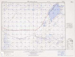 Tamsag Bulag (1955)
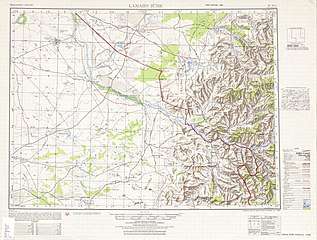 Lamaiin Süme (1955)
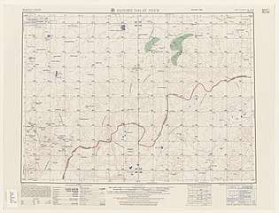 Sangiin Dalay Nurr (1955)
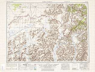 Sabha Horoo (1950)
References
- "2009 Annual Report". Dornod Aimag Statistical Office. Archived from the original on 29 April 2012. Retrieved 14 January 2013.
- "Khalkhgol Climate Normals 1961-1990". National Oceanic and Atmospheric Administration. Retrieved January 14, 2013.

This article is issued from Wikipedia. The text is licensed under Creative Commons - Attribution - Sharealike. Additional terms may apply for the media files.