Kfar Warburg
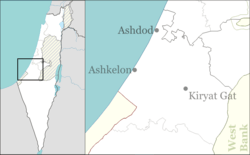
Kfar Warburg (Hebrew: כְּפַר וַרְבּוּרְג, lit. Warburg Village) is a large moshav in south-central Israel. Located near Kiryat Malakhi with 98 farms covering an area of 6,000 dunams, it falls under the jurisdiction of Be'er Tuvia Regional Council. In 2018 it had a population of 1,142.[1]
Kfar Warburg | |
|---|---|
 Kfar Warburg | |
 Kfar Warburg | |
| Coordinates: 31°43′10.55″N 34°43′23.51″E | |
| Country | Israel |
| District | Southern |
| Council | Be'er Tuvia |
| Affiliation | Moshavim Movement |
| Founded | 31 October 1939 |
| Founded by | "Menachem" members |
| Population (2018)[1] | 1,142 |
| Website | www.kfar-warburg.org |
History
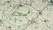
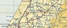
The moshav was founded on 31 October 1939 by members of the "Menachem" organisation. It was named after Felix M. Warburg, one of the leaders of the Jewish community in the United States and a founder of the American Jewish Joint Distribution Committee.[2] It was founded on land that had traditionally belonged to the depopulated Palestinian village of Qastina.[3]
In the early 1950s, after the population of Kfar Warburg doubled, a culture hall with a 880-seat auditorium was built at the crossroads of the village's three main roads. Plays by the Habima and Cameri theaters were performed there almost every week.[4]
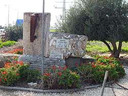
Notable residents include Yigal Hurvitz, a former Minister of Finance, who was buried in the moshav.
References
- "Population in the Localities 2018" (XLS). Israel Central Bureau of Statistics. 25 August 2019. Retrieved 26 August 2019.
- Mapa's concise gazetteer of Israel (in Hebrew). Yuval El'azari (ed.). Tel-Aviv: Mapa Publishing. 2005. p. 285. ISBN 965-7184-34-7.CS1 maint: others (link)
- Khalidi, Walid (1992). All That Remains: The Palestinian Villages Occupied and Depopulated by Israel in 1948. Washington D.C.: Institute for Palestine Studies. p. 131. ISBN 0-88728-224-5. ISBN 0-88728-224-5.
- Once a Cultural Hub, Israeli Modernist Icon Is Left to Languish, Haaretz