Karviná
Karviná (Czech pronunciation: [ˈkarvɪnaː] (![]()
![]()
Karviná Karwina | |
|---|---|
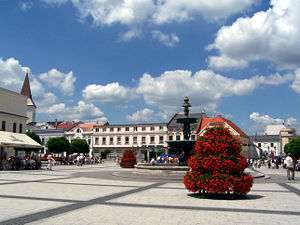 Town square in Karviná-Fryštát | |
 Flag 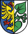 Coat of arms | |
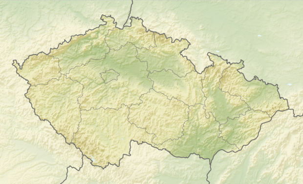 Karviná Location in the Czech Republic | |
| Coordinates: 49°51′15″N 18°32′34″E | |
| Country | |
| Region | Moravian-Silesian |
| District | Karviná |
| First mentioned | 1268 |
| Town rights | 1923 |
| City parts | 9
|
| Government | |
| • Mayor | Jan Wolf (ČSSD) |
| Area | |
| • Total | 57.49 km2 (22.20 sq mi) |
| Elevation | 221 m (725 ft) |
| Population (2020-01-01[1]) | |
| • Total | 52,128 |
| • Density | 910/km2 (2,300/sq mi) |
| Time zone | UTC+1 (CET) |
| • Summer (DST) | UTC+2 (CEST) |
| Postal code | 733 01 or 735 06 |
| Website | www.karvina.cz |
According to 2001 census, it had 65,141 inhabitants, but the population dropped under 53,000 (2019). 8.5% of the population are Slovaks and 8% of the population are Poles.[2] The Polish population has been historically declining. In the past the town had a significant German community. There is also a growing Romani community.
History
Until the 19th century Karviná was a low importance village of Cieszyn Silesia, lying near the important town of Fryštát. Discovery of coal led to rapid urban development in Karviná and surrounding villages, and railways were soon built. After the split of Cieszyn Silesia in 1920 it became a part of Czechoslovakia as a main mining center of the country. In 1923 it gained city rights. In October 1938 was annexed by Poland, together with whole region known as Zaolzie and during World War II was a part of Nazi Germany. After the war it again became a part of Czechoslovakia. In 1948 Karviná, Fryštát and the surrounding villages of Darkov, Ráj and Staré Město were merged into one city named Karviná. The coat of arms of Fryštát was chosen as the coat of arms of Karviná and Fryštát became the historical center of this industrial city.
The period after World War II is characterized by economic orientation on heavy industry. Currently the city is still reliant on dense heavy industry but is slowly restructuring the heavy industry influence and developing other economic activities. Karviná is also the center of education in this region with its wide range of specialized secondary schools and, especially, the Faculty of Commerce and Business of the Silesian University in Opava. In 2003 Karviná became a statutory city.
Karviná is also an important cultural and educational center of the Polish minority in the Czech Republic.
Sport
Karviná, as a multi-ethnic city of Cieszyn Silesia, was a home to many football clubs established by particular ethnic groups after World War I. At that time many football clubs within the Polish, German, Czech and Jewish communities were founded. The best known and most successful Polish club was PKS Polonia Karwina, founded in 1919. After World War II, the German and Jewish clubs were not re-established. The Czech and Polish clubs still existed until the 1950s, when as a part of communist unification of sport life in Czechoslovakia, Czech clubs were joined to ZSJ OKD Mír Karviná and the Polish Polonia Karwina was incorporated into that club. Today, the only football club in the city is MFK Karviná, playing in the first division.
Karviná is also home to a successful handball club, HCB Karviná, which became twice Czechoslovak champions and eleven times Czech champions. Other sport clubs in the city include two ice hockey teams SK Karviná (playing in the lower division) and HC Baník Karviná (playing in the 2nd Czech league); and the athletics club, with tennis, gymnastics and ice-skating being also very popular and established sports within the region.
Notable people
- Wacław Olszak (1868–1939), Polish mayor of Karviná (1929–1936)
- Emanuel Grim (1883–1950), Polish Catholic priest and writer
- Gustaw Morcinek (1891–1963), Polish writer
- Louis Kentner (1905–1987), Hungarian-British pianist
- Dana Zátopková (1922–2020), athlete
- Wilhelm Przeczek (1936–2006), Polish writer
- Eva Kurfürstová (born 1977), alpine skier
- Radek Štěpánek (born 1978), tennis player
- Petra Němcová (born 1979), model
- Jaroslav Bába (born 1984), athlete
- Denisa Rosolová (born 1986), athlete
Twin towns – sister cities


References
- "Population of Municipalities – 1 January 2020". Czech Statistical Office. 30 April 2020.
- "2001 census data". Czech Statistical Office.
- "Partnerská města" (in Czech). Statutární město Karviná. Retrieved 15 June 2020.
Further reading
- Cicha, Irena; Jaworski, Kazimierz; Ondraszek, Bronisław; Stalmach, Barbara; Stalmach, Jan (2000). Olza od pramene po ujście. Český Těšín: Region Silesia. ISBN 80-238-6081-X.
External links
| Wikimedia Commons has media related to Karviná. |


| Authority control |
|---|