Kandep Rural LLG
Kandep Rural LLG is one of two LLGs of the Kandep District of Enga Province, Papua New Guinea. It is located in southern Wabag, the capital town of Enga Province. Kandep shares land borders with Laiagam - Porgera, Wabag, and Wapenimanda District, along with additional land borders between the Southern Highlands, the Western Highlands provinces, and the newly Provinces.
Kandep Rural LLG | |
|---|---|
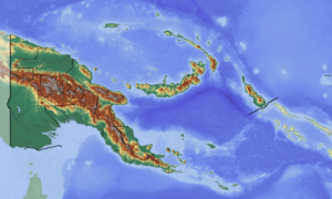 Kandep Rural LLG Location within Papua New Guinea | |
| Coordinates: 5.843457°S 143.509436°E | |
| Country | Papua New Guinea |
| Province | Enga Province |
| Time zone | UTC+10 (AEST) |
Wabag is accessible via a three-hour road trip along the Kandep - Laiagam Road. Access via Kandep - Mendi Road is currently unavailable due to construction efforts; however, the Kandep - Magarima Road remains connected.
Kandep LLG comprises council wards from Lai and Mariant. The Lai River which flows from north to south divides the District into two LLGs.
Wards
- 01. Weri
- 02. Mumunt
- 03. Iuripaka
- 04. Supi
- 05. Aluwaip
- 06. Gini
- 07. Komborosa
- 08. Imali (Pindata)
- 09. Pindaka
- 10. Pura
- 11. Kambia
- 12. Koropa
- 13. Lagalap No.1
- 14. Lakalap No.2
- 15. Winjap No.1
- 16. Winjap No.2
- 17. Lawe
- 18. Muyen
- 19. Warabim No.1
- 20. Warabim No.2
- 21. Teteres
- 22. Yapum
- 23. Murip
- 24. Lakis
- 25. Lyumbi Island
- 26. Porgeramanda
- 27. Kokas
- 28. Rugutengesa
- 29. Kandep Stn
- 30. Sawi
- 31. Werit 2
- 32. Ipul
- 33. Komatin (Megere)
- 34. Tinjipak (Supi No.2)
- 35. Wambokon (Gini No.2)
- 36. Kondo (Kombolos No.2)
- 37. Kamale (Imali 2)
- 38. Kalimang (Pindak 2)
- 39. Mamamdai Pura 2
- 40. Kambia 2
- 41. Lauk Kolopa 2
- 42. Tarapis
- 43. Kiap Akulia
- 44. Lawe 2
- 45. Kemau Tesres
- 46. Kiakau Murip 2
- 47. Keso
- 48. Wapis Kokas 2
- 49. Nangulam Lungutenges 2
- 50. Sawi No.2
- 51. Kola
- 52. Kolopen
References
- OCHA FISS (2018). "Papua New Guinea administrative level 0, 1, 2, and 3 population statistics and gazetteer". Humanitarian Data Exchange. 1.31.9.
- United Nations in Papua New Guinea (2018). "Papua New Guinea Village Coordinates Lookup". Humanitarian Data Exchange. 1.31.9.
External links
- "Home - Global Internet". Igr.gov.pg. Archived from the original on 2014-03-16. Retrieved 2014-03-27.
This article is issued from Wikipedia. The text is licensed under Creative Commons - Attribution - Sharealike. Additional terms may apply for the media files.