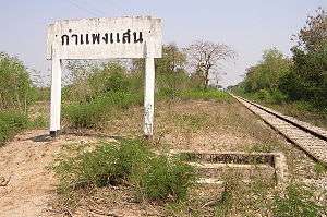
Kamphaeng Saen District
Kamphaeng Saen (Thai: กำแพงแสน, pronounced [kām.pʰɛ̄ːŋ sɛ̌ːn]) is the northwesternmost district (amphoe) of Nakhon Pathom Province, central Thailand.
Kamphaeng Saen กำแพงแสน | |
|---|---|
 District location in Nakhon Pathom Province | |
| Coordinates: 13°59′2″N 99°59′38″E | |
| Country | Thailand |
| Province | Nakhon Pathom |
| Area | |
| • Total | 405.019 km2 (156.379 sq mi) |
| Population (2017) | |
| • Total | 129,081 |
| • Density | 318.70/km2 (825.4/sq mi) |
| Time zone | UTC+7 (ICT) |
| Postal code | 73140 |
| Geocode | 7302 |
History
Kamphaeng Saen was a moated centre of Dvaravati culture, dating from 410-870 CE, with the foundation of a Buddhist stupa identified.[1]:304
Geography
Neighbouring districts are (from the north clockwise): Song Phi Nong of Suphanburi Province; Bang Len, Don Tum, and Mueang Nakhon Pathom of Nakhon Pathom Province; Ban Pong of Ratchaburi Province; and Tha Maka of Kanchanaburi Province.
Kasetsart University's Kamphaeng Saen campus is in this district.
Administration
The district is divided into 15 subdistricts (tambons), which are further subdivided into 202 villages (mubans). Kamphaeng Saen is also a township (thesaban tambon), which covers parts of tambons Kamphaeng Saen and Thung Kraphang Hom.
| 1. | Thung Kraphang Hom | ทุ่งกระพังโหม | |
| 2. | Kratip | กระตีบ | |
| 3. | Thung Luk Nok | ทุ่งลูกนก | |
| 4. | Huai Khwang | ห้วยขวาง | |
| 5. | Thung Khwang | ทุ่งขวาง | |
| 6. | Sa Si Mum | สระสี่มุม | |
| 7. | Thung Bua | ทุ่งบัว | |
| 8. | Don Khoi | ดอนข่อย | |
| 9. | Sa Phatthana | สระพัฒนา | |
| 10. | Huai Mon Thong | ห้วยหมอนทอง | |
| 11. | Huai Muang | ห้วยม่วง | |
| 12. | Kamphaeng Saen | กำแพงแสน | |
| 13. | Rang Phikun | รางพิกุล | |
| 14. | Nong Krathum | หนองกระทุ่ม | |
| 15. | Wang Nam Khiao | วังน้ำเขียว |
References
- Higham, C., 2014, Early Mainland Southeast Asia, Bangkok: River Books Co., Ltd., ISBN 9786167339443