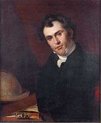
John Arrowsmith (cartographer)
John Arrowsmith (1790–1873) was born at Winston, County Durham England. He was the nephew of Aaron Arrowsmith, the English cartographer.
In 1810 he joined his uncle in the cartography business. After his uncle died in 1823, the family firm was carried on by his sons Aaron and Samuel Arrowsmith, and John began working on his own.[1][2] The Arrowsmith's were founding members of the Geographical Society of London in 1830.[3] The junior Aaron left the family firm in 1832, and upon the death of Samuel in 1839, John merged it into his own successful business. In 1863 he received the gold medal of the Royal Geographical Society, which was what the Geographical Society of London was known after gaining the patronage of King William IV.
Arrowsmith spent the years after his uncle's death preparing maps for his iconic London Atlas of Universal Geography, the first edition of which was published in 1834 with 50 maps. He published subsequent editions, adding and removing maps until there were 72 plates in one late edition.[4] The atlas continued to be published after his death, the rights to publish the maps being acquired by Edward Stanford in 1874.
Mount Arrowsmith, situated east of Port Alberni on Vancouver Island, British Columbia, is named for John Arrowsmith and his uncle Aaron Arrowsmith.[5] The Arrowsmith River in Western Australia was named by Sir George Grey after Arrowsmith, who later produced the maps for the published journals of Grey's two Western Australian expeditions.[6]
Maps of John Arrowsmith
1821–1832

John and his uncle built on Aaron's A map exhibiting all the new discoveries in the interior parts of North America 1811 version which was heavily based on information provided by the Hudson's Bay Company, Indian maps, and British Navy sea charts[7] to produce and publish an updated map: North America in 1821.[8] John spent the next ten years drawing and engraving 40 maps that he published in 1832 and that were eventually included in the 1834 atlas. The Map of British North America also heavily dependent upon information from the Hudson's Bay Company, was sold under its own cover, but it's unclear if the others were sold prior to publication of the 1834 atlas.
The 40 maps include the following (not a complete list; these maps were found in the David Rumsey map collection as included in Arrowsmith's 1838 Atlas. The Rumsey collection has digitized the maps in the 1838 and 1844 edition of the Atlas. Other editions of the atlas were published in 1834, 1835, 1839, 1840, 1842, 1859 and 1861.) :
- Orbis Veteribus Notus (Europe/Asia/Africa)
- World, Mercators projection
- Europe
- England
- Ireland
- Sweden & Norway
- Denmark (with Iceland)
- Belgium & Holland
- Western Germany
- Russia & Poland
- Austrian Empire
- Switzerland & the Passes of the Alps
- South Italy
- Turkey in Europe
- Greece & the Ionian Islands
- Spain & Portugal
- Nubia, Abyssinia
- Egypt
- Asia
- Turkey in Asia
- India
- Burmah, Siam, Cochin China
- China
- North Asia
- Asiatic Archipelago
- Pacific Ocean
- Mexico
- West Indies &
- Brazil
- British North America
Second edition (1835) of the London Atlas of Universal Geography (50 maps)
In addition to the maps published in 1832 in the above list, the 1835 atlas included the following (not a complete list):
Map with 1833 date:
- Discoveries in Western Australia
1834 Maps
- Inland navigation, rail roads, geology, minerals of England & Wales
- Scotland
- France
- Prussia & Poland
- North Italy, Alps, Apennines
- Africa
- Northwest Africa
- Central Asia
- Map of the discoveries in Australia
- Van Diemens Land
- United States
- South America
- Columbia
- Peru & Bolivia
- United Provinces of La Plata, Banda Oriental, Chile
Third edition (1838) of the London Atlas of Universal Geography (50-54 maps)
The first 1838 edition of the Atlas has the same maps as the 1835 edition, except for these maps that had been updated:
- America (1835)
- Cape of Good Hope (1835)
- Map of British North America (1837)
- Upper Canada (1837)
- Lower Canada (1837)
Later 1838 editions of the atlas than the one in the Rumsey collection replaced the following maps:
- Discoveries in Western Australia
- Discoveries in Australia
with
- The Colony of Western Australia
- The south eastern portion of Australia
and added the following maps:[4]
- Sketch of the Acquisitions of Russia since the Accession of Peter 1st. to the Throne
- Australia from surveys made by order of the British Government
- Eastern portion of Australia
- Maritime portion of South Australia
1840 edition of the London Atlas of Universal Geography (62 maps)
The 1840 edition of the Atlas (in the Library of Congress) had the same 54 maps as the 1838 edition, with the addition of the following maps:
- Cockburn Sound by J.S. Roe
- Map *District of Adelaide, South Australia
- Eastern townships of Lower Canada
- Western townships of Lower Canada with inset of Quebec
- Map of Jamaica
- Map of The Leeward Islands
- Map of the Windward Islands
- Map of British Guiana
1844 edition of the London Atlas of Universal Geography (65 maps)
The 1844 edition of the Atlas (also in the Rumsey collection) had 58 maps of the 1840 edition, excluding the following:
- Cockburn Sound by J.S. Roe
- District of Adelaide, South Australia
- Eastern townships of Lower Canada
- Western townships of Lower Canada with inset of Quebec
with the addition of the following maps:
- The West Coast of Africa
- The River Niger
- Map of Asia Minor
- The Caspian Sea
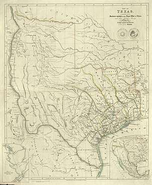
- Map of Texas
- New Zealand
- The Ionian Islands and Malta
Later maps
- 1848: Southern Tip of Vancouver Island and Oregon Territory
- 1849: Vancouver Island and the Adjacent Coasts
- 1850: Southern Tip of Vancouver Island
- 1850: Asia Trade Routes
- 1856: Vancouver Island
- 1857: South Africa - Showing the Routes of the Rev'd Dr. Livingstone between the years 1849 & 1857
- 1865: South Eastern Africa - Map of the River Shire, the Lakes Nyassa & Shirwa, the Lower Courses of the Rivers Zambesi, & Rovuma
References
- https://www.crouchrarebooks.com/mapmakers/john-arrowsmith
- Hayes, Derek (1999), Historical Atlas of British Columbia and the Pacific Northwest, Vancouver: Cavendish Books, p. 58, ISBN 978-1-55289-900-7
- Herbert, Francis (1989). "The 'London Atlas of Universal Geography' from John Arrowsmith to Edward Stanford: Origin, Development and Dissolution of a British World Atlas from the 1830s to the 1930s". Imago Mundi. 41: 99–123. doi:10.1080/03085698908592672. JSTOR 1151137.
- http://www.asmp.esrc.unimelb.edu.au/biogs/E000003b.htm
- Integrated Land Management Bureau, Government of British Columbia. Geographic place names.
- Grey, George (1841). Journals of two expeditions of discovery in North-West and Western Australia, during the years 1837, 38, and 39, describing many newly discovered, important, and fertile districts, with observations on the moral and physical condition of the aboriginal inhabitants, etc. etc. 2. London: T. and W. Boone. p. 56. Retrieved 2012-03-17.
- https://www.loc.gov/exhibits/lewisandclark/lewis-before.html#27
- http://www.swaen.com/item.php?id=33357
| Wikimedia Commons has media related to John Arrowsmith. |
| Wikisource has the text of the 1885–1900 Dictionary of National Biography's article about John Arrowsmith. |
| Authority control |
|
|---|