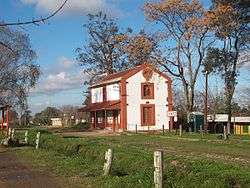
Joaquín Suárez (town)
Joaquín Suárez is a village in the Canelones Department of southern Uruguay.
Joaquín Suárez | |
|---|---|
Village | |
 | |
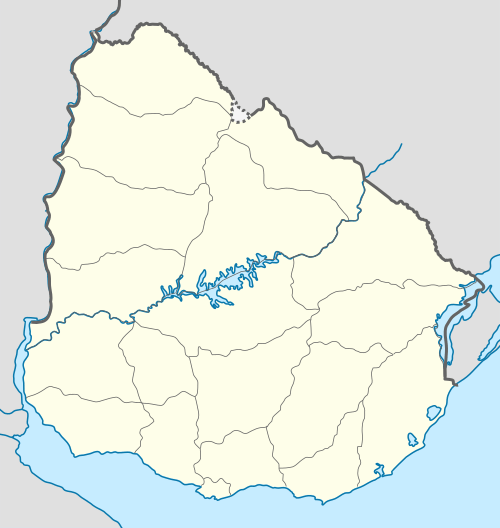 Joaquín Suárez Location in Uruguay | |
| Coordinates: 34°44′0″S 56°2′0″W | |
| Country | |
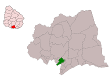
| Department | Canelones Department |
| Founded | 1882 |
| Population (2011) | |
| • Total | 6,570 |
| Time zone | UTC -3 |
| Postal code | 91200 |
| Dial plan | +598 2 (+7 digits) |
Suárez is also the name of the municipality to which the village belongs.
Location
The village is located on the intersection of Routes 84 and 74, northeast of Toledo and southwest of Pando. Sauce lies about 10 kilometres (6.2 mi) to the north. They are all considered parts of the wider metropolitan area of Montevideo.
History
It is named after Joaquín Suárez, President of Uruguay from 1843 to 1852. The foundation of a town (Villa) in this place was approved by Decree of 21 July 1866. It was founded on 15 October 1882 by Francisco Piria. It was declared a "Pueblo" (village) on 2 October 1929 by the Act of Ley Nº 8.482.[1]
Places of worship
- Parish Church of St. Francis of Assisi (Roman Catholic, Dominican Sisters of the Presentation)
Population
In 2011 Joaquín Suárez had a population of 6,570.[2][3]
| Year | Population |
|---|---|
| 1908 | 1,425 |
| 1963 | 2,357 |
| 1975 | 3,458 |
| 1985 | 4,175 |
| 1996 | 5,173 |
| 2004 | 6,214 |
| 2011 | 6,570 |
Source: Instituto Nacional de Estadística de Uruguay[1]
References
- "Statistics of urban localities (1908–2004)". INE. 2012. Archived from the original (PDF) on 23 March 2015. Retrieved 7 September 2012.
- "Censos 2011 Cuadros Canelones". INE. 2012. Archived from the original on 10 October 2012. Retrieved 25 August 2012.
- "Censos 2011 Canelones". INE. 2012. Archived from the original on 7 September 2012. Retrieved 28 August 2012.
External links
| Wikimedia Commons has media related to Joaquín Suarez, Uruguay. |
Capital: Canelones | ||
| Towns and villages |
|  |
| Resorts of the Ciudad de la Costa | ||
| Sights |
| |