Jitpur Simara
Jitpur Simara is a sub-metropolitan city in Bara District in Province No. 2 of southern Nepal that was formed on 10 March 2017 after merging Gadhimai Municipality, Inarwasira, Amlekhganj, as well as parts of Manharwa, Haraiya and Rampur Tokani to form a new sub-metropolitan city.[1] At the time of the 2011 Nepal census, the former settlements that would make up the sub-metropolitan city had a joint population of 117,094 people living in 21,670 individual households.[2]
Jitpur Simara जीतपुर सिमरा | |
|---|---|
Sub-Metropolitan City | |
| Nickname(s): Simara | |
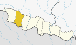
 Jitpur Simara Location in Nepal | |
| Coordinates: 27.18°N 84.72°E | |
| Country | Nepal |
| Province | Province No. 2 |
| District | Bara District |
| Government | |
| • Mayor | Dr Krishna Paudel (NCP) |
| • Deputy Mayor | Mrs. Saraswati Chaudhary (NCP) |
| Area | |
| • Total | 309.67 km2 (119.56 sq mi) |
| Population (2011) | |
| • Total | 117,094 |
| • Density | 380/km2 (980/sq mi) |
| Time zone | UTC+5:45 (Nepal Time) |
| Area code(s) | 053 |
| Website | www.jeetpursimaramun.gov.np |
Geography
Jitpur Simara lies in the Terrai region of Nepal. To the north, it borders Hetauda Sub-metropolitan city, to south and west Birgunj Metropolitan City, and to the east Kalaiya sub-metropolitan city. It is regarded as the youngest sub-metropolitan city in the country.[3]
Climate
The highest temperature ever recorded in Simara was 42.8 °C (109.0 °F) on 6 June 1979, while the lowest temperature ever recorded was 1.0 °C (33.8 °F) on 23 January 1985.[4]
| Climate data for Simara Airport 130m (1981-2010) | |||||||||||||
|---|---|---|---|---|---|---|---|---|---|---|---|---|---|
| Month | Jan | Feb | Mar | Apr | May | Jun | Jul | Aug | Sep | Oct | Nov | Dec | Year |
| Average high °C (°F) | 21.6 (70.9) |
25.5 (77.9) |
30.7 (87.3) |
34.9 (94.8) |
34.9 (94.8) |
34.3 (93.7) |
32.5 (90.5) |
32.7 (90.9) |
32.3 (90.1) |
31.5 (88.7) |
28.7 (83.7) |
24.6 (76.3) |
30.4 (86.7) |
| Daily mean °C (°F) | 14.6 (58.3) |
17.5 (63.5) |
22.2 (72.0) |
27.0 (80.6) |
29.0 (84.2) |
29.8 (85.6) |
29.0 (84.2) |
29.1 (84.4) |
28.3 (82.9) |
25.7 (78.3) |
21.3 (70.3) |
17.0 (62.6) |
24.2 (75.6) |
| Average low °C (°F) | 7.7 (45.9) |
9.5 (49.1) |
13.6 (56.5) |
19.0 (66.2) |
23.1 (73.6) |
25.3 (77.5) |
25.5 (77.9) |
25.5 (77.9) |
24.2 (75.6) |
20.0 (68.0) |
13.9 (57.0) |
9.3 (48.7) |
18.1 (64.6) |
| Average precipitation mm (inches) | 14.4 (0.57) |
14.1 (0.56) |
18.4 (0.72) |
50.4 (1.98) |
130.9 (5.15) |
282.0 (11.10) |
580.9 (22.87) |
439.2 (17.29) |
291.9 (11.49) |
69.4 (2.73) |
5.0 (0.20) |
11.2 (0.44) |
1,907.8 (75.11) |
| Source: Department Of Hydrology and Meteorology[5] | |||||||||||||
Infrastructure
Simara Airport lies in Old-Pipara Simara offering flights to Kathmandu and is the nearest airport from Kathmandu also.[6] Mahendra Highway & Tribhuvan Highway links Jitpur Simara to different regions of Nepal as well as to the Indian Border.
Amlekhgunj Raxaul Railway
The Amlekhgunj Raxaul railway has been a historic monument since India was a British colony. The railway was constructed to transport logs and sleepers. It led to the opening of major roads and construction of the infrastructure. This railway is at the verge of extinction due to the illegal encroachment of lands/buildings and deforestation by gangs.[7]
Facilities
60% of the land is utilized for agriculture.[8]
Parsa National Park
A newly founded park hosts elephants, one horned rhinoceros, "neelgai", diverse birds, python etc. The park is based on "charkose jhhadi". [9]
Dumarbana
Dumarbana is located in the north east corner of the metropolitan region. It is the center of agriculture. A special economic zone is in development. Protection and development of the sugar mill land has been controversial. It created a loss of billions rupees of taxpayer money. Illegal occupation of government lands impeded the development of the local area and caused the loss of significant agricultural jobs. The plan is to recover these encroached lands and reestablish the Birgunj Sugar Mill for farmers. Destruction of the natural forest and river by domestic and cross border gangs created flood and desertization of fertile lands. Electricity theft using unauthorized hooks disturbed electricity availability.[10]
Dumarbana has its own college, high schools and cooperatives. It has been developing as an educational, agricultural, socioeconomic hub in Bara district. In Dumarwana there are many football teams as Danfe Youth Club (Bhawanipur), Sundarbasti youth club (Sunderbasti), Rajghatta Youth club (Rajghatta).
Education
- Shree Nepal Rastriya Secondary School, Auraha
- Subhatara Academy, Auraha
- Shree Nepal Rastriya Secondary School, Simara
- Simara College
- Subharambha College
- Bakuliya Campus
- Dumarwana Multiple Campus
- Brighter Academy, Simara
- Simara Public English Secondary School
- Akshara pathsala
- Mount Everest Secondary Boarding School
- Lotus Academy
- Ekta Public Secondary School
- St.Peters Boarding School
- St.Alphonsa English School
- Ex-serviceman secondary boarding school
- Bara Academy
- Rastriya vibhuti samudayik shikhsa sadan
- Progress Education Academy
- Shahid smarak School
- Jivan Jyoti English secondary School
- Emerald Academy
Facilities
Jitpur Simara is full of facilties including best health services, education, drinking water supply and many more. Most of the industries are located in this place.
Organizations
- Trishul club (Bhawanipur)
- Baba Youth Organization
- Lions/LEO Club of Jitpur-Simara
- Nawa Janjagriti Youth Club
- Bikashshil Club
- Santi Yuwa Bikash Manchh (Jeetpur Santitole)
- Danfe Youth Club
- Sundarbasti Youth Club
Temples
- Shree Durga Bhagwati Temple, Auraha
- Krishna Temple, Auraha
- Gadhimai Temple
- Musarnimai Temple
- Thanimai Temple
- Ghantimai Temple
- Sahajnath mahadev Temple
- Churiyamai Temple
- Bakuliya temple
Industries
- Jagdamba Steels Pvt. Ltd.
- Sipradi Trading Private Ltd (Branch)
- Shree Jagdamba Enterprises Pvt. Ltd.
- Ashok steel Pvt. Ltd.
- Advance cement (Bhawanipur)
- Hulas Steel Ltd.
- Surya Nepal Pvt. Ltd.
- Hama Iron & Steel Industries Pvt. Ltd.
- Puja Soap & Household Products Pvt. Ltd.
- Yazat Food Pvt. Ltd.
- Alliance Pharmaceuticals Pvt. Ltd.
- Nepal Cable & Wire Industries Pvt. Ltd.
Hotels
- Lama Hotel
- Hotel Ichchha
- Hotel Simara Inn
- Hotel Durbar Inn
References
- "Kalaiya residents agitate demanding sub metropolitan city". My Republica. Retrieved 2017-06-16.
- "National Population and Housing Census 2011" (PDF). Central Bureau of Statistics. November 2017. Archived from the original (PDF) on 27 January 2018. Retrieved 1 May 2018.
- "Nepal Census 2001". Nepal's Village Development Committees. Digital Himalaya. Archived from the original on 12 October 2008. Retrieved 9 December 2008.
- "Archived copy" (PDF). Archived from the original (PDF) on March 4, 2016. Retrieved February 27, 2016.CS1 maint: archived copy as title (link). Retrieved 27 February 2016.
- . Department Of Hydrology and Meteorology Retrieved 26 September 2014.
- "Simara Airport" (PDF). Civil Aviation authority of Nepal. Retrieved 1 October 2018.
- Yadav, Upendra. "Land of Nepal Railway in Raxaul remains unutilized". My Republica. Retrieved 2018-12-19.
- "Rising demand gives boost to fish farming". kathmandupost.ekantipur.com. Retrieved 2018-12-19.
- "Parsa National Park welcomes baby elephant". kathmandupost.ekantipur.com. Retrieved 2018-12-19.
- "Early sowing of maize seeds blamed for repeated crop failures". kathmandupost.ekantipur.com. Retrieved 2018-12-19.
Headquarter: Kalaiya | ||
| Sub-Metropolitan Cities |
|  |
| Municipalities | ||
| Rural municipalities | ||