Jeffersonville, Illinois
Jeffersonville is a village in Wayne County, Illinois, United States. The population was 366 at the 2000 census.
Geff | |
|---|---|
Village | |
 Public park and town hall (right) | |
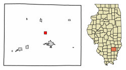 Location of Jeffersonville in Wayne County, Illinois. | |
.svg.png) Location of Illinois in the United States | |
| Coordinates: 38°26′31″N 88°24′16″W | |
| Country | United States |
| State | Illinois |
| County | Wayne |
| Area | |
| • Total | 1.02 sq mi (2.64 km2) |
| • Land | 1.02 sq mi (2.64 km2) |
| • Water | 0.00 sq mi (0.00 km2) |
| Population (2010) | |
| • Total | 367 |
| • Estimate (2016)[2] | 356 |
| • Density | 349.02/sq mi (134.77/km2) |
| Time zone | UTC-6 (CST) |
| • Summer (DST) | UTC-5 (CDT) |
| ZIP Code(s) | 62842 |
| Area code(s) | 618 |
| FIPS code | 17-38323 |
| Wikimedia Commons | Jeffersonville, Illinois |
Although its official name is Jeffersonville, the village is known locally as Geff, with that spelling appearing on local road signs, the US Post office, and many official documents. "Geff" is pronounced as though it were spelled "Jeff". The name change is said to have been made during the 19th century by the railroad, in order to distinguish the village in Illinois from Jeffersonville, Indiana.
Geography
Jeffersonville is located at 38°26′31″N 88°24′16″W (38.442024, -88.404562).[3]
According to the 2010 census, Jeffersonville has a total area of 1.02 square miles (2.64 km2), all land.[4]
History
Demographics
| Historical population | |||
|---|---|---|---|
| Census | Pop. | %± | |
| 1880 | 238 | — | |
| 1890 | 256 | 7.6% | |
| 1900 | 286 | 11.7% | |
| 1910 | 237 | −17.1% | |
| 1920 | 322 | 35.9% | |
| 1930 | 288 | −10.6% | |
| 1940 | 288 | 0.0% | |
| 1950 | 326 | 13.2% | |
| 1960 | 330 | 1.2% | |
| 1970 | 294 | −10.9% | |
| 1980 | 340 | 15.6% | |
| 1990 | 311 | −8.5% | |
| 2000 | 366 | 17.7% | |
| 2010 | 367 | 0.3% | |
| Est. 2016 | 356 | [2] | −3.0% |
| U.S. Decennial Census[5] | |||
As of the census[6] of 2000, there were 366 people, 156 households, and 99 families residing in the village. The population density was 358.8 people per square mile (138.5/km²). There were 171 housing units at an average density of 167.6 per square mile (64.7/km²). The racial makeup of the village was 97.81% White, 1.37% African American, 0.55% Native American, 0.27% from other races. Hispanic or Latino of any race were 2.46% of the population.
There were 156 households out of which 34.6% had children under the age of 18 living with them, 50.0% were married couples living together, 12.2% had a female householder with no husband present, and 36.5% were non-families. 32.1% of all households were made up of individuals and 16.7% had someone living alone who was 65 years of age or older. The average household size was 2.35 and the average family size was 2.98.
In the village, the population was spread out with 28.1% under the age of 18, 9.0% from 18 to 24, 26.2% from 25 to 44, 18.6% from 45 to 64, and 18.0% who were 65 years of age or older. The median age was 34 years. For every 100 females, there were 98.9 males. For every 100 females age 18 and over, there were 82.6 males.
The median income for a household in the village was $25,521, and the median income for a family was $28,500. Males had a median income of $25,521 versus $16,458 for females. The per capita income for the village was $11,882. About 15.4% of families and 19.7% of the population were below the poverty line, including 23.7% of those under age 18 and 21.1% of those age 65 or over.
Notable people
- Clyde W. Robbins, farmer and politician
- Shelton Brothers Gang, Southern Illinois, Prohibition era gangsters, brothers Carl, Earl, and Bernie were born and raised in "Geff" Jeffersonville.
References
- "2016 U.S. Gazetteer Files". United States Census Bureau. Retrieved Jun 29, 2017.
- "Population and Housing Unit Estimates". Retrieved June 9, 2017.
- "US Gazetteer files: 2010, 2000, and 1990". United States Census Bureau. 2011-02-12. Retrieved 2011-04-23.
- "G001 - Geographic Identifiers - 2010 Census Summary File 1". United States Census Bureau. Archived from the original on 2020-02-13. Retrieved 2015-08-04.
- "Census of Population and Housing". Census.gov. Retrieved June 4, 2015.
- "U.S. Census website". United States Census Bureau. Retrieved 2008-01-31.
Municipalities and communities of Wayne County, Illinois, United States | ||
|---|---|---|
| Cities | Map of Illinois highlighting Wayne County | |
| Villages | ||
| Townships | ||
| Unincorporated communities | ||
| Footnotes | ‡This populated place also has portions in an adjacent county or counties | |