Jefferson, Louisiana
Jefferson is a census-designated place (CDP) in Jefferson Parish, Louisiana, United States, on the north side (referred to as the "East Bank") of the Mississippi River. Jefferson is part of the New Orleans–Metairie–Kenner Metropolitan Statistical Area. The population was 11,193 at the 2010 census.[1] It is often known by locals as "Old Jefferson" (to distinguish itself from the rest of Jefferson Parish), but should not be confused with Old Jefferson in East Baton Rouge Parish, Louisiana.
Jefferson, Louisiana Old Jefferson | |
|---|---|
Census-designated place | |
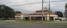
 Old Jefferson welcome sign at the boundary with the City of New Orleans | |
 Jefferson, Louisiana Location of Jefferson in Louisiana | |
| Coordinates: 29°57′51″N 90°09′26″W | |
| Country | United States |
| State | Louisiana |
| Parish | Jefferson |
| Area | |
| • Total | 3.3 sq mi (9 km2) |
| • Land | 2.7 sq mi (7 km2) |
| • Water | 0.6 sq mi (2 km2) |
| Elevation | 3 ft (0.9 m) |
| Population (2010) | |
| • Total | 11,193 |
| • Density | 3,400/sq mi (1,300/km2) |
| Time zone | UTC-6 (CST) |
| • Summer (DST) | UTC-5 (CDT) |
| ZIP Code | 70121 |
| Area code(s) | 504 |
History

Early French colonial documents show what would become Jefferson as part of the "Tchoupitoulas Coast" of Native American settlement. In the French and Spanish colonial era it was divided into a series of plantations with boundary lines perpendicular to the Mississippi River.
In the American Civil War, Camp Parapet was built originally by Confederate forces to defend New Orleans from an attack from the upriver side. After the Union liberated the city sailing up from downriver, U.S. troops expanded the fortifications to defend from Confederate counterattacks which never came.
What is now Jefferson includes formerly separate small communities dating back to the 19th century, including, Hoeyville, New Carrollon, Southport, and Shrewsbury, along with 20th century subdivisions/land developments including Azalea Gardens, Camellia Gardens, Jefferson Heights, and Rio Vista. Some of these names continue to sometimes be used locally to refer to neighborhoods.
The current 4 lane Jefferson Highway was inaugurated in 1928, accelerating development as a suburban area within Greater New Orleans.
Former landmarks included what is best remembered as "The Beverly". An old plantation house was first converted to a "road house" music venue called "Suburban Gardens" in the 1920s; Louis Armstrong and his band had a summer residency here in 1931. In 1945 it was expanded into a lush (but illegal) gambling casino under the name the Beverly Country Club. After Federal crackdowns, it became a dinner theater until it burned down in 1983.[2]
Geography
Jefferson is located in northern Jefferson Parish at 29°57′51″N 90°9′26″W (29.964132, -90.157170).[1] It is bordered to the north by Metairie, to the west by Elmwood, to the south, across the Mississippi River, by Bridge City, and to the east by the city of New Orleans in Orleans Parish. U.S. Route 90 (Jefferson Highway) runs through the center of the community, leading east 6 miles (10 km) to downtown New Orleans.
According to the United States Census Bureau, the Jefferson CDP has a total area of 3.3 square miles (8.5 km2), of which 2.7 square miles (7.0 km2) are land and 0.58 square miles (1.5 km2), or 17.46%, are water.[3] The western part of Jefferson's Census area was lost to Elmwood during the 2000 census.
The northern boundary is separated from Metairie by the triple barriers of a drainage canal, railroad tracks, and the Earhart Expressway. The only open public road crossings are Causeway Boulevard and Central Avenue. Many years ago, Labarre Road and Shrewsbury Road connected from River Road to Airline Dr. Many Residents in Old Jefferson perfer the route to continue to Airline Dr. Old Jefferson now is a tucked away neighborhood. It's largely expanding with new shops and businesses coming in.
Landmarks include the Ochsner Medical Center complex.
Demographics
| Historical population | |||
|---|---|---|---|
| Census | Pop. | %± | |
| 1960 | 19,353 | — | |
| 1970 | 16,489 | −14.8% | |
| 1980 | 15,550 | −5.7% | |
| 1990 | 14,521 | −6.6% | |
| 2000 | 11,843 | −18.4% | |
| 2010 | 11,193 | −5.5% | |
| source:[4][5] | |||
As of the census[6] of 2000, there were 11,843 people, 5,400 households, and 2,878 families residing in the CDP. The population density was 4,294.0 people per square mile (1,656.7/km²). There were 5,816 housing units at an average density of 2,108.7 per square mile (813.6/km²). The racial makeup of the CDP was 71.85% White, 23.47% African American, 0.26% Native American, 1.50% Asian, 0.03% Pacific Islander, 1.65% from other races, and 1.24% from two or more races. Hispanic or Latino of any race were 5.07% of the population.
There were 5,400 households out of which 22.0% had children under the age of 18 living with them, 32.8% were married couples living together, 15.1% had a female householder with no husband present, and 46.7% were non-families. 39.2% of all households were made up of individuals and 12.7% had someone living alone who was 65 years of age or older. The average household size was 2.11 and the average family size was 2.83.
In the CDP, the population was spread out with 18.8% under the age of 18, 8.0% from 18 to 24, 33.0% from 25 to 44, 22.9% from 45 to 64, and 17.3% who were 65 years of age or older. The median age was 39 years. For every 100 females, there were 92.1 males. For every 100 females age 18 and over, there were 89.6 males.
The median income for a household in the CDP was $32,106, and the median income for a family was $40,408. Males had a median income of $32,256 versus $26,673 for females. The per capita income for the CDP was $19,245. About 10.4% of families and 14.5% of the population were below the poverty line, including 19.3% of those under age 18 and 9.3% of those age 65 or over.
Education
Primary and secondary schools
Jefferson Parish Public Schools operates schools in the parish and serves Jefferson.[7]
Most residents are zoned to Jefferson Elementary School in Jefferson, while some are zoned to Dolhonde Elementary in Metairie.[8] All students are zoned to Riverdale Middle School in Jefferson,[9] and Riverdale High School in Jefferson.[10] In regards to the advanced studies academies, students are zoned to Metairie Academy or Haynes Academy in Old Metairie.[11]
St. Agnes School a K-7 Catholic school of the Roman Catholic Archdiocese of New Orleans, was previously in Jefferson. It was created in 1941,[12] and closed in 2015.[13] In 2014 it had 161 students,[13] and then in 2015 it had 125 students. Principal Michael Buras stated that the school community gained an acceptance that the school will close.[14] The school accepted school vouchers.[15] As of 2020 Jefferson Chamber Foundation Academy (JCFA) maintains a charter school for non-traditional students in the building.[12]
Public libraries
Jefferson Parish Library operates the Rosedale Library in Jefferson.[7][16] A Greek revival plantation house named "Rosedale," established in 1838, used to occupy the present day site of the library. In 1978 two fires destroyed the house, which was 140 years old. The library was established in 1986.[16]
Notable people
Old Jefferson was home to jazz musicians Johnny Wiggs and William "Baba" Ridgely.
References
| Wikimedia Commons has media related to Jefferson, Louisiana. |
| Wikivoyage has a travel guide for Jefferson, Louisiana. |
- "US Gazetteer files: 2010, 2000, and 1990". United States Census Bureau. 2011-02-12. Retrieved 2011-04-23.
- "Remembering the Beverly". Times-Picayune. Retrieved 2018-02-03.
- "Geographic Identifiers: 2010 Census Summary File 1 (G001): Jefferson CDP, Louisiana". American Factfinder. U.S. Census Bureau. Archived from the original on February 13, 2020. Retrieved July 3, 2018.
- "CENSUS OF POPULATION AND HOUSING (1790-2000)". U.S. Census Bureau. Retrieved 2010-07-17.
- Census area returned as Jefferson Heights in 1960 & 1970.
- "U.S. Census website". United States Census Bureau. Retrieved 2008-01-31.
- "2010 CENSUS - CENSUS BLOCK MAP: Jefferson CDP, LA" (Archive). U.S. Census Bureau. Retrieved on May 18, 2014.
- "Elementary School Districts 2012-2013 East Bank of Jefferson Parish Louisiana Archived 2013-09-05 at the Wayback Machine" (Archive). Jefferson Parish Public School System. Retrieved on May 18, 2014.
- "Middle School Districts 2012-2013 East Bank of Jefferson Parish Louisiana Archived 2013-09-05 at the Wayback Machine" (Archive) Jefferson Parish Public School System. Retrieved on May 18, 2014.
- "High School Districts 2012-2013 East Bank of Jefferson Parish Louisiana Archived 2014-05-18 at WebCite." (Archive) Jefferson Parish Public School System. Retrieved on May 18, 2014.
- "East Bank Advanced Studies Attendance Zones Archived 2013-09-05 at the Wayback Machine" (Archive). Jefferson Parish Public School System. Retrieved on May 18, 2014.
- "School". Jefferson, Louisiana: St. Agnes Church. Retrieved 2020-05-26.
- "Closing of 3 New Orleans-area schools to displace hundreds of students in 2015". The Times Picayune. 2014-10-27. Retrieved 2020-05-26.
- Williams, Jessica (2015-05-14). "St. Agnes School at peace with closure, principal tells newspaper". The Times Picayune. Retrieved 2020-05-26.
- Williams, Jessica (2014-10-24). "Much discussion around New Orleans-area Catholic school closures, but some parents say not with them". The Times Picayune. Retrieved 2020-05-26.
- "Rosedale Library." Jefferson Parish Library. Retrieved on September 29, 2010.
Municipalities and communities of Jefferson Parish, Louisiana, United States | ||
|---|---|---|
Parish seat: Gretna | ||
| Cities | 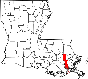 | |
| Towns | ||
| CDPs | ||
| Other unincorporated communities | ||
Baton Rouge (capital) | ||
| Topics |
| |
| Society |
| |
| Regions |
| |
| Cities | ||
| CDPs | ||
| Metros | ||
| Parishes | ||