Jacksonville, Texas
Jacksonville is a city located in Cherokee County, Texas, United States. The population was 14,544 at the 2010 census. It is the principal city of the Jacksonville Micropolitan Statistical Area, which includes all of Cherokee County, and part of the larger Tyler–Jacksonville combined statistical area.
Jacksonville, Texas | |
|---|---|
City | |
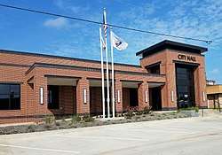 Jacksonville's City Hall, located downtown on South Ragsdale Street, was completed in November 2016. | |
| Nickname(s): The Biggest Small Town in Texas; Tomato Capital of the World | |
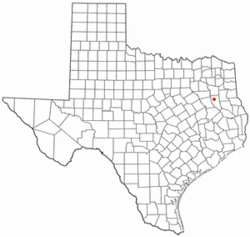 Location of Jacksonville, Texas | |
 | |
| Coordinates: 31°57′49″N 95°16′7″W | |
| Country | |
| State | |
| County | Cherokee |
| Government | |
| • Type | Council-Manager |
| • City Council | Lawyer Dick Stone Hubert Robinson Jeff Smith Randy Gorham Rob Gowin |
| • City Manager | Greg Smith |
| Area | |
| • Total | 14.1 sq mi (36.6 km2) |
| • Land | 14.1 sq mi (36.6 km2) |
| • Water | 0.0 sq mi (0.0 km2) |
| Elevation | 522 ft (159 m) |
| Population (2010) | |
| • Total | 14,544 |
| • Density | 1,031.5/sq mi (397.4/km2) |
| Time zone | UTC-6 (Central (CST)) |
| • Summer (DST) | UTC-5 (CDT) |
| ZIP code | 75766 |
| Area code(s) | 430, 903 (903 Exchanges: 541,586,589) |
| FIPS code | 48-37216[1] |
| GNIS feature ID | 1374262[2] |
| U.S. Highways | |
| Major State Highways | |
| Website | http://www.jacksonvilletx.org |
Jacksonville is located in an area of rolling hills in East Texas, north of the county seat, Rusk, and south of Tyler, in neighboring Smith County, on U.S. Highway 69. The north-south Highway 69 intersects the east–west U.S. Highway 79 adjacent to the city's downtown area.
Area production and shipping of tomatoes gained the town the title "Tomato Capital of the World". The impressive red iron ore rock Tomato Bowl, built by Works Progress Administration workers during the Great Depression, is home to the Jacksonville High School "Fightin' Indians" football and soccer teams. Annual events include the "Tops in Texas Rodeo" held in May and the "Tomato Fest" celebration in June.
History
Jacksonville began in 1847 as the town of Gum Creek. Jackson Smith built a home and blacksmith shop in the area, and became postmaster in 1848, when a post office was authorized. Shortly afterward, Dr. William Jackson established an office near Smith's shop. When the townsite was laid out in 1850, the name Jacksonville was chosen in honor of these two men. The name of the post office was changed from Gum Creek to Jacksonville in June 1850.
An attempt to unionize meatcutters at Walmart
Despite never having organized unions in any Walmart stores before, meatcutters working at the Jacksonville Walmart voted in favor of organizing under the wing of the United Food and Commercial Workers union in February 2000. During a flurry of subsequent legal actions, Walmart discontinued store-level meatcutting and started shipping in pre-packaged/pre-frozen meat to their stores. When all the hearings and appeals were exhausted, it was decided that the local meatcutters didn't embody the characteristics of a group that could bargain since they weren't specialized, while Walmart was found to have engaged in unfair labor practices. Even now, there is no one in the Jacksonville meat department to make special cuts of meat or any union presence there.[3][4]
Demographics
| Historical population | |||
|---|---|---|---|
| Census | Pop. | %± | |
| 1880 | 349 | — | |
| 1890 | 970 | 177.9% | |
| 1900 | 1,558 | 60.6% | |
| 1910 | 2,875 | 84.5% | |
| 1920 | 3,723 | 29.5% | |
| 1930 | 6,748 | 81.3% | |
| 1940 | 7,213 | 6.9% | |
| 1950 | 8,607 | 19.3% | |
| 1960 | 9,590 | 11.4% | |
| 1970 | 9,734 | 1.5% | |
| 1980 | 12,264 | 26.0% | |
| 1990 | 12,765 | 4.1% | |
| 2000 | 13,868 | 8.6% | |
| 2010 | 14,544 | 4.9% | |
| Est. 2019 | 14,815 | [5] | 1.9% |
| U.S. Decennial Census[6] | |||
As of the census[1] of 2000, there were 13,868 people, 4,882 households, and 3,358 families residing in the city. The population density was 981.0 people per square mile (378.7/km2). There were 5,397 housing units at an average density of 381.8 per square mile (147.4/km2). The racial makeup of the city was 62.60% White, 21.70% African American, 0.48% Native American, 0.68% Asian, 0.13% Pacific Islander, 12.72% from other races, and 1.69% from two or more races. Hispanic or Latino of any race were 23.04% of the population.
There were 4,882 households out of which 35.6% had children under the age of 18 living with them, 46.5% were married couples living together, 17.9% had a female householder with no husband present, and 31.2% were non-families. 27.7% of all households were made up of individuals and 13.8% had someone living alone who was 65 years of age or older. The average household size was 2.71 and the average family size was 3.28.
In the city, the age distribution of the population shows 29.2% under the age of 18, 12.1% from 18 to 24, 25.2% from 25 to 44, 17.9% from 45 to 64, and 15.5% who were 65 years of age or older. The median age was 31 years. For every 100 females, there were 89.9 males. For every 100 females age 18 and over, there were 83.8 males.
The median income for a household in the city was $25,800, and the median income for a family was $31,176. Males had a median income of $23,650 versus $19,375 for females. The per capita income for the city was $13,541. About 19.2% of families and 23.1% of the population were below the poverty line, including 29.0% of those under age 18 and 17.7% of those age 65 or over.
Geography
Jacksonville is located a 31°57′49″N 95°16′07″W.[7]
According to the United States Census Bureau, the city has a total area of 14.1 square miles (37 km2), of which 14.1 square miles (37 km2) is land and 0.07% is water.
Lake Jacksonville
Lake Jacksonville is three miles (5 km) southwest of Jacksonville. It is the city's primary water source. It is a popular location for recreation and residences. It was created in 1957 and the city expected it to take years to fill with water from the surrounding creeks. But, with an unusually rainy season, the lake reached full capacity in a year.
- Lake characteristics
- Location: 3 miles southwest of Jacksonville off US 79
- Surface area: 1,320 acres
- Maximum depth: 62 feet
- Impounded: 1957
Government
Local government
According to the city's most recent Adopted Budget, the city's various funds had $14.9 million in Revenues, $15.7 million in expenditures, and $4.4 million fund balance.[8]
Management of the city and coordination of city services are provided by:[9]
| Department | Director |
|---|---|
| City Mayor | Dick Stone |
| City Manager | Mo Raissi |
| Director of Finance | Roxanna Martin |
| Fire Chief | Keith Fortner |
| Police Chief | Andrew Hawkes |
| Director of Public Works | Jordan Yutzy |
| Director of Water and Sewer | Randall Chandler |
| Director of Development Services | Jody Watson |
| Director of Streets | James Worley |
| Library Director | Trina Stidham |
State government
Jacksonville is represented in the Texas Senate by Republican Robert Nichols, District 3, and in the Texas House of Representatives by Republican Travis Clardy, District 11.
Federal government
At the Federal level, the two U.S. Senators from Texas are Republicans John Cornyn and Ted Cruz; Jacksonville is part of the Fifth Congressional District, represented by Republican Lance Gooden.
Attractions
The Jacksonville Public Library[10] has served the City of Jacksonville and Cherokee County for over 70 years. The Library is a member of the Texas Library Association, the Northeast Texas Library System and the Forest Trails Library Consortium.
Vanishing Texana Museum, located downtown, displays many local historical artifacts related to Jacksonville and its vicinity.
Education
The City of Jacksonville is served by the Jacksonville Independent School District. Jacksonville High School, the district's only high school, has "Fightin' Indians“/"Maidens" as mascots for its team sports.
Colleges, universities
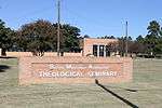
Jacksonville College and the Baptist Missionary Association Theological Seminary, both of which are owned by the Baptist Missionary Association of America, are located in Jacksonville.
Lon Morris College, a United Methodist Church operated private junior college, was located in Jacksonville until ceasing operations in 2012.
Transportation
Many highways pass through and intersect in Jacksonville: US 69, US 79, US 175, SH 135, SH 204, FM 347, FM 768, FM 2138, and Loop 456. Where 3 railroads once served the Jacksonville area (Southern Pacific and Cotton Belt abandoned their tracks in the mid-1980s), only one, Union Pacific, remains. Cherokee County Airport serves small airplanes and general aviation a few miles south of town. Shipping and trucking firms can serve area customers, or pass through town to several important points directly from Jacksonville, including Beaumont, Houston, Austin, Dallas-Fort Worth, Kansas City, Shreveport, and Memphis.
Notable people
- Kevin Aldridge - former Tennessee Titans Defensive Lineman
- Ray Benge - baseball pitcher
- Bruce Channel - singer/songwriter[11]
- Travis Clardy - Texas House of Representatives member for District 11
- John Clark - previous state-championship-winning high school football coach and later athletic director for Plano ISD in Plano
- Al Dexter - country music singer
- Sandy Duncan - actress, originally from Henderson, graduated from the former Lon Morris College
- Paul Gipson - running back
- Toby Gowin - former NFL punter
- Micah Hoffpauir - former Chicago Cubs first baseman
- Craig James - former pro football player, former ESPN and Fox Sports commentator
- John B. Kendrick - (1857-1933), United States Senator from Wyoming and ninth Governor of Wyoming, was born on a ranch near Jacksonville.[12]
- Pete Lammons - former New York Jets tight end and defensive end
- Billy Martindale - former pro golfer, golf course designer
- Margo Martindale - award-winning actress, graduated from the former Lon Morris College
- Josh McCown - New York Jets quarterback
- Luke McCown - former NFL quarterback
- Neal McCoy - country music singer
- Robert Nichols - Texas State Senator (2007–present), former Jacksonville mayor and city councillor; a park and an intermediate school in the city bear his surname
- Grady Nutt - (1934–1982), was a Christian minister and humorist who resided in Jacksonville for several years; many of his stories are based on people and places in the Jacksonville area
- V. O. Stamps - (1892–1940), was co-founder of the Stamps-Baxter Music Company. He moved to Jacksonville in 1919 to sell gospel songbooks, began the V.O. Stamps Publishing Company in Jacksonville in 1924, and ran the Jacksonville office of the Stamps-Baxter Music Company from its beginning in 1927 until the offices moved to Dallas in 1929.
- Alan Tudyk - actor, originally from El Paso, graduated from the former Lon Morris College
- Lee Ann Womack - country music singer
References
- "U.S. Census website". United States Census Bureau. Retrieved 2008-01-31.
- "US Board on Geographic Names". United States Geological Survey. 2007-10-25. Retrieved 2008-01-31.
- Wal-Mart's "Meat Wars" With Union Sizzles On, HuffingtonPost.com, Al Norman--writer, March 16, 2008. Retrieved 2009-10-24.
- UFCW Timeline Archived 2011-07-28 at the Wayback Machine, Retrieved 2009-10-24.
- "Population and Housing Unit Estimates". Retrieved May 21, 2020.
- "Census of Population and Housing". Census.gov. Retrieved June 4, 2015.
- "US Gazetteer files: 2010, 2000, and 1990". United States Census Bureau. 2011-02-12. Retrieved 2011-04-23.
- 2008-09 Adopted Budget Archived 2009-05-28 at the Wayback Machine Retrieved 2009-06-10
- City of Jacksonville Archived 2009-05-16 at the Wayback Machine Retrieved 2009-06-03
- Website, Jacksonville Public Library. Retrieved 2019-02-23.
- Bruce Channel Biography, IMDb. Retrieved 2019-03-12.
- "KENDRICK, John Benjamin, (1857 - 1933)". Biographical Directory of the United States Congress. Retrieved November 18, 2012.
| Wikimedia Commons has media related to Jacksonville, Texas. |
External links
- City of Jacksonville
- Jacksonville Chamber of Commerce
- Jacksonville Economic Development
- Jacksonville Progress (newspaper)
- Jacksonville Public Library
- Baptist Missionary Association Theological Seminary
- Jacksonville College
- Jacksonville Independent School District
- Jacksonville History and Memorabilia
- Jacksonville, TX from the Handbook of Texas Online
Municipalities and communities of Cherokee County, Texas, United States | ||
|---|---|---|
| Cities | 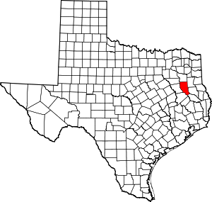 Cherokee County map | |
| Towns | ||
| CDP | ||
| Other unincorporated communities | ||
| Ghost towns | ||
| Footnotes | ‡This populated place also has portions in an adjacent county or counties | |
| Authority control |
|
|---|