Ishasha River Camp Airport
Ishasha River Camp Airport is an airport serving the Ishasha River Camp[3][4] and the Queen Elizabeth National Park in Uganda.
Ishasha River Camp Airport | |||||||||||
|---|---|---|---|---|---|---|---|---|---|---|---|
| Summary | |||||||||||
| Airport type | Public | ||||||||||
| Serves | Ishasha River Camp, Queen Elizabeth National Park | ||||||||||
| Elevation AMSL | 3,140 ft / 957 m | ||||||||||
| Coordinates | 00°36′50″S 29°39′55″E | ||||||||||
| Map | |||||||||||
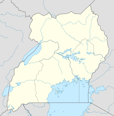 Ishasha Location of the airport in Uganda | |||||||||||
| Runways | |||||||||||
| |||||||||||
The Kisoro non-directional beacon (Ident: KS) is located 39.9 nautical miles (73.9 km) south of the airport.[5]
Ishasha River Camp is on the Ugandan side of the Ishasha River (which is locally the Uganda-Democratic Republic of the Congo border) and is a base camp for tourist safaris into the Ishasha section of the park. Several trails and roads fan out from the camp into the park.[4]
See also

- Transport in Uganda
- List of airports in Uganda
References
- Google Maps - Ishasha River Camp Airport
- OpenStreetMap - Ishasha River Camp Airport
- "Google Maps". Google Maps. Retrieved 2018-08-29.
- Queen Elizabeth National Park,(1961) Lower left corner of map
- "Kisoro NDB". Our Airports. Retrieved 29 August 2018.
This article is issued from Wikipedia. The text is licensed under Creative Commons - Attribution - Sharealike. Additional terms may apply for the media files.