Irving, Wisconsin
Irving is a town in Jackson County, Wisconsin, United States. The population was 602 at the 2000 census. The unincorporated community of Irving is located in the town.
Irving, Wisconsin | |
|---|---|
 Location of Irving, Wisconsin | |
| Coordinates: 44°11′37″N 90°57′36″W | |
| Country | |
| State | |
| County | Jackson |
| Area | |
| • Total | 44.4 sq mi (115.0 km2) |
| • Land | 43.9 sq mi (113.7 km2) |
| • Water | 0.5 sq mi (1.3 km2) |
| Elevation | 932 ft (284 m) |
| Population (2000) | |
| • Total | 602 |
| • Density | 13.7/sq mi (5.3/km2) |
| Time zone | UTC-6 (Central (CST)) |
| • Summer (DST) | UTC-5 (CDT) |
| FIPS code | 55-37275[2] |
| GNIS feature ID | 1583437[1] |
Geography
According to the United States Census Bureau, the town has a total area of 44.4 square miles (115.0 km²), of which, 43.9 square miles (113.7 km²) of it is land and 0.5 square miles (1.3 km²) of it (1.17%) is water.
Demographics
At the 2000 census there were 602 people in 216 households, including 163 families, in the town. The population density was 13.7 people per square mile (5.3/km²). There were 237 housing units at an average density of 5.4 per square mile (2.1/km²). The racial makeup of the town was 98.84% White, 0.33% African American, 0.50% Native American, and 0.33% from two or more races.[2] Of the 216 households 39.4% had children under the age of 18 living with them, 66.2% were married couples living together, 3.7% had a female householder with no husband present, and 24.5% were non-families. 19.0% of households were one person and 8.3% were one person aged 65 or older. The average household size was 2.79 and the average family size was 3.24.
The age distribution was 29.7% under the age of 18, 6.6% from 18 to 24, 30.9% from 25 to 44, 21.4% from 45 to 64, and 11.3% 65 or older. The median age was 36 years. For every 100 females, there were 115.0 males. For every 100 females age 18 and over, there were 110.4 males.
The median household income was $37,625 and the median family income was $42,500. Males had a median income of $30,729 versus $18,409 for females. The per capita income for the town was $15,287. About 8.9% of families and 12.9% of the population were below the poverty line, including 15.2% of those under age 18 and 10.3% of those age 65 or over.
Notable people
- Emil G. Gilbertson, Wisconsin State Representative and farmer, was born in the town.[3]
References
- "US Board on Geographic Names". United States Geological Survey. 2007-10-25. Retrieved 2008-01-31.
- "U.S. Census website". United States Census Bureau. Retrieved 2008-01-31.
- 'Wisconsin Blue Book 1929,' Biographical Sketch of Emil G. Gilbertson, pg. 552
Municipalities and communities of Jackson County, Wisconsin, United States | ||
|---|---|---|
| City | 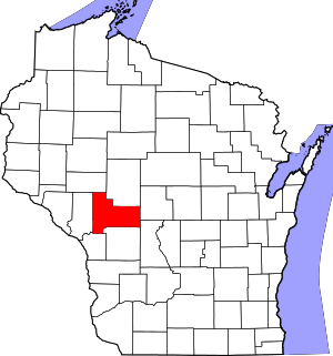 | |
| Villages | ||
| Towns | ||
| CDPs | ||
| Unincorporated communities | ||
| Ghost towns/neighborhoods | ||
| Indian reservation | ||
| Footnotes | ‡This populated place also has portions in an adjacent county or counties | |