Interstate 759
Interstate 759 (I-759) is a part of the Interstate Highway System in the U.S. state of Alabama. It is a spur route that runs for 4.54 miles (7.31 km) between the cities of Attalla and Gadsden in Etowah County. It begins at an Interstate 59 (I-59) in Attalla and ends at U.S. Route 411 (US 411) in southern Gadsden adjacent to the Gadsden Mall. The route continues east as the at-grade thoroughfare State Route 759 (SR 759) until the route ends at SR 291 in Gadsden.
| ||||
|---|---|---|---|---|

I-759 and SR 759 highlighted in red | ||||
| Route information | ||||
| Length | 5.407 mi[1] (8.702 km) 4.541 mi (7.308 km) as I-759 0.866 mi (1.394 km) as SR 759 | |||
| Existed | October 22, 1986[2]–present | |||
| Major junctions | ||||
| West end | ||||
| East end | ||||
| Location | ||||
| Counties | Etowah | |||
| Highway system | ||||
| ||||
.svg.png)

Route description
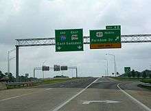
I-759 begins at Exit 182 of I-59 in Attalla.[3] From this point the route travels in an easterly direction across a marshy area prior to reaching its first exit at Black Creek Parkway, a diamond interchange.[4][5] From the Black Creek exit, I-759 continues in its easterly direction and crosses the Coosa River along a causeway and short bridge prior to reaching US 411.[6] At the US 411 interchange, the I-759 designation ends, but the route continues as SR 759 in spanning the Coosa River.[7]
History
A new four lane bridge crossing the Coosa River opened in 2004.[8]
Future
Currently, there are plans to extend I-759 east to US 278 on the east side of Gadsden,[9] as well as west towards Attalla and linking it to SR 77. This would mean that SR 759 would be completely removed.
Exit list
The entire route is in Etowah County.
| Location | mi[1] | km | Exit[10] | Destinations | Notes |
|---|---|---|---|---|---|
| Attalla | 0.00 | 0.00 | 0A-B | Western terminus; I-59 exit 182; signed as left exit 0A (south) & 0B (north) westbound; tri-stack interchange. | |
| Gadsden | 2.67 | 4.30 | 2 | Black Creek Parkway | |
| 4.54 | 7.31 | 4 | Signed as exits 4A (south) and 4B (north); I-759 ends and SR 759 begins; eastern terminus | ||
| 5.41 | 8.71 | ||||
| 1.000 mi = 1.609 km; 1.000 km = 0.621 mi | |||||
Alabama State Route 759
SR 759 or Interstate 759 Extension is the I-759 at-grade extension past US 411. It runs to SR 291 in Gadsden, where SR 759 ends.
Major junctions
The entire route is in Gadsden, Etowah County.
| mi | km | Destinations | Notes | ||
|---|---|---|---|---|---|
| 0.00 | 0.00 | ||||
| 0.35 | 0.56 | Bridge over Coosa River | |||
| 1.00 | 1.61 | ||||
| 1.000 mi = 1.609 km; 1.000 km = 0.621 mi | |||||
References
- Alabama Department of Transportation. "Milepost Maps". Archived from the original on July 27, 2011. Retrieved March 27, 2011.
- Alford, Chip (October 20, 1986). "I-759 opens Wednesday". The Gadsden Times. p. A1. Retrieved April 21, 2010.
- Google Maps street maps and USGS topographic maps, accessed April 21, 2010 via ACME Mapper
- Google (April 21, 2010). "Interstate 759 spanning marsh" (Map). Google Maps. Google. Retrieved April 21, 2010.
- Google (April 21, 2010). "Interstate 759/Exit 2" (Map). Google Maps. Google. Retrieved April 21, 2010.
- Google (April 21, 2010). "Interstate 759/ Neely Henry Lake causeway" (Map). Google Maps. Google. Retrieved April 21, 2010.
- Google (April 21, 2010). "Interstate 759 eastern terminus" (Map). Google Maps. Google. Retrieved April 21, 2010.
- "Bridge on the River Coosa Helped Ease Traffic Flow". The Gadsden Times. March 7, 2006. p. C1.
- Powell, Andy (July 12, 2012). "Interstate 759 extension hits roadblock". The Gadsden Times. Retrieved June 16, 2013.
- Official Highway Map (Map) (2007-2008 ed.). Alabama Department of Transportation.
External links
- Interstate 759 Alabama @ Interstate-Guide.com
- Alabama @ SouthEastRoads.com - Interstate 759