List of Interstate Highways in Alabama
The Interstate Highways in Alabama are the components of the Interstate Highway System in the U.S. state of Alabama. All numbered highways in Alabama are maintained by the Alabama Department of Transportation (ALDOT).
.svg.png) .svg.png) Highway markers for I-65 and I-459 | |
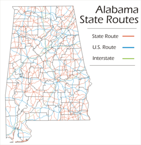 Map of Alabama State Route System Interstate Highways | |
| Highway names | |
|---|---|
| Interstates | Interstate nn (I-nn) |
| US Highways | U.S. Route nn (US-nn) |
| State | State Route nn (SR-nn) |
| System links | |
| |
Currently, there are 11 routes and 1,130 miles (1,820 km) of Interstates in Alabama. The Interstate with the longest segment in Alabama is Interstate 65, covering 367.00 miles (590.63 km); the shortest is Interstate 359, covering 2.30 miles (3.70 km).[1] There are six Interstate primary routes and five Interstate auxiliary routes serving the six largest cities in the state, and 22 of the 25 largest.
Primary Interstate highways
| Number | Length (mi)[1] | Length (km) | Southern or western terminus | Northern or eastern terminus | Formed | Removed | Notes | |
|---|---|---|---|---|---|---|---|---|
| 66.31 | 106.72 | Interstate 10 in Mississippi | Interstate 10 in Florida | — | — | I-10 enters the state from Mississippi near Grand Bay, Alabama | ||
| — | — | Mississippi state line near Isney (undecided) | Georgia state line near Fort Benning (undecided) | proposed | — | Proposed "14th Amendment Highway" linking western Texas and South Carolina | ||
| 214.7 | 345.5 | I-20/I-59 at the Mississippi state line near Cuba | I-20 at the Georgia state line | — | — | I-20 runs concurrently with I-59 from the Mississippi state line, northeast through Tuscaloosa, through its junction with I-459, and into Birmingham. Near the Birmingham Airport, the highway splits with I-59 and heads east, to Pell City and Anniston-Oxford, before crossing into Georgia on its way to Atlanta.[2][3][4][5][6][7][8][9][10] | ||
| 95 | 153 | I-22/US 78 at Mississippi state line | I-65/US 31 in Birmingham | — | — | I-22 enters Alabama from Mississippi near Hamilton. It roughly follows the former route of US 78, bypassing Winfield and Jasper before reaching the Birmingham metropolis, where it reaches its eastern terminus at I-65 and US 31.[11] | ||
| 241.36 | 388.43 | I-20/I-59 at the Mississippi state line near Cuba | I-59 at the Georgia state line | — | — | I-59 runs concurrently with I-20 from the Mississippi state line, northeast through Tuscaloosa, through its junction with I-459, and into Birmingham. Near the Birmingham Airport, the highway splits with I-20 and heads northeast, towards Gadsden and Fort Payne, before crossing into Georgia on its way to Chattanooga, Tennessee.[3][4][5][6][7][12][13][14] | ||
| 367.00 | 590.63 | I-10 in Mobile | I-65 at the Tennessee state line near Ardmore | — | — | I-65 is the major north-south route in the state, and Alabama's longest interstate and third-longest numbered route. It begins at | ||
| 80 | 129 | I-65 & Day Street in Montgomery | I-85 at the Georgia state line in Lanett | — | — | I-85 begins at I-65 in Montgomery, and continues eastward near Tuskegee and Auburn, before crossing into Georgia on its way to Atlanta.[15][16][17][18][19] | ||
| ||||||||
 I-10 entering the George Wallace Tunnel in Mobile
Auxiliary Interstate highways
| Number | Length (mi)[1] | Length (km) | Southern or western terminus | Northern or eastern terminus | Formed | Removed | Notes | |
|---|---|---|---|---|---|---|---|---|
| 4.90 | 7.89 | US 90/Truck US 98/SR 16 at Beauregard & North Water Streets in Mobile | I-65 in Prichard | — | — | I-165 serves as a spur route connecting downtown Mobile with Interstate 65 northwest of Mobile.[20][21] | ||
| 5.10 | 8.21 | I-10 in Mobile | I-65 in Prichard | 1991 | 1994 | I-210 was a planned spur route connecting I-10 in downtown Mobile with Interstate 65 northwest of Mobile. It is now signed as I-165 with a missing connection to I-10. | ||
| 2.26 | 3.64 | I-22/US 78 in Brookside | I-422 in Birmingham | proposed | — | I-222 will provide connection between I-422 and I-22 which due to topography will not have an intersection.[22] | ||
| 2.30 | 3.70 | I-20/I-59/US 11/SR 7/SR- 9 | US 11/US 43/SR 13/SR 69 | — | — | I-359 serves as a spur route connecting I-20/I-59 with downtown Tuscaloosa.[5][23] | ||
| 51.04 | 82.14 | I-20/I-59/I-459 at Bessemer | I-59 in Trussville | proposed | — | I-422 is the under-construction Birmingham North Beltline set to bypass the Birmingham metropolis, from I-59 to I-59. It also carries the designation Alabama State Route 959.[24] | ||
| 32.80 | 52.79 | I-20/I-59/US 11/SR 5/SR 7 near Bessemer | I-59 at Trussville | — | — | I-459 forms a partial southern loop around Birmingham, connecting I-20/I-59 in Bessemer and I-59 near Trussville. There are plans to extend the loop around the north of the city, as Interstate 422.[6][25] | ||
| 21.40 | 34.44 | I-65/SR 20 in Decatur | US 72 in Huntsville | 1991 | current | I-565 serves as a spur route connecting I-65 with Huntsville and crossing the City of Huntsville.[26][27][28] | ||
| 14 | 23 | I-65 at Montgomery | I-85/US 80 in Montgomery | proposed | — | With the completion of the Montgomery Southern Bypass, I-85 will be shifted to that new route. AASHTO approved in October 2010 the co-signing of I-685 to be put up along with current I-85 up to the point it moves to the new roadway.[29] | ||
| 4.50 | 7.24 | I-59 in Attalla | US 411/SR 25/SR 759 in Gadsden | — | — | I-759 serves as a spur route from I-59 to the Gadsden metropolis.[13][30] | ||
| ||||||||
 Eastern terminus of I-759 in Gadsden
See also


References
- "FHWA Route Log and Finder List". Federal Highway Administration. 2002. Retrieved October 23, 2008.
- Google (December 14, 2008). "Overview Map of I-20" (Map). Google Maps. Google. Retrieved December 14, 2008.
- General Highway Map, Sumter County (PDF) (Map). Alabama Department of Transportation. 2001. Archived from the original (PDF) on November 24, 2008. Retrieved October 23, 2008.
- General Highway Map, Greene County (PDF) (Map). Alabama Department of Transportation. 2001. Archived from the original (PDF) on November 24, 2008. Retrieved October 23, 2008.
- General Highway Map, Tuscaloosa County (PDF) (Map). Alabama Department of Transportation. 2001. Archived from the original (PDF) on November 24, 2008. Retrieved October 23, 2008.
- General Highway Map, Jefferson County (PDF) (Map). Alabama Department of Transportation. 2001. Archived from the original (PDF) on November 24, 2008. Retrieved October 23, 2008.
- General Highway Map, St. Clair County (PDF) (Map). Alabama Department of Transportation. 2001. Archived from the original (PDF) on November 24, 2008. Retrieved October 23, 2008.
- General Highway Map, Talladega County (PDF) (Map). Alabama Department of Transportation. 2001. Archived from the original (PDF) on November 24, 2008. Retrieved October 23, 2008.
- General Highway Map, Calhoun County (PDF) (Map). Alabama Department of Transportation. 2001. Archived from the original (PDF) on November 24, 2008. Retrieved October 23, 2008.
- General Highway Map, Cleburne County (PDF) (Map). Alabama Department of Transportation. 2001. Archived from the original (PDF) on November 24, 2008. Retrieved October 23, 2008.
- "Future Interstate 22 @ Interstate-Guide.com". Interstate Guide. Retrieved February 15, 2008.
- Google (December 14, 2008). "Overview Map of I-59" (Map). Google Maps. Google. Retrieved December 14, 2008.
- General Highway Map, Etowah County (PDF) (Map). Alabama Department of Transportation. 2001. Archived from the original (PDF) on November 24, 2008. Retrieved October 23, 2008.
- General Highway Map, DeKalb County (PDF) (Map). Alabama Department of Transportation. 2001. Archived from the original (PDF) on November 24, 2008. Retrieved October 23, 2008.
- Google (December 14, 2008). "Overview Map of I-85" (Map). Google Maps. Google. Retrieved December 14, 2008.
- General Highway Map, Macon County (PDF) (Map). Alabama Department of Transportation. 2001. Archived from the original (PDF) on November 24, 2008. Retrieved October 23, 2008.
- General Highway Map, Lee County (PDF) (Map). Alabama Department of Transportation. 2001. Archived from the original (PDF) on November 24, 2008. Retrieved October 23, 2008.
- General Highway Map, Chambers County (PDF) (Map). Alabama Department of Transportation. 2001. Archived from the original (PDF) on November 24, 2008. Retrieved October 23, 2008.
- Google (December 14, 2008). "Overview Map of I-165" (Map). Google Maps. Google. Retrieved December 14, 2008.
- "Future Interstate 222". American Association of State Highway and Transportation Officials Special Committee on U.S. Route Numbering. Retrieved June 4, 2012.
- Google (December 14, 2008). "Overview Map of I-359" (Map). Google Maps. Google. Retrieved December 14, 2008.
- "Future Interstate 422". American Association of State Highway and Transportation Officials Special Committee on U.S. Route Numbering. Retrieved June 4, 2012.
- Google (December 14, 2008). "Overview Map of I-459" (Map). Google Maps. Google. Retrieved December 14, 2008.
- Google (December 14, 2008). "Overview Map of I-565" (Map). Google Maps. Google. Retrieved December 14, 2008.
- General Highway Map, Madison County (PDF) (Map). Alabama Department of Transportation. 2001. Archived from the original (PDF) on November 24, 2008. Retrieved October 23, 2008.
- Vaughn, D. W. (October 29, 2010). Decisions & Meeting Minutes (PDF) (Report). American Association of State Highway and Transportation Officials Special Committee on U.S. Route Numbering. Retrieved December 13, 2011.
- Google (December 14, 2008). "Overview Map of I-759" (Map). Google Maps. Google. Retrieved December 14, 2008.
This article is issued from Wikipedia. The text is licensed under Creative Commons - Attribution - Sharealike. Additional terms may apply for the media files.