Interstate 20 in Louisiana
Interstate 20 (I-20) is a part of the Interstate Highway System that spans 1,539.38 miles (2,477.39 km)[2] from Reeves County, Texas to Florence, South Carolina. Within the state of Louisiana, the highway travels 189.84 miles (305.52 km)[1] from the Texas state line west of Greenwood to the Mississippi River, which it crosses into Vicksburg, Mississippi.
| ||||
|---|---|---|---|---|
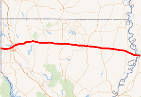
I-20 highlighted in red | ||||
| Route information | ||||
| Maintained by Louisiana DOTD | ||||
| Length | 189.844 mi[1][lower-alpha 1] (305.524 km) | |||
| Existed | 1960–present | |||
| Major junctions | ||||
| West end | ||||
| East end | ||||
| Location | ||||
| Parishes | Caddo, Bossier, Webster, Bienville, Lincoln, Ouachita, Richland, Madison | |||
| Highway system | ||||
| ||||

I-20 traverses the northern portion of the state, serving the metropolitan areas of Shreveport–Bossier City and Monroe, as well as the smaller cities of Minden and Ruston. It entirely parallels the older U.S. Highway 80 (US 80) corridor through Louisiana. The route is mirrored by I-10, which traverses the southern portion of the state. The two are connected by I-49, the state's major north–south interstate highway.
Route description
Texas state line to Shreveport (Interstate 49)
Interstate 20 enters Louisiana about 20 miles east of Marshall, Texas, near Waskom. Interstate 20 passes through Greenwood to the north of town, where US 80/ 79 serve as the main east-west highway. I-20 enters Shreveport about 5 miles east of Greenwood. I-20 intersects I-220 (the north Shreveport bypass) and Hwy 3132 (the south Shreveport bypass) on the westside of the city. On the way to Downtown Shreveport, I-20 intersects US 171 and serves as the current northern terminus of I-49.
Shreveport to Monroe
As I-20 leaves Shreveport, it passes through Bossier City where it shares an overlap with US 71. I-20 passes north of Barksdale AFB where it intersects I-220 and heads east towards Monroe. On its way to Monroe, I-20 traverses mainly rural, hilly terrain as it passes through the towns of Minden, Arcadia, Grambling, Ruston, and West Monroe.
Monroe to Mississippi state line
I-20 passes through Monroe, where it intersects US 165. East of Monroe, I-20 enters flatter terrain as it passes through Rayville, Delhi, and Tallulah. About 15 miles east of Tallulah, I-20 crosses over the Mississippi River into Mississippi in Vicksburg.
Exit list
| Parish | Location | mi[1] | km | Exit | Destinations | Notes |
|---|---|---|---|---|---|---|
| Caddo | | 0.000 | 0.000 | Continuation in Texas | ||
| | 0.039 | 0.063 | Texas Travel Information Center (westbound exit within Louisiana) | |||
| Greenwood | 2.292– 2.928 | 3.689– 4.712 | Greenwood Rest Area & Visitor's Center (eastbound only) | |||
| 3.592– 4.085 | 5.781– 6.574 | 3 | ||||
| 5.368– 5.894 | 8.639– 9.485 | 5 | ||||
| Shreveport | 8.370– 8.886 | 13.470– 14.301 | 8 | Location also known as Flournoy; US 80 signed westbound only | ||
| 10.272– 10.959 | 16.531– 17.637 | 10 | Pines Road | To Louisiana Baptist University | ||
| 11.349– 12.295 | 18.264– 19.787 | 11 | Western terminus of I-220 and LA 3132 (exits 1B–C on both); Alexandria signed eastbound only | |||
| 12.749– 13.180 | 20.518– 21.211 | 13 | Monkhouse Drive | To Shreveport Regional Airport | ||
| 14.670– 15.053 | 23.609– 24.225 | 14 | Jewella Avenue | To State Fair Grounds and Louisiana State Exhibit Museum (signed eastbound) | ||
| 15.824– 16.224 | 25.466– 26.110 | 16A | To State Fair Grounds and Louisiana State Exhibit Museum (signed westbound) | |||
| 16.403– 16.761 | 26.398– 26.974 | 16B | To Willis-Knighton Medical Center | |||
| 16.850– 17.972 | 27.117– 28.923 | 17A | Lakeshore Drive, Linwood Avenue | To LSU Medical Center and Cross Lake | ||
| 17.236– 18.167 | 27.739– 29.237 | 17B | Exit 206 on I-49; northern end of open I-49 segment | |||
| 18.260– 18.752 | 29.387– 30.178 | 18A | Common Street, Line Avenue | Westbound exit via exit 18D | ||
| 18.475– 18.752 | 29.733– 30.178 | 18C | Fairfield Avenue | Eastbound entrance and westbound exit | ||
| 18.907 | 30.428 | 18D | Common Street, Louisiana Avenue | Westbound exit only (other movements via exit 18A) | ||
| 18.506– 19.367 | 29.783– 31.168 | 19A | Western end of US 71 concurrency; to Shreveport Riverfront Convention Center and VA Medical Center | |||
| Red River | 19.394– 19.655 | 31.212– 31.632 | Red River Bridge (Purple Heart Recipients Highway) | |||
| Bossier | Bossier City | 19.551– 19.995 | 31.464– 32.179 | 19B | Traffic Street | To Louisiana Boardwalk |
| 19.995– 20.373 | 32.179– 32.787 | 20A | Hamilton Road, DiamondJacks Boulevard | To CenturyLink Center | ||
| 20.509– 20.651 | 33.006– 33.235 | 20B 20C | Eastern end of US 71 concurrency; southern terminus of LA 3; eastbound exit and westbound entrance | |||
| 21.110– 21.554 | 33.973– 34.688 | 21 | To Convention Complex | |||
| 22.006– 22.425 | 35.415– 36.090 | 22 | Airline Drive | Airline Drive is LA 3105 (not signed) | ||
| 23.426– 24.007 | 37.700– 38.636 | 23 | Industrial Drive – Barksdale AFB | Industrial Drive is LA 782-2 (not signed) | ||
| 25.870– 26.939 | 41.634– 43.354 | 26 | Eastern terminus of I-220; exit 17B on I-220 | |||
| Haughton | 32.872– 33.602 | 52.902– 54.077 | 33 | |||
| Webster | | 38.438– 39.165 | 61.860– 63.030 | 38 | Goodwill Road – Camp Minden | Goodwill Road is Parish Road 117 |
| Dixie Inn | 44.164– 44.663 | 71.075– 71.878 | 44 | Western end of US 371 concurrency | ||
| Minden | 46.697– 47.322 | 75.152– 76.157 | 47 | Eastern end of US 371 concurrency; southern terminus of LA 159 | ||
| 49.470– 50.017 | 79.614– 80.495 | 49 | ||||
| | 52.173– 52.592 | 83.964– 84.639 | 52 | |||
| Bienville | | 54.833– 55.324 | 88.245– 89.035 | 55 | ||
| | 60.846– 61.461 | 97.922– 98.912 | 61 | |||
| | 67.145– 67.726 | 108.059– 108.994 | 67 | To Lake Claiborne State Park | ||
| Arcadia | 69.455– 69.907 | 111.777– 112.504 | 69 | |||
| Lincoln | | 76.633– 77.213 | 123.329– 124.262 | 77 | Northern terminus of LA 507 | |
| | 77.776– 78.453 | 125.168– 126.258 | 78 | To Simsboro via LA 563 south | ||
| Grambling | 80.982– 81.666 | 130.328– 131.429 | 81 | Northern terminus of LA 149; to Grambling State University | ||
| Ruston | 83.413 | 134.240 | 83 | Tarbutton Road | Under construction; scheduled for completion around 2019 | |
| 84.500– 85.069 | 135.990– 136.905 | 84 | To Louisiana Tech University | |||
| 85.408– 86.002 | 137.451– 138.407 | 85 | US 167 is concurrent with US 63 and LA 146 (not signed); southern terminus of US 63 | |||
| 86.556– 87.281 | 139.298– 140.465 | 86 | To Lake D'Arbonne State Park | |||
| Choudrant | 92.910– 93.439 | 149.524– 150.375 | 93 | To Jimmie Davis State Park | ||
| | 94.925– 95.851 | 152.767– 154.257 | Tremont Eastbound Rest Area (eastbound only) | |||
| | 96.514– 97.309 | 155.324– 156.604 | Tremont Westbound Rest Area (westbound only) | |||
| Ouachita | | 101.535– 102.137 | 163.405– 164.374 | 101 | ||
| | 103.484– 104.267 | 166.541– 167.801 | 103 | |||
| | 107.010– 107.845 | 172.216– 173.560 | 107 | |||
| Cheniere | 108.464– 109.087 | 174.556– 175.559 | 108 | |||
| West Monroe | 111.660– 112.235 | 179.699– 180.625 | 112 | Well Road | Well Road is LA 3249 (not signed) | |
| 112.399– 112.988 | 180.889– 181.837 | 113 | Downing Pines Road | To Hamilton Expo Center and Well Road | ||
| 113.667– 114.418 | 182.929– 184.138 | 114 | ||||
| 114.959– 115.744 | 185.009– 186.272 | 115 | To West Monroe Historic & Business District | |||
| 115.828– 116.491 | 186.407– 187.474 | 116A | Fifth Street | |||
| West Monroe–Monroe line | 115.672– 117.482 | 186.156– 189.069 | World War II Memorial Bridge over Ouachita River | |||
| Monroe | 116.533– 116.614 | 187.542– 187.672 | 116B | Jackson Street – Civic Center | Eastbound exit and westbound entrance | |
| 116.614– 116.829 | 187.672– 188.018 | 117A | Hall Street | Eastbound exit and westbound entrance | ||
| 116.859– 117.467 | 188.066– 189.045 | 117C | Eastbound exit via exit 116B | |||
| 117.120– 117.250 | 188.486– 188.696 | 117D | South Second Street, Layton Avenue | Eastbound entrance and westbound exit (other movements via exit 116B) | ||
| 117.558– 118.111 | 189.191– 190.081 | 117B | ||||
| 118.356– 119.151 | 190.476– 191.755 | 118 | Signed westbound as exit 118A (south) and 118B (north); to University of Louisiana Monroe | |||
| 119.205 | 191.842 | – | Pecanland Mall Drive | Westbound entrance only (further access via exit 120) | ||
| 119.833– 120.771 | 192.853– 194.362 | 120 | Pecanland Mall Drive Garrett Road – Monroe Airport | Eastbound exit only to Pecanland Mall, complete access to Garrett Road | ||
| Millhaven | 123.716– 124.605 | 199.102– 200.532 | 124 | To Russell Sage Wildlife Area | ||
| Richland | Start | 131.506– 132.135 | 211.638– 212.651 | 132 | ||
| Rayville | 137.639– 137.934 | 221.508– 221.983 | 138 | To Winnsboro via US 425 south | ||
| | 141.241– 141.937 | 227.305– 228.425 | 141 | Southern terminus of LA 583 | ||
| | 145.275– 145.939 | 233.797– 234.866 | 145 | Southern terminus of LA 183 | ||
| | 147.955– 148.725 | 238.110– 239.350 | 148 | |||
| Delhi | 153.137– 153.860 | 246.450– 247.614 | 153 | |||
| Madison | | 157.574– 158.322 | 253.591– 254.795 | 157 | ||
| Tallulah | 170.960– 171.523 | 275.133– 276.040 | 171 | |||
| Richmond | 172.632– 173.367 | 277.824– 279.007 | 173 | Southern terminus of LA 602-1 | ||
| Mound | 182.355– 182.787 | 293.472– 294.167 | 182 | Southern terminus of LA 602-2 | ||
| Delta | 183.941– 184.865 | 296.024– 297.511 | Mound Rest Area & Visitor's Center (westbound only) | |||
| 185.780– 186.440 | 298.984– 300.046 | 186 | Western end of US 80 concurrency | |||
| Mississippi River | 187.763– 189.844 | 302.175– 305.524 | Vicksburg Bridge | |||
| Continuation in Mississippi | ||||||
1.000 mi = 1.609 km; 1.000 km = 0.621 mi
| ||||||
Related routes
| |
|---|---|
| Location | Monroe |
| Length | 10.2 mi[3] (16.4 km) |
| Existed | 1950s–1964 |
Interstate 420 was to be a bypass of Monroe, Louisiana. Initially proposed in the late 1950s, this route was to have been only two lanes wide at a cost $29 million with a projected 2,500 to 3,000 ADT in 1964.[3] The project was effectively canceled on October 12, 1964, when then Louisiana Representative Hale Boggs agreed to no longer seek funding for the route. This was done in favor of focusing all efforts at funding and getting built New Orleans' Vieux Carré Expressway.[3]
Notes
- For the federal government's purposes, the Federal Highway Administration lists Louisiana's portion of I-20 as 189.87 miles (305.57 km) in length.[2]
References
- Louisiana Department of Transportation and Development, Highway Inventory Unit (2016). "LRS Conversion Tool". Louisiana Department of Transportation and Development. Retrieved July 30, 2017.
- "FHWA Route Log and Finder List / Table 1: Main Routes of the Dwight D. Eisenhower National System Of Interstate and Defense Highways as of December 31, 2016". Federal Highway Administration. February 22, 2017. Retrieved July 30, 2017.
- Weingroff, Richard (April 7, 2011). "The Second Battle of New Orleans: Vieux Carré Riverfront Expressway (I-310)". Highway History. Federal Highway Administration. Retrieved September 14, 2011.
External links
- Maps / GIS Data Homepage, Louisiana Department of Transportation and Development
| Previous state: Texas |
Louisiana | Next state: Mississippi |