Inhulets
The Inhulets (Ukrainian: Інгулець) or Ingulets (Russian: Ингуле́ц) is a river, a right tributary of the Dnieper, which flows through Ukraine. It has a length of 557 km and a drainage basin of 14,460 km².[1]
| Inhulets, Інгулець | |
|---|---|
 | |
 | |
| Location | |
| Country | Ukraine |
| Physical characteristics | |
| Source | |
| ⁃ location | Kirovohrad Oblast, Ukraine |
| Mouth | |
⁃ location | Dnieper |
⁃ coordinates | 46.6842°N 32.8125°E |
| Length | 557 km (346 mi)[1] |
| Basin size | 14,460 km2 (5,580 sq mi)[1] |
| Basin features | |
| Progression | Dnieper→ Dnieper–Bug estuary→ Black Sea |
The Inhulets has its source in the Dnieper Upland in a ravine (balka) to the west from village Topylo,[1] Znamianka Raion in the Ukrainian province of Kirovohrad, about 30 km away from the Dnieper river itself, to which it flows parallel. The Inhulets then turns south, where it flows through the Dnipropetrovsk, Kherson, and Mykolaiv Oblasts, before finally flowing approx. 30 km east of the city of Kherson into the Dnieper. The river flows through southern spurs of the Dnieper Uplands and then the over the Black Sea Lowland.[1] Upper portion of the Inhulets basin lays with forest steppe zone, lower – within the Pontic steppe.[1]
While flowing near the city of Kryvyi Rih, the course of the river has created many small islands, which have a rich vegetation. However, the vegetation is impaired by the high level of contamination of the river, due to the nearby mining industry.
Urban localities located on the river include Kryvyi Rih, Shyroke, Inhulets (former city merged with Kryvyi Rih), and Snihurivka.
There is a professional football team in Ukraine which is named after the river as FC Inhulets Petrove.
References
- Zelenska, L., Demianov, V. Inhulets (ІНГУЛЕ́ЦЬ). Encyclopedia of Modern Ukraine. 2011
External links
- Zelenska, L., Demianov, V. Inhulets (ІНГУЛЕ́ЦЬ). Encyclopedia of Modern Ukraine. 2011
The river Dnieper | ||
|---|---|---|
| Tributaries1 | 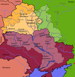 | |
| Reservoirs | ||
| Hydroelectric stations | ||
| Canals |
| |
| Cities | ||
| Crossings | ||
| ||