Indiana State Road 158
State Road 158 is a short connector route in Lawrence County in the southwest portion of the U.S. State of Indiana.
| ||||
|---|---|---|---|---|
 | ||||
| Route information | ||||
| Maintained by INDOT | ||||
| Length | 10.169 mi[1] (16.365 km) | |||
| Existed | 1932[2]–present | |||
| Major junctions | ||||
| West end | Crane Naval Surface Warfare Center | |||
| East end | ||||
| Location | ||||
| Counties | Lawrence | |||
| Highway system | ||||
| ||||

Route description
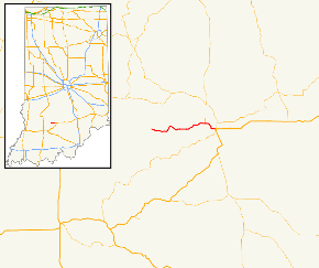
State Road 158 begins at the Martin County line, at the east edge of the Crane Naval Surface Warfare Center (which is west of Bedford). The road winds to the east through the small towns of Fayetteville and Eureka. It terminates at State Road 450 on the west edge of Bedford, near U.S. Route 50. It covers a distance of about 10 miles.
Major intersections
The entire route is in Lawrence County.
| Location | mi[1] | km | Destinations | Notes | |
|---|---|---|---|---|---|
| Indian Creek Township | 0.000 | 0.000 | Crane Naval Surface Warfare Center | Western terminus of SR 158 | |
| 8.348 | 13.435 | Southern terminus of SR 458 | |||
| Bedford | 10.169 | 16.365 | Eastern terminus of SR 158 | ||
| 1.000 mi = 1.609 km; 1.000 km = 0.621 mi | |||||
References
- Indiana Department of Transportation (July 2015). Reference Post Book (PDF). Indianapolis: Indiana Department of Transportation. Retrieved September 23, 2016.
- "Roads Added to State System". The Daily Reporter. Greenfield. June 8, 1932. p. 1. Retrieved December 21, 2016 – via Newspapers.com.

External links
This article is issued from Wikipedia. The text is licensed under Creative Commons - Attribution - Sharealike. Additional terms may apply for the media files.