Inchyra
Inchyra (/ɪnˈtʃaɪrə/; Scottish Gaelic: An Innis Iarach "the west isle") is a hamlet in the Carse of Gowrie in Scotland. It lies on the northern bank of the River Tay near Perth and is notable particularly for a number of archaeological finds made in the immediate vicinity.
| Inchyra | |
|---|---|
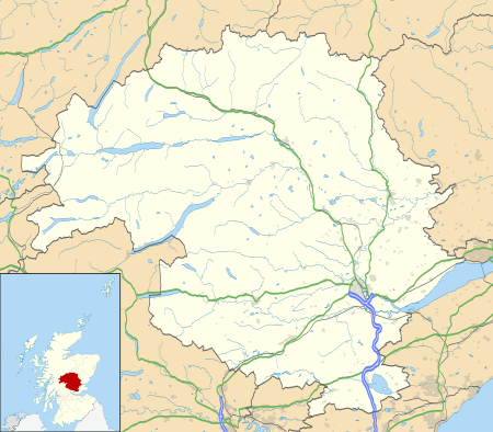 Inchyra Location within Perth and Kinross | |
| Population | 21 |
| OS grid reference | NO183203 |
| • Edinburgh | 47 miles |
| • London | 364 miles |
| Council area | |
| Lieutenancy area | |
| Country | Scotland |
| Sovereign state | United Kingdom |
| Post town | PERTH |
| Postcode district | PH2 |
| Dialling code | 01738 |
| Police | Scotland |
| Fire | Scottish |
| Ambulance | Scottish |
| UK Parliament |
|
| Scottish Parliament | |
Geography
Inchyra lies on the northern bank of the River Tay to the south of the A90. It is approximately 5 kilometres (3.1 mi) east of Perth and 20 kilometres (12 mi) west-south-west of Dundee.[1] It is situated close to St Madoes. It is the only L-shaped village in Scotland. It is surrounded by farmland.
Toponomy
In common with a number of villages in the Carse of Gowrie, Inchyra has the Celtic placename element innis meaning "island".[2] Carses such as the Carse of Gowrie are estuarine landforms that have been uplifted by isostatic rebound following the last glacial period.[3] It is likely that Inchyra was an island in the firth of Tay at the time of its settlement.
Inchyra Stone
In 1945 a class I Pictish stone was unearthed during ploughing in a field at Inchyra.[4] The stone is inscribed with a variety of Pictish symbols, including a double disc, mirror and comb, two fish and a serpent as well as an Ogham inscription.[5] It is now on display at Perth Museum.
Roman archaeology
In June 1993, a small hoard of eight Roman Denarii coins were discovered at Inchyra, subsequently being declared as treasure trove and placed in Perth Museum.[6] A Roman brooch with blue enamel inlay has also been found in river silt at Inchyra, again now displayed at Perth Museum.[7]
Gallery
 A row of traditional cottages
 A house by a backwater of the Tay estuary
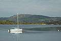 High Tide at Inchyra
References
- "Perth & Alloa", Ordnance Survey Landranger Map (B2 ed.), 2007, ISBN 0-319-22997-1
- Taylor, Isaac (1864), Words and Places: or etymological illustrations of history ethnology and geography, London: Macmillan and co, p. 373
- Ballantyne, Colin K.; Dawson, Alastair G. (1997), "Geomorphology and landscape change", in Edwards, Kevin J.; Ralston, Ian B.M. (eds.), Scotland after the Ice Age. Environment, Archaeology and History 8000 BC - AD 1000, Edinburgh: Edinburgh University Press, pp. 23–45, retrieved 11 April 2011
- Fraser, Iain (2008), The Pictish Symbol Stones of Scotland, Edinburgh: Royal Commission on the Ancient and Historic Monuments of Scotland
- Stevenson, Robert B.K. (1958–59), "The Inchyra Stone and Some Other Unpublished Early Christian Monuments" (PDF), Proceedings of the Society of Antiquaries of Scotland, 92, pp. 33–55, retrieved 10 April 2011
- "Inchyra (St Madoes parish) Roman coin hoard" (PDF), Discovery and Excavation in Scotland, p. 90, 1994, retrieved 10 April 2011
- "Inchyra (St Madoes parish) Romano British trumpet brooch" (PDF), Discovery and Excavation in Scotland, p. 77, 1992, retrieved 11 April 2011