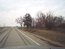
Illinois Route 115
Illinois Route 115 is a minor north–south road in northeastern Illinois. It runs from Illinois Route 9 near Perdueville to the concurrent U.S. Routes 45/52 in Kankakee. This is a distance of 63.37 miles (101.98 km).[1]
| ||||
|---|---|---|---|---|
| Route information | ||||
| Maintained by IDOT | ||||
| Length | 63.37 mi[1] (101.98 km) | |||
| Existed | 1924[2]–present | |||
| Major junctions | ||||
| South end | ||||
| North end | ||||
| Location | ||||
| Counties | Ford, Kankakee | |||
| Highway system | ||||
| ||||
Route description

IL 115 at the intersection with IL 116
Illinois 115 is a north–south highway from Perdueville to Buckingham; at Buckingham, it turns east but is still marked north–south. South of Kankakee, Illinois 115 turns north again on its way into Kankakee.
Illinois 115 is an undivided two-lane surface road for its entire length.
History
SBI Route 115 ran from near Kankakee to Perdueville along what is Illinois 115 now. In 1954, when U.S. 45 was moved onto a new road, Illinois 115 was extended north into Kankakee onto old U.S. 45.[2]
Major Intersections
| County | Location | mi[3] | km | Destinations | Notes |
|---|---|---|---|---|---|
| Ford | | 0.0 | 0.0 | ||
| Roberts | 10.6 | 17.1 | Southern end of IL 54 concurrency | ||
| 11.0 | 17.7 | Northern end of IL 54 concurrency | |||
| Piper City | 20.1 | 32.3 | Southern end of US 24 concurrency | ||
| 20.4 | 32.8 | Northern end of US 24 concurrency | |||
| | 30.1 | 48.4 | |||
| Kankakee | Kankakee | 63.37 | 101.98 | ||
1.000 mi = 1.609 km; 1.000 km = 0.621 mi
| |||||
References
- Illinois Technology Transfer Center (2006). "T2 GIS Data". Retrieved 2007-11-08.
- Carlson, Rich. Illinois Highways Page: Routes 101 thru 120. Last updated March 15, 2005. Retrieved May 5, 2006.
- Google (March 1, 2017). "Overview Map of IL 115" (Map). Google Maps. Google. Retrieved March 1, 2017.
This article is issued from Wikipedia. The text is licensed under Creative Commons - Attribution - Sharealike. Additional terms may apply for the media files.
