Hyndburn Brook
Hyndburn Brook is a minor river in eastern Lancashire. It is approximately 4.5 miles (7.3 km) long and has a catchment area (not including the River Hyndburn) of 13.61 square miles (35.243 km2).[lower-alpha 1][1][2]
| Hyndburn Brook | |
|---|---|
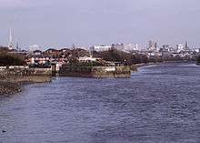
 Hyndburn Brook from the Mill Lane Bridge. | |
| Location | |
| Country | England |
| Physical characteristics | |
| Source | |
| ⁃ location | West of Church, Lancashire. |
| Mouth | |
⁃ location | River Calder, south of Martholme. |
| Length | 4.5 mi (7.3 km) |
Thought to begin at the confluence of Tinker Brook and White Ash Brook to the west of Church, the river runs north. It collects the River Hyndburn just before the M65 motorway bridge and Bottom Syke (from Dunkenhalgh) just afterward, meeting Shaw Brook and Spaw Brook to the east of Rishton. Turning to the northeast between Great Harwood and the Oakenshaw side of Clayton-le-Moors, it is joined by Norden Brook and then Harwood Brook. After passing under the A680 Hyndburn Bridge, the brook eventually joins the River Calder next to the district's waste water treatment works at Martholme.[3]
Both Tinker and White Ash Brooks drain the north side of Oswaldwistle Moor. Tinker Brook originates as Jackhouse Brook at the confluence of Cocker Brook and Cocker Lumb near Jackhouse, the former having passed through the old Warmwithens and Jackhouse reservoirs. It becomes Tinker Brook as it enters the south of town of Oswaldtwistle before it collects Whams Brook. While White Ash Brook begins as Lottice Brook northeast of Belthorn and flows in a northerly direction until it turns back east at the Haslingden Old Road bridge near the M65 motorway. It becomes White Ash Brook as flows under the Smithes Bridge in western Oswaldwistle.[3]
The name possibly originates from the Old English words hind (female deer) and burna (stream). Brook (OE broc) is a common name for a stream, most often found in southern and central England[4][5]
An ongoing river improvement scheme aimed to allow migrating salmon, trout and eels access to the River Hyndburn, saw the construction in 2017 of a fish bypass at the 4-metre (13 ft 1 in) high, 19th-century Oakenshaw Print Works weir.[6][7] In June 2019 work started on a similar project, upstream at the Dunkenhalgh weir near Rishton.[8]
Tributaries
- Harwood Brook
- Causeway Brook
- Norden Brook
- Spaw Brook
- Shaw Brook
- Bottom Syke
- River Hyndburn
- White Ash Brook
- Wolfenden Syke
- Lottice Brook
- Tinker Brook
- Whams Brook
- Jackhouse Brook
- Cocker Brook
- White Syke
- Cocker Lumb
- Cocker Brook
References
Notes
- Measured using mapping website.
Citations
| Wikimedia Commons has media related to Hyndburn Brook. |
- "Hyndburn Brook - Lower". Catchment Data Explorer. Environment Agency. Retrieved 3 December 2017.
- "Hyndburn Brook - Upper". Catchment Data Explorer. Environment Agency. Retrieved 3 December 2017.
- "103" (Map). Blackburn & Burnley (C2 ed.). 1:50,000. Landranger. Ordnance Survey. 2006. ISBN 978-0-319-22829-6.
- Ekwall, Eilert (1922). The place-names of Lancashire. Manchester University Press. pp. 8, 66. OCLC 82106091.
- Cara Giaimo, "Mapping the U.K.'s Many, Many Names for Streams", atlasobscura.com, retrieved 30 November 2017
- Nic Marko (21 February 2018). "New £128k fish bypass opens to bring salmon back to River Hyndburn". Lancashire Telegraph. Retrieved 26 July 2019.
- "Brown trout have been tracked since new fish pass was put in place". Natural Course. 22 May 2019. Retrieved 26 July 2019.
- RLTWebadmin (20 June 2019). "Work commences on Dunkenhalgh Weir". Ribble Life Together. Retrieved 26 July 2019.
| Next confluence upstream | River Calder | Next confluence downstream |
| Green Brook (South) | Hyndburn Brook | Sabden Brook (North) |
External links
- Images from culverted sections at substormflow.com Tinker Brook, White Ash Brook