Hydestile
Hydestile is a medium-sized hamlet between the villages of Busbridge and Hambledon, straddling their civil parish borders, centred 2.5 miles (4.0 km) south of Godalming in Waverley, south west Surrey. Hydestile in its west has West Surrey Golf Club and in the east has three sets of woods and a Leonard Cheshire home. The other main landmark is Hydon's Ball, a large woodland and promontory of the Greensand Ridge, about which a very old poem has been written; the site is free to visitors.
| Hydestile | |
|---|---|
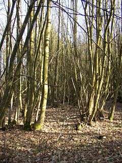 Coppiced trees at Hydon Heath | |
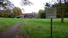 A converted barn in West Surrey Golf Course | |
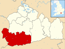
 Hydestile Location within Surrey | |
| Population | 431 - the population in 2011 was at most half of the two output areas drawn around portions of the two related areas.[1] |
| OS grid reference | SU96814056 |
| Civil parish | |
| District |
|
| Shire county | |
| Region | |
| Country | England |
| Sovereign state | United Kingdom |
| Post town | GODALMING |
| Postcode district | GU8 4 |
| Dialling code | 01483 |
| Police | Surrey |
| Fire | Surrey |
| Ambulance | South East Coast |
| UK Parliament | |
History
Hydestile was the site for two hospitals: from 1921 King George V Hospital (formerly a TB Sanatorium) and from 1941 St. Thomas' Hospital (formed from the World War II evacuation of St. Thomas' Hospital in Lambeth). The hospitals were demolished and redeveloped in the late 1990s following years of disuse and dereliction. The only visible remains are the Gatehouse, former Superintendent's house, 6 staff cottages and a cluster of footings amongst the woods.
Geography
Were it not for its long-held community ties with neighbouring proper villages Hydestile would be a village. The hamlet forms a ribbon development on all roads towards its crossroads. To the south-east is the steeper of two neighbouring outcrops of the Greensand Ridge. Elevations range from, 74m in the narrow wooded vale of the Shad Well spring that issues near the central crossroads of the hamlet and flows to the north, to 117m AOD less than a mile to the east. However, the road leading east, Salt Lane has a fork to access Hascombe but otherwise ascends further, it veers southeast after the Hydon's Ball promontory at 171m, past steep banks of woods (Hurt Wood and Breakneck Hill to the left side) to access Dunsfold village.
To the west of West Surrey Golf Course, hamlets Enton Green and Great Enton share one 2011 census output area (of between 50 and 150 homes) and their surrounding terrain is flatter, they are mentioned in the article on their civil parish, Hambledon.[2]
Landmarks
- Hydon's Ball (a steep, wooded hill) (NT)
- A Cheshire Home.
- The Tolt, Hydon Heath and Busbridge Woods are three woodlands directly east of the cluster of homes in the hamlet's centre.
- West Surrey Golf Course occupies the west and south-west of the hamlet.
Demography
The settlement has a small population, split between two considerably larger United Kingdom Census 2011 output areas: E00157389 (north-east and beyond) and E00157740 (rest and beyond).[3]
| Output area | Population | Households | % Owned outright | % Owned with a loan[1] |
|---|---|---|---|---|
| E00157389 | 528 | 171 | 50.3 | 36.3 |
| E00157740 | 338 | 116 | 42.2 | 26.7 |
External links
| Wikimedia Commons has media related to Hydestile. |
References
- 2011 Census
- Census Map of relevant output areas Office for National Statistics
- Output Area Map Office for National Statistics