Hunston, Suffolk
Hunston is a small Suffolk village and civil parish set in a conservation area of Mid-Suffolk and lies between Stowlangtoft and Badwell Ash off the A1088, nearly eight miles east of the centre of Bury St Edmunds. It is set in flattish farmland, mostly arable.
| Hunston | |
|---|---|
.jpg) St Michael's church | |
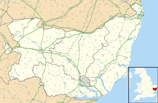 Hunston Location within Suffolk | |
| Population | 197 (2011 Census)[1] |
| District | |
| Shire county | |
| Region | |
| Country | England |
| Sovereign state | United Kingdom |
| Post town | Bury St Edmunds |
| Postcode district | IP31 |
St Michael's Church
St Michael's Church stands in farmland about one-third of a mile south of the village centre, behind the site of Hunston Hall. It is an interesting specimen of Early English architecture. There are a number of Early English windows and some perpendicular insertions. The nave roof is of good hammer-beam type, the restored chancel roof being copied from it. The chancel arch is plain, supported on circular shafts with richly foliated capitals.
The priest's door to the south is elegant; the head is a segmented arch boldly trifoliated the cusps are terminated with fleur-de-lys. In the east wall of the transept is a niche leaf with beautiful moulding of foliate design In the south-east angle of the transept is a beautiful Early English double piscina under two trefoil arches one in each wall supported on three circular shafts the central shaft being in the angle of the walls In the chancel are two ancient benches with well carved poppy heads.
The font is Norman. Near the font is a well preserved chest of unusual design.
The 14th Century flint tower which contains 5 bells is plain decorated of three stages without buttresses with a late brick parapet. In 1887 the chancel was thoroughly restored by the late JH Heigham. In the same year the chancel floor was relaid with mosaic work by Major C Heigham who in 1882 placed 6 new windows in the chancel.
The most recent refurbishment completed in 2005 was restoration of a central window in the chancel.
References
- "Civil Parish population 2011". Neighbourhood Statistics. Office for National Statistics. Retrieved 23 August 2016.
External links
| Wikimedia Commons has media related to Hunston, Suffolk. |
| Boroughs or districts |
|
|---|---|
| Major settlements |
|
| Topics | |