Holt, Alabama
Holt is an unincorporated community and census-designated place (CDP) in Tuscaloosa County, Alabama, United States. At the 2010 census the population was 3,638.[3] It is part of the Tuscaloosa, Alabama Metropolitan Statistical Area. Holt appeared on the 1930 census.
Holt, Alabama | |
|---|---|
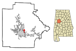 Location in Tuscaloosa County and the state of Alabama | |
| Coordinates: 33°13′49″N 87°29′10″W | |
| Country | United States |
| State | Alabama |
| County | Tuscaloosa |
| Area | |
| • Total | 3.18 sq mi (8.2 km2) |
| • Land | 3.16 sq mi (8.2 km2) |
| • Water | 0.02 sq mi (0.05 km2) |
| Elevation | 381 ft (116 m) |
| Population (2010) | |
| • Total | 3,638 |
| • Estimate (2016)[2] | N/A |
| • Density | 1,100/sq mi (440/km2) |
| Time zone | UTC-6 (Central (CST)) |
| • Summer (DST) | UTC-5 (CDT) |
| ZIP code | 35404 |
| Area code(s) | 205, 659 |
| FIPS code | 01-35704 |
| GNIS feature ID | 0120295 |
Geography
Holt is located at 33°13′50″N 87°29′11″W (33.230467, -87.486303).[4]
According to the U.S. Census Bureau, the community has a total area of 3.2 square miles (8.3 km2), all land.
Demographics
| Historical population | |||
|---|---|---|---|
| Census | Pop. | %± | |
| 1950 | 2,453 | — | |
| 1990 | 4,125 | — | |
| 2000 | 4,102 | −0.6% | |
| 2010 | 3,638 | −11.3% | |
| U.S. Decennial Census[5] | |||
Holt first appeared on the census in 1950 as the unincorporated community of Holt-Fox. It did not reappear again until 1990 when it was classified as a census-designated place (CDP) as Holt.
At the 2000 census there were 4,103 people, 1,785 households, and 1,252 families living in the community. The population density was 1,268.0 people per square mile (488.9/km²). There were 2,006 housing units at an average density of 567.1 per square mile (218.7/km²). The racial makeup of the community was 51.67% White, 47.04% Black or African American, 0.44% Native American, 0.02% Asian, 0.12% from other races, and 0.71% from two or more races. 1.49% of the population were Hispanic or Latino of any race.[6] Of the 1,614 households 31.4% had children under the age of 18 living with them, 41.4% were married couples living together, 20.4% had a female householder with no husband present, and 33.0% were non-families. 28.5% of households were one person and 9.3% were one person aged 65 or older. The average household size was 2.54 and the average family size was 3.12.
The age distribution was 27.1% under the age of 18, 10.7% from 18 to 24, 27.5% from 25 to 44, 21.6% from 45 to 64, and 13.1% 65 or older. The median age was 35 years. For every 100 females, there were 97.2 males. For every 100 females age 18 and over, there were 94.3 males.
The median household income was $26,095 and the median family income was $33,165. Males had a median income of $28,212 versus $17,048 for females. The per capita income for the community was $13,116. About 11.3% of families and 20.2% of the population were below the poverty line, including 24.7% of those under age 18 and 23.3% of those age 65 or over.
2010 census
At the 2010 census there were 3,638 people, 1,385 households, and 925 families living in the community. The population density was 1,389 people per square mile (536/km²). There were 1,603 housing units at an average density of 500.9 per square mile (190.8/km²). The racial makeup of the community was 55.2% Black or African American, 39.4% White, 0.4% Native American, 0.2% Asian, 3.2% from other races, and 1.6% from two or more races. 7.2% of the population were Hispanic or Latino of any race.[7] Of the 1,385 households 26.8% had children under the age of 18 living with them, 33.9% were married couples living together, 25.5% had a female householder with no husband present, and 33.2% were non-families. 28.2% of households were one person and 10.0% were one person aged 65 or older. The average household size was 2.63 and the average family size was 3.18.
The age distribution was 25.2% under the age of 18, 10.5% from 18 to 24, 26.0% from 25 to 44, 26.2% from 45 to 64, and 12.1% 65 or older. The median age was 35.6 years. For every 100 females, there were 95.7 males. For every 100 females age 18 and over, there were 100.5 males.
The median household income was $28,750 and the median family income was $32,731. Males had a median income of $23,517 versus $21,186 for females. The per capita income for the community was $13,964. About 24.7% of families and 31.9% of the population were below the poverty line, including 56.7% of those under age 18 and 19.0% of those age 65 or over.
Notable people
- Johnny Shines, blues guitarist[8]
- Jimmy Walker, American football and basketball coach[9]
See also
- Cottondale, Alabama — adjacent unincorporated community in Tuscaloosa County
- Alberta City, Tuscaloosa — adjacent suburb in Tuscaloosa County
References
- "2016 U.S. Gazetteer Files". United States Census Bureau. Retrieved Jul 17, 2017.
- "Population and Housing Unit Estimates". Retrieved June 9, 2017.
- "U.S. Census website". United States Census Bureau. Retrieved 2011-05-14.
- "US Gazetteer files: 2010, 2000, and 1990". United States Census Bureau. 2011-02-12. Retrieved 2011-04-23.
- "U.S. Decennial Census". Census.gov. Retrieved June 6, 2013.
- "U.S. Census website". United States Census Bureau. Retrieved 2008-01-31.
- "U.S. Census website". United States Census Bureau. Retrieved 2015-08-13.
- "Johnny Shines Dead; Delta Blues Singer, 76". The New York Times. April 21, 1992.
- Reed, Delbert (July 17, 1996). "Jimmy Walker is now more than just a name". The Tuscaloosa News. Google News Archives. p. 2E. Retrieved January 7, 2015.
Municipalities and communities of Tuscaloosa County, Alabama, United States | ||
|---|---|---|
| Cities | 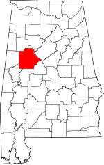 Map of Alabama highlighting Tuscaloosa County | |
| Towns | ||
| CDP | ||
| Unincorporated communities | ||
| Ghost town | ||
| Footnotes | ‡This populated place also has portions in an adjacent county or counties | |