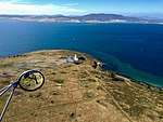
History of Smooth Island (Tasmania)
This article outlines the history of Smooth Island, popularly known as Garden Island, in Norfolk Bay, Tasmania. The names come from the island's gently undulating topography and lush vegetation in comparison with the stony mainland. It has been privately owned since 1864.
History
Aborigines and European settlement |
|---|
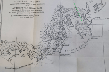 1793: D'Entrecasteaux's map of Norfolk Bay after a brief exploration. Smooth Island, which he had not named, is indicated with a green arrow. .png) Matthew Flinders' 1798 map of Norfolk Bay shows his passage around Smooth Island. Prior to European settlement, the Forestier Peninsula to the east of Smooth Island is believed to have been occupied by the Pydairrerme band of the Oyster Bay (Paredarerme) tribe of Aboriginal Tasmanians.[1][2][3] They spoke the Paredarerme language. There is no recorded evidence of any remaining Paredarerme people in the region after the 1830s.[3] European settlementIn 1793 Jean-Baptiste Philibert Willaumez (of the Antoine Bruni d'Entrecasteaux expedition) was the first Anglo-Saxon to discover Smooth Island. The island is found on d'Entrecasteaux's maps, though it is unnamed.[4] On 15 December 1798 Matthew Flinders was the first Anglo-Saxon to set foot on Smooth Island. He stopped to take bearings[5] and spent two nights on the island. He described his impression of the island:[4]
Flinders charted the island and his passage through the region on the map Chart of Terra Australis – By M Flinders – 1798–1799 – South Coast, Sheet VI.[7] He described his initial impression of sailing eastwards from Doughboy Island in Frederick Henry Bay towards Norfolk Bay:
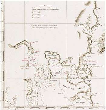 1812: Freycinet, Louis-Claude de Saulces from Voyage de Découvertes aux Terres Australes (English: Discovery Trip to the Southern Lands), navigation and geography atlas. Paris: Dépôt général des cartes et plans de la marine. .jpg) A sketch of Capt. Flinder's voyage through Norfolk Bay, Tasmania in 1814
In A Voyage to Terra Australis he wrote, "Smooth Island [...] is three quarters of a mile long, and covered with grass and a few small trees. It has been visited by the natives, as had the Isle of Caves; but from the eggs of gulls found upon both, I judge they do not go often."[10] In the same text he also said, "Of the four islands in the bay, Smooth and Gull islands were found superior in fertility to the mainland: the first contains about 40 acres [16 ha] of tolerable pasturage".[10] In Matthew Flinders narrative of a voyage in the sloop Norfolk, 7 October 1798 – 12 January 1799 he wrote, "In the afternoon we weighed and steered for a smooth beautiful looking island up the opening which bore from E.5°.30' to 10°.40' south from the Isle of Caves; and measured another base in the same manner as before; their distance asunder is five miles and three quarters. On landing upon this smooth island in the evening we did not find the goodness of the soil equal to its appearance: it would however make a fine large Garden, there being more than a hundred acres of culturable ground upon it. December. 16. Sunday. In the morning I again landed to take bearings from another part of the island; after which, we weighed and ran to the south side of a point which lays one mile and a half to the S.Eward; the wind fresh from the Northward. From a hill, that stands a little within this point, I had a good view of the form of the bay in its neighbourhood. Monday. 17th. In the evening we ran round to the north side of the point, there being every appearance of a southerly Gale coming on; but it continued moderate, and in the morning we landed upon the Islet called Gull Island in the chart."[11] |
1800s
1800s: Offshore detention site for Risdon Settlement. Public sale of Crown land. Land survey. Frequent title transactions |
|---|
Role in the Risdon Cove convict settlement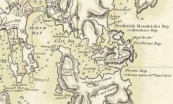 1824: Thomas Scott's map of Norfolk Bay. Smooth Island is labelled 'Garden Island'
From "Early History of Tasmania", Volume 2, by Ronald Worthy Giblin:
On 6 May 1804 the King requested Collins take over command of the Risdon settlement from Bowen. Upon taking over, Collins decided to relocate the Risdon settlement to Sullivan Cove, leaving Bowen in charge of Risdon until the move had completed. On 8 May Collins issued the following instructions to Bowen:
In 1824 Thomas Scott conducted a survey of Tasmania, producing a detailed map of Tasmania (including the Norfolk Bay region).[17] 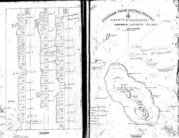 1863: Official surveyance report of Smooth Island On 15 February 1836 Smooth Island was defined as lying within the county of Pembroke.[18] On 10 February 1837 Captain Charles O'Hara Booth (commandant of Port Arthur penal settlement) woke on Slopin Main and travelled to Smooth Island (called Garden Island) to spend the day hunting with his associate, Ramsay.[19]On 17 September 1839, Smooth Island was offered for sale as part of the 'Estate of Fulham'.[20]
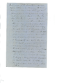
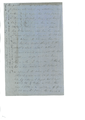
Captain Charles O'Hara Booth liked the idea of owning an island; in 1839 he applied to the Land and Survey Department to buy Smooth Island but was informed that, although a lease could be arranged, ownership of all islands was reserved for the government.[21] A publication from 2011 indicates Smooth Island may have been used to grow vegetables for the Port Arthur penal settlement, which was in operation from 1833 to 1853.[22] However this claim cannot yet be verified. On 19 February 1863 Thomas Reid commissioned the surveyor general, James Erskine Calder, to assess the island.[23] In his survey, Calder determined the island was 146 acres (59 ha), lightly timbered, with about 40 acres (16 ha) suitable for agriculture[24] with little or no clearing. He believed that the remaining portion of the land could be cleared or burned-off for pasture. He rated the island's water to be of good quality but unproven for the demands of cattle.[25] The eastern shore of the island was found to have the best landings, and had been improved in four places, Calder believed, for whaling operations carried out on Norfolk Bay.[26] There had been some mineral exploration for blue granite and iron, though no beds were found. Calder evaluated the island as "well worth £2 per acre".[27] On 14 April 1863 Smooth Island, which was classed as agricultural Crown land at the time, was designated for sale at public auction on 23 April the following year, in accordance with the Waste lands Act. Several key clauses of the act were described.[28] It was initially listed for a minimum sale price of £227.[29] Thomas Gabriel Reid commissioned a detailed survey of the island which took place between 10 and 14 July 1863 (see survey report inset). It appears Thomas Gabriel Reid purchased the island on 21 April 1864 for only £155.[30] A "Thomas G. Read" was recorded as living in the nearby town of Sorell in 1866.[31] On 31 October 1894 Thomas Gabriel Read died at New Norfolk at 70 years of age. He was the second son of Captain G. F. Read.[32] Thomas Gabriel Read was a notable gold-miner. A detailed biography of Thomas Gabriel Read is available.[33] On 8 November 1869, Lieutenant Colonel Mundy said, "the pretty wooded Garden Island [was] lying in the jaws of [Norfolk Bay]",[34] suggesting that clearfelling had not yet occurred on the island. On 4 April 1870, a sailor traveling past Smooth Island wrote in a local newspaper,
On 14 March 1878, a newspaper article reported "[In] Norfolk Bay, about two miles from East Bay Neck, lies Garden Island, which is under cultivation, and yields excellent crops".[36] On 26 July 1878, Smooth Island was sold at auction for £400.[37] Prior to its sale, real estate agents had advertised it as:[38][39][40][41]
On 5 August 1878, Garden Island's new owner, James Quested, published a notice in newspapers warning that he would prosecute any fishermen, craftsman or others trespassing upon the island.[42][43][44] On 15 November 1883, Captain Haughton Forrest liquidated James Quested's assets at Sorell police station.[45]On 2 June 1883, the island was again advertised for private sale.[46][47]
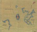
On 14 June 1884, a local newspaper reported, "Garden Island, of about 100 acres, situated about a mile off the northern limit of King George's Sound, Forestier's Peninsula, is occupied, and appears to have good soil by the newly-turned sod of the paddocks, and has upon it the buildings and paraphernalia of the average farm."[48] On 19 November 1889, an advertisement in a local newspaper offered "100 prime fat wethers from Garden Island".[49] From 3 December 1893 until December 1894, the island was advertised for private sale:[50] On 14 July 1894, Captain Jones and his crew of whale hunters (on the whaling barque Taranna[51]) "shifted their quarters from Slopen Island Sloping Island to Garden Island, as it [was] believed that 3 whales had been sighted in the vicinity of King George Sound".[52][51][53] The expedition was unsuccessful and returned to Hobart on 16 July 1894.[54]  1894: British survey map of Norfolk Bay showing Smooth Island On 8 December 1894, the island was advertised for sale. The description suggests that fresh water was available on the island, corresponding with the "Spring" found the survey map of 1863.[55][56] In January 1895, a real estate agent was used. It appears that all trees had been cleared from the island by this stage. The island was advertised as, "146 Acres Grass Land, suitable for cultivation. Easy Terms. R. DARLING, Agent, 54, Murray-street."[57] The British conducted a survey of Norfolk Bay and Frederick Henry Bay (a.k.a. North Bay) in 1894, producing the map seen to the right. It was published on 1 October 1925[58][59] |
1900s
1900s: Boating accidents. Grazing land. Attempted introduction of European Grey Partridge birds. Marine survey. Infrequent title transactions |
|---|
|
On 4 January 1900 a reader of the Mercury demanded a lighthouse be placed on Garden Island.[60] Smooth Island was owned by Samuel Nicholas Wellard in the early 1900s. He was a well-known sheep breeder who lived in Forcett, Tasmania.[61] He died in August 1934.[62] On 16 November 1903, the Commissioner of Police (Mr G. Richardson) received a telegram, intimating that the fishing boat Stella had been lost off Smooth Island. A man named Netherton, and another, were drowned. No particulars were available.[63] On 7 August 1905, a report describes docking at Smooth Island during one of the first passages through the Denison Canal:
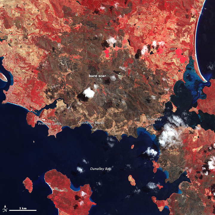
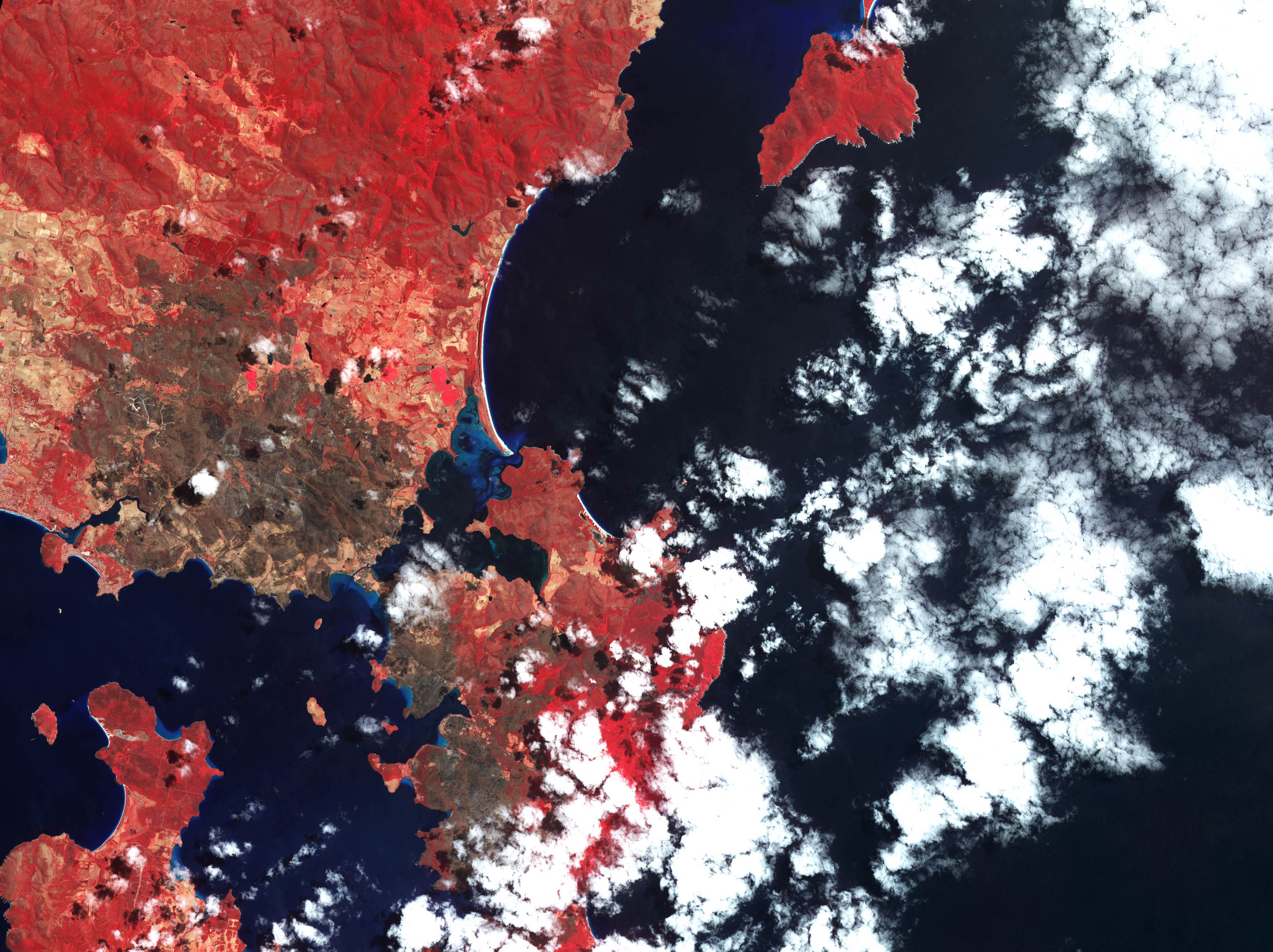
On 21 August 1914, Chris Wellard, a nephew of Smooth Island's owner, died mysteriously after sailing away from the island. The Mercury reported on 25 August that Chris Wellard, a resident of Forester's Peninsula, had conveyed sheep from Smooth Island to the S.S. Breone then cast off with the intention of returning to the mainland. Three days later his boat was found several miles away, floating upside-down, with one of the three dogs he'd had with him sitting on the keel.[65] On 2 September the Mercury reported that after transporting sheep to the Breone, Wellard returned to the island and loaded his dinghy with some 300 kg of fish manure, a lamb and three dogs. The Breone offered to tow Wellard to the mouth of King George's Sound on the west side of Forestrier's Peninsula, which was near Wellard's home. However, once underway, the dinghy began taking water over its bow and was cast off. Wellard at once turned back toward the island's jetty, which was only 200 yards away, while the Breone lost sight of him around a point.[66] On 4 September, S. N. Wellard wrote that the fish manure, which had unusually been loaded in the bow of the boat, would have become much heavier as it absorbed water. He suggested that his nephew had tried to lighten the dinghy and caused it to imbalance, the front going down before it rolled.[67] In August 1917, 92 head of cattle, "fattened on Garden Island, down Port Arthur way" were exported to Victoria.[68] Several livestock-clearing sales occurred throughout 1919. These references suggest the clearing sale was due to the recent sale of the island.[69][70] The family which owned the island (immediately prior to the current owners) acquired it in 1927.[71] In 1936 the Tasmanian Game Protection and Acclimatisation Society, assisted by the Animals and Birds Protection Board, imported 110 European grey partridges to Tasmania from England, at a cost of £150.[72] These were liberated with Tasmania at Smooth Island, Marrawah, Whiteford and Colebrook. By 1950 these birds had disappeared. The European grey partridge is not established anywhere in Australia, at present.[73] Newspaper articles from the 1940s suggest that the Bellerive Yacht Club held an annual boat race around Smooth Island.[74][75] .jpg) 2013: False colour fire map of Norfolk Bay (black regions were burned, red regions were unaffected). Smooth Island is highlighted.
Prior to change of ownership, Smooth Island was primarily used as pasturage for livestock. It is reported that on some occasions up to 600 sheep would graze on the island simultaneously.[71] Marine surveyBetween February 1995 and December 1996, a beam trawl was placed within the Zostera tasmanica site on the Smooth Island's east coast. The common name (taxa): total individual fish (% of catch) were reported as follows: Little Rock Whiting (Neoodax balteatus): 1262 (49.8%); Bridled Leatherjacket (Acanthaluteres spilomelanurus): 966 (38.2%); Spotted Pipefish (Stigmatopora argus): 90 (3.6%); Soldierfish (Gymnapistes marmoratus): 56 (2.2%); Crested Weedfish (Cristiceps australis): 45 (1.8%); Southern Cardinal Fish (Vincentia conspersa): 21 (0.8%); Port Phillip Pipefish (Vanacampus phillipi): 15 (0.6%); Sand Flathead (Platycephalus bassensis): 14 (0.6%); Girdled Goby (Nesogobius sp.1): 12 (0.5%); Orange-Spotted Goby (Nesogobius hinisbyi): 7 (0.3%); Red Cod (Pseudophycis bachus): 6 (0.2%); Toothbrush Leatherjacket (Acanthaluteres vittiger): 6 (0.2%); Red Rock Cod (Helicolenus barathri): 5 (0.2%); Half-Banded Pipefish (Mitotichthys semistriatus): 4 (0.2%); Adelaide Weedfish (Heteroclinus adelaidae): 4 (0.2%); Common Weedfish (Heteroclinus perspicillatus): 4 (0.2%); Six-Spined Leatherjacket (Meuschenia freycineti): 4 (0.2%); Castelnau's Goby (Nesogobius pulchellus): 2 (0.1%); Greenback Flounder (Rhombosolea tapirina): 2 (0.08%); Pot Bellied Seahorse (Hippocampus abdominalis): 1 (0.04%); Spotted Flounder (Ammotretis rostratus): 1 (0.04%); Richardson's Hardyhead (Atherinason hepsetoides): 1 (0.04%); Long Snouted Flounder (Long Snouted Flounder (Ammotretis rostratus): 1 (0.04%); Brownstriped Leatherjacket (Meuschenia australis): 1 (0.04%); Pigmy Leatherjacket (Brachaluteres jacksonianus): 1 (0.04%).[77] |
2000s
2000s: Property transaction. Structure fire. Aircraft noise complaints. |
|---|
|
Between 2003 and 2007 Smooth Island was subleased to a local oyster farmer to transport oyster stock to and from a processing facility in Boomer Bay.[78] The island was reportedly priced at A$1,650,000 in 2010.[79] Satellite imagery indicates that the 2013 Tasmanian bushfires did not burn Smooth Island.[80][81] During 2013, Smooth Island was advertised for sale, with the following description:[82]
In November 2013, after just 19 days on the market, Smooth Island was sold to a couple from Victoria.[83][84][85][86][87] On 16 January 2018, a structure on Smooth Island was damaged by fire.[88][89][90] On 9 April 2018, the Aircraft Noise Ombudsman published recommendations after investigating noise complaints from residents of Dunalley and Smooth Island following changes to flight paths into Hobart Airport[91][92] On 15 January 2019, dry lightning struck a large tree on the middle of the east coast of the island. This spread to adjacent trees and caused a 1-acre grass fire which was contained independently by the owners. On 16 January 2019, the local fire service attended and completed a 'blackout', to fully extinguish any residual smouldering embers. |

Historical owners
Extended content | ||||||||||||||||||||||||||||||||||||||||||||||||||||||||||||||||
|---|---|---|---|---|---|---|---|---|---|---|---|---|---|---|---|---|---|---|---|---|---|---|---|---|---|---|---|---|---|---|---|---|---|---|---|---|---|---|---|---|---|---|---|---|---|---|---|---|---|---|---|---|---|---|---|---|---|---|---|---|---|---|---|---|
|
Previous owners and property transactions
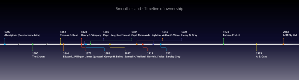 Smooth Island - timeline of ownership Thomas Gabriel ReadTasmanian gold prospector Thomas Gabriel Read started the Otago Gold Rush.[103] He was born in Tasmania, the second son of Captain G. F. Read. Between 1861 and 1864 he was prospecting for gold in New Zealand. He received a reward of £1,000 and had returned to Tasmania in 1864, where he purchased Smooth Island. He purchased it from the government sale of crown land for £155,[104] a significant discount from the £227 asking price advertised the week beforehand.[105][56] Thomas Read was said to have taken up farming by 1865. He married Amelia Mitchell on 2 January 1869.[106] He was admitted to a psychiatric hospital from 1887 until he died in 1894.  Edward James Pillinger's land grant for Smooth Island, 1866 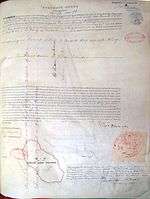 Property title: Edward James Pillinger Edward James Pillinger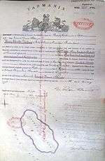 Property title: Henry Charles Vimpany Edward James Pillinger married on 5 September 1857 to Amelia Little,[107] who was related to Mr E Vimpany. Pillinger claimed to live on the island 20 August 1867, and the Pillingers had a daughter, of unknown name, born 22 July 1874.[108] Pillinger was engaged in a financial dispute with Read, the island's previous owner.[109] Pillinger was found dead in Mr Neil Lewis's run in Milford, Cambridge on 8 June 1878, in an advanced state of decomposition. He was 50 years old. An inquest returned an open verdict,[110] however given a partly empty bottle of strychnine was found near the corpse, poisoning was presumed to be the cause of death.[93] Mr Pillinger's wife, Amelia, died on Smooth Island on 1 October 1876 after a 'short and painful' illness.[111] Mr Pillinger probably sold the island between 1877 and 1878.[112] Edward Pillinger was the brother-in-law of Mr Vimpany. Henry Charles VimpanyVimpany died 22 December 1909.[113] James Head Quested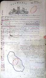 Property title: James Quested James Head Quested was born in 1819 in Kent, England to Jane Seath (1791–1881, died in Hobart) and James Quested (1791–1877, died in Hobart). On 6 January 1827 his father was sentenced to life imprisonment for aiding and abetting smugglers;[114][115] he was transported from London to Tasmania on the ship Governor Ready and received a conditional pardon on 9 March 1839. James Head Quested became a master mariner and married Anne Mack (a.k.a. Ann Macnamara) on 17 October 1842 in Hobart. The couple lived on Smooth Island. In 1851 James Head Quested joined the Bendigo gold rush with John Rowlands (of Brushy Plains) and a man named 'Bannan' – the group was "fairly successful" there.[116] Quested owned the ship Boomerang and traded between Tasmania, New Zealand and mainland Australia.[117] He testified that a man boarded his ship in a drunk and quarrelsome manner.[118] When the Boomerang was shipwrecked, Quested was accused of exaggerating the severity of the damage to obtain undue charity from the public.[119][120] Quested subsequently moved to Garden Island (he either rented it from Mr E Vimpany[95] or purchased it himself) and started a butchering business.[116] On 13 April 1871, James Quested's sheep dog died. He suspected it had been poisoned and offered a £10 reward for information leading to a conviction.[121] Anne Mack was a drunk,[95] had a very long, elaborate criminal record[95] and was known to have a "very infirm temper". The Daly and Quested families had a long, bitter history of petty conflict which frequently aired in public, beginning at least during 1872.[122] In 1872 Anne Mack reportedly had a public quarrel with John Daly, where she broke windows, used foul language and threw meat bones at him.[123] On 15–16 May 1877, Mack was sentenced to 2 months of manual labor for maliciously wounding her daughter, Sarah Quested, with a knife.[95] On 28 May 1878, James Quested submitted a notice in a newspaper calling for all his financial accounts (debts and credits) to be settled, stating that his solicitor would seek to recover any debt not repaid by 10 June 1878.[124] In spite of his financial difficulties, on 19 August 1878, Quested took the unusual decision to "purchase Smooth Island from Henry Vimpany for £400."[125] Quested obtained at least four mortgages on the property[126][127][127][127] and lost a court case (Adkins v. Quested, 1880) over unpaid wages.[128] In late 1880, Quested was summoned to appear in court as part of these financial disputes.[129] Quested was forced to sell the island via public auction on 15 November 1880 due to court order (Daly v. Quested, 1880). Police superintendent Houghton Forrest (Bailiff of the court of requests for the municipality of Sorell), who forced Quested to sell the island, purchased the island himself. (The title deed shows on 5 February 1881, Houghton Forrest transferred £70 to George Herbert Bailey, the island's future owner).[130][131] On 18 November 1880 Quested continued to occupy the house and 145 acres of land, paying £25 rent annually to E Vimpany.[95] In 1881 he was arrested for disobeying a court summons and found liable for underpaying the wages of an employee.[132] Quested continued to occupy the homestead on Smooth Island while it was owned by George Herbert Bailey (who held the deed from 11 February 1881 to 16 January 1884),[98] and reportedly still lived on the island until at least 6 June 1883.[47][133] There is no known record suggesting Quested occupied the island during any of Capt Thomas de Houghton's period of ownership (16 Jan 1884 to 4 Oct 1897). In 1886 Jamed Quested was charged with deserting his illegitimate child in Prahran, Victoria.[134] Quested died 30 March 1892 (At Walker street, Redfern, Sydney). He was buried at Church of England section B No.47 at Cornelian Bay Cemetery, Hobart. Captain Haughton ForrestCapt Forrest seems to have lived in Sandy Bay[135] and moved to the region in approximately 1876.[135] Forrest was an artist[136][137][138][135][135][139] but also Superintendent of Police. He was appointed Bailiff of Crown lands in the municipality of Sorell.[140] He had to deal with a rebellion in Sorell, lead by Mr Trooper Newitt, over a pay dispute.[141] Forrest and Newitt went to court over the disputed cost of boat transport to Smooth Island (called Garden Island). The details of this dispute are as follows: In 1880, Newitt, a policeman of the Sorell municipality, had to go to Smooth Island to summon Quested and Townsend, another man living on the island, to court. Newitt had to pay a boatsman to transport him and attempted to reclaim this cost in court from Forrest, the police superintendent and his superior officer in Sorell.[142] Between 25 October 1880 and 15 November 1880, Captain Forrest then proceeded to sell Quested's title, rights and interest in Smooth Island at a public auction at Sorell police station.[143] The title deed shows, on 5 February 1881, Haughton Forrest transferred £70 to George Herbert Bailey, the island's future owner.[131] It is likely that Captain Forrest acquired possession of the island for 3 to 4 months before it was then sold to Bailey. 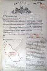 Property title: George Herbert Bailey George Herbert BaileyThe title deed shows that Bailey purchased the island from Forrest on 11 February 1881. Bailey sold his possessions on 17 March 1882, before leaving the colony.[144] 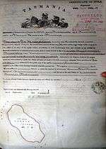 Property title: Captain Thomas de Hoghton Captain Thomas de HoghtonThomas de Hoghton was born on 24 October 1845.[145] In 1861 de Hoghton was a cadet in the Royal Navy, and lived in Portsea, Hampshire in 1871. He married Julia Georgina Read on 29 March 1881 in Plenty, Tasmania.[146][147] Capt de Hoghton owned the island between 16 January 1884 and 4 October 1897. In 1891 media reported that he lived in Cirencester, Gloucestershire, but on 5 December 1891, newspapers then reported that Capt de Hoghton intended to return to Tasmania and begin living on the island.[101] Thomas had attempted to sell the island between 9 December 1893 and 12 January 1895. However, it may not have sold during this period. On 15 April 1911 he made comments in a newspaper relating to workers rights.[148][149] He may have kept the island until just prior to his death, in line with a clearing sale in 1919. Further advertisements indicate another clearing sale occurred on 29 October 1919, after the island was reportedly sold. Thomas died 29 June 1920 at age 74 at his residence in Cleveland, Holebrook-place (Pontville). Julia died on 18 July 1928.[150] 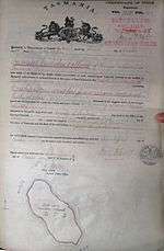 Property title: Samuel Nicholas Wellard Samuel Nicholas WellardSamuel Wellard was born 27 October 1849 in Hobart to Thirza "Theresa" Champion (1812–1855) and Samuel Nicholas Wellard (1812–1859). He married Harriet Morey on 15 June 1871. He died 23 August 1934 in Bellerive, Tasmania. He publicly expressed opinions on the Ralph Bay Neck Canal.[151] One of his family members died near Smooth Island.[152] Wellard was said to have given up the lease of Smooth Island on 16 October 1901.[153] Samuel's will was executed 6 June 1935 and all Samuel's property was assigned to Annie Wellard, the daughter of his brother Walter William Wellard. 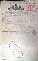 Property title: Arthur Charles Vince Arthur Charles VinceInitially, Vince was a butcher. On 4 December 1915, Vince was the plaintiff in a court case claiming £27/10 against the Hobart Meat Supply So., in the civil sittings of the Supreme Court.[154] On 24 October 1923, Vince filed a petition for liquidation of his affairs.[155] On 26 August 1930 he was the plaintiff in a case against Thomas Adams, accusing him of theft of various items, including several fowls.[156] Vince was not a good driver. He pled guilty to driving an unlicenced motor vehicle and for not stopping at an intersection, on 22 May 1931.[157] On 7 August 1932, Arthur Vince was involved in a serious traffic accident on the Huon Highway, when his milk lorry collided with Benjamin Kyle Price's car. Vince's wife, Eva Ellen Vince, attempted to sue Price for damages on grounds of negligent driving.[158] On 6 December 1935, Arthur Vince was fined for driving a motor vehicle with insufficient brakes.[159] On 3 June 1935, Arthur Charles Vince was involved in another accident on the Huon Highway, again while driving his milk lorry. On this occasion he collided with Mrs T. Fitzgerald's car.[160] On 3 December 1941, Arthur (or his son by the same name) was charged with driving his milk lorry at an excessive speed (60 mph) and also for driving his tractor (with spiked wheels) on the Huon Highway.[161] On 8 June 1943, Vince gave evidence at a Milk Inquiry Committee at Parliament House, Hobart.[162][163] On 9 February 1944, Vince was fined for selling milk which was of insufficient standard.[164] On 18 October 1944, Vince used his lorry to transport milk from Thomas Henry Tennant's dairy farm to Hobart, for sale by an agent. Tennant was charged with diluting the milk with 18% water, prior to it being transported by Vince. Vince was not found guilty.[165] On 20 October 1948, Eva Helen Vince died, survived by her husband, Arthur, and children, Arthur and Barbara.[166] Eva's estate was transferred to her husband, Arthur.[167] On 18 February 1952, Arthur was charged with cruelty for failing to prevent 5 of 13 head of cattle from falling off the tray of his lorry, thus causing death to 2 of the cattle. The magistrate eventually dismissed the charge, saying it was a borderline case.[168] 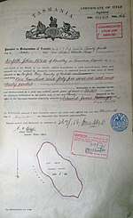 Property title: Norfolk John Wise Norfolk John WiseNorfolk John Wise married Elizabeth Reid McDowell on 7 June 1899.[169] The Governor General appointed Wise a Special Magistrate of the Commonwealth of Australia, for the purposes of the Invalid and Old-age Pensions Act 1908–1918.[170] He died 5 April 1944.[171] Barclay GrayBarclay commissioned a survey for phosphate rock on the island in 1941.[172] |
Gallery
_(slightly_cropped).png)

References
- Laurent Dousset. "Detailed record of the Oyster Bay Tribe". ausanthrop.net. Archived from the original on 16 July 2002. Retrieved 22 March 2015.
- Super User. "Local History". tasman.tas.gov.au. Retrieved 22 March 2015.
- "Port Arthur, Tas – Aussie Towns". Aussie Towns. Retrieved 22 March 2015.
- Taylor, H. G. (1973). "The Discovery of Tasmania". google.com.au.
- Morgan, Kenneth (24 March 2016). Matthew Flinders, Maritime Explorer of Australia. Bloomsbury Publishing. ISBN 9781441149107 – via Google Books.
- Egli, J. J. (Johann Jacob), 1825–1896. (15 March 1872). Nomina geographica Versuch einer allgemeinen ... – Full View – HathiTrust Digital Library – HathiTrust Digital Library. hathitrust.org. Leipzig. Retrieved 22 March 2015.CS1 maint: multiple names: authors list (link)
- http://gutenberg.net.au/ebooks/e00049-images/flinders1-atlas3.jpg
- Flinders M (1965). "Observations on the Coasts of Van Diemen's Land, on Bass's Strait and Its Islands, and on Part of the Coasts of New South Wales: Intended to Accompany the Charts of the Late Discoveries in Those Countries". Gutenberg.net.au. Retrieved 11 January 2015.
- Observations on the Coasts of Van Diemen's Land, on Bass's Strait and Its Islands, and on Part of the Coasts of New South Wales: Intended to Accompany the Charts of the Late Discoveries in Those Countries. Librairies Board of South Australia. 1965.
- Flinders M (1814). A Voyage to Terra Australia, Undertaken for the Purpose of Completing the Discovery of that Vast Country, and Prosecuted in the Years 1801, 1802, and 1803, in His Majesty's Ship the Investigator and Subsequently in the Armed Vessel Porpoise and Cumberland Schooner.
- "Matthew Flinders narrative of a voyage in the sloop Norfolk, 7 October 1798 – 12 January 1799". acms.sl.nsw.gov.au.
- http://arrow.latrobe.edu.au/store/3/4/6/1/1/public/B13858427S3V1Series%203.%20Volume%20I.%20Complete%20work.pdf
- Walker JB (1914). "Tasmania RSo: Early Tasmania: papers read before the Royal Society of Tasmania during the years 1888 to 1899". J. Vail.
- "The Mercury". Mercurynie.com.au. Retrieved 11 January 2015.
- Giblin, Ronald Worthy (5 May 2018). "The Early History of the Tasmania". Methuen & Company Limited – via Google Books.
- https://eprints.utas.edu.au/21799/1/whole_WilliamsJohn1972_thesis.pdf
- "LINC Tasmania catalogue • "0 @@ Chart of Van Diemen's Land from the best authorities and from actual surveys and measurements" by z @@ Scott, Thomas, 1800–1855". LINC Tasmania catalogue. Retrieved 11 April 2015.
- "The Hobart Town Courier". Retrieved 11 April 2015 – via Trove.
- Booth, Charles O'Hara; Heard, Dora (1 January 1981). "The journal of Charles O'Hara Booth: commandant of Port Arthur penal settlement". Tasmanian Historical Research Association – via Google Books.
- "01 Oct 1839 – Advertising". nla.gov.au. Retrieved 11 April 2015.
- Booth, Charles O'Hara; Heard, Dora (1981). "The journal of Charles O'Hara Booth". google.com.au.
- Warner, Georgia (2011). Living in History. ISBN 9781742694153.
- Request to survey the island. (original document)
- Survey report by E. Calder Esp, Surveyor General, 1863. (original document)
- Survey report by E. Calder Esp, Surveyor General, 1863. (original document)
- Survey report by E. Calder Esp, Surveyor General, 1863. (original document)
- Survey report by E. Calder Esp, Surveyor General, 1863. (original document)
- "Advertising". The Mercury. Hobart, Tasmania. 30 March 1861 – via Trove.
- "Garden Island, Norfolk Bay". Retrieved 11 January 2015 – via Trove.
Lot 2879, 145 acres 1 rood 30 perches, comprising an island known as Garden Island, situate in Norfolk Bay and King George's Sound. Upset price £227
- "23 April 1864: Government Land Sale". Retrieved 28 December 2014 – via Trove.
- "Sorell tasmania 1866 residents". ancestry.com. Retrieved 22 March 2015.
- "17 Nov 1894 – Family Notices". nla.gov.au.
- "Read, Thomas Gabriel – Biography – Te Ara Encyclopedia of New Zealand". teara.govt.nz.
- "Illustrated Australian News for Home Readers (Melbourne, Vic.: 1867–1875)". Retrieved 11 January 2015 – via Trove.
- "The Cornwall Chronicle". Launceston, Tasmania. Retrieved 11 January 2015 – via Trove.
- "Overland to Tasman's Peninsula". Tribune. Hobart, Tasmania. 14 March 1878.
- "30 Jul 1878 – Commercial Intelligence. The Mercury Office, Mon..." nla.gov.au. Retrieved 22 March 2015.
- The Mercury. Hobart, Tasmania http://nla.gov.au/nla.news-article8964730. Retrieved 11 January 2015 – via Trove. Missing or empty
|title=(help) - "The Mercury". Hobart, Tasmania. Retrieved 11 January 2015 – via Trove.
- http://trove.nla.gov.au/newspaper/article/8965875?searchTerm=%22Garden%20Island%22%20%22Port%20Arthur%22%20-steamers%20-coasters&searchLimits=
- http://trove.nla.gov.au/newspaper/article/201729238?searchTerm=%22Garden%20Island%22%20%22Port%20Arthur%22%20-steamers%20-coasters&searchLimits=
- "Advertising". The Mercury. Hobart, Tasmania. 6 August 1878 – via Trove.
- "Advertising". The Mercury. Hobart, Tasmania. 8 August 1878 – via Trove.
- "Advertising". The Mercury. Hobart, Tasmania. 10 August 1878 – via Trove.
- https://trove.nla.gov.au/newspaper/article/8989399
- "The Mercury". Hobart, Tasmania. Retrieved 11 January 2015 – via Trove.
- "Advertising". The Mercury. Hobart, Tasmania. 6 June 1883 – via Trove.
- "The Mercury". Hobart, Tasmania. Retrieved 11 January 2015 – via Trove.
- "The Mercury". Hobart, Tasmania. Retrieved 11 January 2015 – via Trove.
- "Garden Island, Norfolk Bay, for private sale. Apply to Captain de Hoghton, "Winton", Brighton". Retrieved 11 January 2015 – via Trove.
- "Shipping – Arrived — July 14". The Mercury. Hobart, Tasmania. 16 July 1894.
- "SHIPPING. – ARRIVED.—Yesterday". Tasmanian News. Hobart, Tasmania. 18 July 1894.
- "Southern News – Hobart. Hobart, July 12". The Tasmanian. Launceston, Tasmania. 21 July 1894.
- "SHIPPING. – ARRIVED.—Yesterday". Tasmanian News. Hobart, Tasmania. 14 July 1894.
- https://trove.nla.gov.au/newspaper/article/9323952?searchTerm=%22Garden%20Island%22%20water&searchLimits=l-decade=189%7C%7C%7Cl-year=1894%7C%7C%7Cl-state=Tasmania%7C%7C%7Cl-month=12
- "Advertising". The Mercury. Hobart, Tasmania. 20 April 1863 – via Trove.
- "The Mercury". Hobart, Tasmania. Retrieved 11 January 2015 – via Trove.
- "The Sydney Morning Herald". Retrieved 11 January 2015 – via Trove.
- "The Sydney Morning Herald". Retrieved 11 January 2015 – via Trove.
- "04 Jul 1900 – East Bay Neck. To the Editor of "The Mercury."". nla.gov.au. Retrieved 11 April 2015.
- "Nelson Evening Mail — 24 July 1909 — Local & General News". Paperspast.natlib.govt.nz. Retrieved 11 January 2015.
- "The Mercury". Hobart, Tasmania. Retrieved 11 January 2015 – via Trove.
- "A Fishing Boat Fatality". Daily Telegraph. Launceston, Tasmania. 16 November 1903.
- "East Bay Neck – First Excursion Tripo Through the Canal". The Mercury. Hobart, Tasmania. 7 August 1905.
- "The Mercury". Hobart, Tasmania. Retrieved 11 January 2015 – via Trove.
- "02 Sep 1914 – The Norfolk Bay Tragedy. A Mysterious Occurrence..." nla.gov.au. Retrieved 6 April 2015.
- "The Mercury". Hobart, Tasmania. Retrieved 11 January 2015 – via Trove.
- "Tasmania". 28 July 1917. p. 8 – via Trove.
- "The Mercury". Hobart, Tasmania. Retrieved 11 January 2015 – via Trove.
- "15 Oct 1919 – Advertising". nla.gov.au. Retrieved 22 March 2015.
- "Lot 1 Norfolk Bay, Dunalley TAS 7177". Homebound.com.au. Retrieved 10 January 2015.
- Sharland, Michael (1958). "Tasmanian Birds". google.com.au.
- Long, John L.; Australia, Agriculture Protection Board of Western (August 1981). Introduced birds of the world. ISBN 9780876633182.
- "The Mercury". Hobart, Tasmania. Retrieved 11 January 2015 – via Trove.
- "08 Nov 1946 – Engines Not To Be Sealed in Ocean Race – Hobart Re..." nla.gov.au. Retrieved 22 March 2015.
- "09 Apr 1946 – Advertising". nla.gov.au. Retrieved 11 April 2015.
- (page 31)
- "533 Scheme Amendment – Boomer Jetty Road, Boomer Bay". Google Docs. Retrieved 22 March 2015.
- Duncan, Philippa (23 May 2010). "Island Life on Sale at $1.65m". Sunday Tasmanian.
- http://eoimages.gsfc.nasa.gov/images/imagerecords/80000/80252/tasmania_ast_2013014.jpg
- http://eoimages.gsfc.nasa.gov/images/imagerecords/80000/80252/tasmania_ast_2013014_lrg2.jpg
- "0 Smooth Island Mmurdunna Tas 7178 – for sale – the tasman peninsula – Waterviews or Coastal Beach Ocean Lifestyle – Real Estate from watersidepropertysales.com.au".
- http://reit.com.au/wp-content/uploads/SPDR-NOV13.pdf
- Glaetzer, Sally (17 November 2013). "Sold, An Island of Your Own: Interstate Buyers Snap Up Tassie's Property Gems". Sunday Tasmanian. p. 7.
- Druce, Alex (23 January 2015). "Chance for a Slice of Paradise". The Examiner. Tasmania.
- Kempton, Helen (1 June 2016). "Private Island Retreat: Overseas Buyer for Rare Tassie Gem". The Mercury.
- "An island of your own". 16 November 2013.
- Mobbs, Melissa (16 January 2018). "Tasmania Fire Service fighting house blaze on Smooth Island".
- Mobbs, Melissa (16 January 2018). "Tasmania Fire Service fighting house blaze on Smooth Island".
- "Tasmania Fire Service". Tasmania Fire Service.
- http://ano.gov.au/reportsstats/reports/Hobart_Noise_Improvements_Apr2018_Review_ASA_Response.pdf
- "Flight path backlash forces route rethink". www.themercury.com.au. 18 October 2017.
- "02 Aug 1878 – Advertising". nla.gov.au.
- "11 Jun 1878 – The Mercury. Tuesday Morning, June 11, 1878". nla.gov.au.
- http://researchtasmania.com.au/documents/biographies/MACK_Ann.pdf
- http://trove.nla.gov.au/newspaper/article/8989399. Missing or empty
|title=(help) - Garrott, G. R. Australian Dictionary of Biography. National Centre of Biography, Australian National University – via Australian Dictionary of Biography.
- "Advertising". 15 March 1882. p. 4 – via Trove.
- "02 Jul 1920 – Family Notices". nla.gov.au.
- "Ancestry".
- "Tasmanian Topics". 5 December 1891. p. 1 – via Trove.
- "Ancestry".
- "Full text of "A Statistical Account of the Seven Colonies of Australasia, 1901–1902"". archive.org.
- "Government Land Sale". The Mercury. Hobart, Tasmania. 23 April 1864 – via Trove.
- "Advertising". The Mercury. Hobart, Tasmania. 15 April 1863 – via Trove.
- "Mitchell, Amelia". sirsidynix.net.au.
- "Pillenger, Edward". sirsidynix.net.au.
- "Pillenger, Given Name Not Recorded". sirsidynix.net.au.
- "21 Aug 1867 – Advertising". nla.gov.au.
- "Death the Bush". The Mercury. Hobart, Tasmania. 12 June 1878 – via Trove.
- "30 Oct 1876 – Family Notices". nla.gov.au.
- "11 Jun 1878 – The Mercury Tuesday Morning, June 11, 1878". nla.gov.au.
- "Family Notices". The Mercury. Hobart, Tasmania. 22 December 1911 – via Trove.
- "Archives Office of Tasmania – digitised record". archives.tas.gov.au.
- "Quested – jail time (father or son...).jpg".
- "Bushranging Days Recalled – Mrs. S. Wessberg's Death (By Our Travelling Correspondent.)". The Mercury. Hobart, Tasmania. 6 May 1937.
- "An Old Settler's Story – The Late Mrs. Jane Rowlands. Visits of the Bushrangers. (From a Correspondent.)". The Mercury. Hobart, Tasmania. 18 August 1910.
- "Quested – placed charged against drunken sailor.jpg".
- "The Boomerang – To the Editor of the Border Watch". Border Watch. Mount Gambier, SA. 29 July 1865.
- "James Quested – over-the-top shipwreck.jpg".
- "Advertising". The Mercury. Hobart, Tasmania. 15 April 1871 – via Trove.
- "16 Oct 1872 – Law Intelligence. Police Court. Tuesday, October..." nla.gov.au.
- "Law Intelligence – Police Court. Wednesday, 24th January, 1872". The Mercury. Hobart, Tasmania. 25 January 1872.
- http://trove.nla.gov.au/newspaper/article/8963735?searchTerm=%22James%20Qusted%22&searchLimits=sortby=dateAsc|||l-state=Tasmania|||l-decade=187. Missing or empty
|title=(help) - "Bushranging Days Recalled". 6 May 1937. p. 15 – via Trove.
- https://upload.wikimedia.org/wikipedia/en/2/24/Smooth_Island_-_James_Quested_-_Property_Title.JPG
- https://upload.wikimedia.org/wikipedia/en/d/d1/Smooth_Island_-_George_Herbert_Bailey_-_Property_Title.JPG
- "No title". The Mercury. Hobart, Tasmania. 6 May 1880 – via Trove.
- "Sorell". 12 December 1883. p. 1 – via Trove.
- "26 Oct 1880 – Advertising". nla.gov.au.
- "File:Smooth Island (Tasmania)- Quested mortgage information.JPG". 16 September 2017 – via Wikipedia.
- "Sorell – [From our own Correspondent.]". The Mercury. Hobart, Tasmania. 23 March 1881 – via Trove.
- "Advertising". The Mercury. Hobart, Tasmania. 2 June 1883 – via Trove.
- "James Quested – 1886, deserting illigitimate child in Victoria.jpg".
- "The Mercury – Thursday Morning, Oct. 19, 1876". The Mercury. Hobart, Tasmania. 19 October 1876 – via Trove.
- "The Mercury – Friday Morning, January 11, 1878". The Mercury. Hobart, Tasmania. 11 January 1878 – via Trove.
- "The Mercury – Thursday Morning, Jan. 18, 1877". The Mercury. Hobart, Tasmania. 18 January 1877 – via Trove.
- "The Mercury – Saturday Morning, Dec. 16, 1876". The Mercury. Hobart, Tasmania. 16 December 1876 – via Trove.
- "Advertising". Launceston Examiner. Tasmania. 7 March 1892 – via Trove.
- "The Gazette". The Mercury. Hobart, Tasmania. 24 July 1877 – via Trove.
- "Rebellion in Sorell – To the Editor of the Mercury". The Mercury. Hobart, Tasmania. 20 March 1878 – via Trove.
- "Sorell – [From our own Correspondent.]". The Mercury. Hobart, Tasmania. 12 December 1883 – via Trove.
- "Advertising". The Mercury. Hobart, Tasmania. 26 October 1880 – via Trove.
- "Advertising". The Mercury. Hobart, Tasmania. 15 March 1882 – via Trove.
- "Captain Thomas de Hoghton, lots of information (paid for this at UK national archives).pdf".
- "de Hoghton Death data (ancestory.com.au) 31768_210888__0007--01428.jpg".
- "De-hoghton, Thomas". sirsidynix.net.au.
- "Bishop Mercer's Address to the W.P.L. – To the Editor of" – via Trove.
- "Keeping the Workers Down – To the Editor of" – via Trove.
- "07 Oct 1919 – Advertising". nla.gov.au.
- "07 Sep 1912 – Ralph Bay Neck Canal. To the Editor of "The Merc..." nla.gov.au.
- "28 Aug 1914 – Late Mr. C. Wellard. To the Editor of "The Mercu..." nla.gov.au.
- "16 Oct 1901 – Advertising". nla.gov.au.
- "Question of Delivery – Butchers Profits". Daily Post. Hobart, Tasmania. 4 December 1915 – via Trove.
- "Petition in Liquidation". The Mercury. Hobart, Tasmania. 24 October 1923 – via Trove.
- "Charge of Theft – Case at Kingston". The Mercury. Hobart, Tasmania. 27 August 1930 – via Trove.
- "Traffic Cases – Hobart Prosecutions. Unlicensed Vehicles". The Mercury. Hobart, Tasmania. 6 June 1931 – via Trove.
- "Huon ROad Smash – Collision Between Cars Action for Damages". The Mercury. Hobart, Tasmania. 22 September 1932 – via Trove.
- "Traffic Prosecutions – Hobart. Right-of-Way Reulations". The Mercury. Hobart, Tasmania. 15 January 1935 – via Trove.
- "Accidents. Severe Head Injuries – Fall from Motor-Cycle Sandy Bay Accident". The Mercury. Hobart, Tasmania. 5 June 1935 – via Trove.
- "Lorry Driver Fined". The Mercury. Hobart, Tasmania. 4 December 1941 – via Trove.
- "Central Milk Depot – Dairymen State Preference Before Inquiry". The Mercury. Hobart, Tasmania. 9 June 1943 – via Trove.
- "Milk Enquiry at Hobart". The Examiner. Launceston, Tasmania. 9 June 1943 – via Trove.
- "Fine Imposed – Milk Sold Under Standard". The Mercury. Hobart, Tasmania. 10 February 1944 – via Trove.
- trove.nla.gov.au/newspaper/article/26035707?searchTerm="Arthur Charles Vince"&searchLimits=sortby=dateAsc
- "Family Notices". The Mercury. Hobart, Tasmania. 21 October 1948 – via Trove.
- "Advertising". The Mercury. Hobart, Tasmania. 17 November 1948 – via Trove.
- "Farmer Cleared of Cruelty". The Mercury. Hobart, Tasmania. 19 February 1952 – via Trove.
- "Wise, Norfolk John". talis.ent.sirsidynix.net.au.
- https://www.legislation.gov.au/file/1913GN03
- "Wise, Norfolk John". talis.ent.sirsidynix.net.au.
- http://www.mrt.tas.gov.au/mrtdoc/dominfo/download/UR1891_1969_151_152_OLD/UR1891-1969_151-152.pdf
-_Quested_mortgage_information.JPG&oldid=800890904)