High Street (Lake District)
High Street is a fell in the English Lake District. At 828 metres (2,718 ft), its summit is the highest point in the far eastern part of the national park. The fell is named after the Roman road which ran over the summit.
| High Street | |
|---|---|
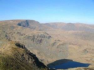 High Street seen from Harter Fell with Small Water in the foreground | |
| Highest point | |
| Elevation | 828 m (2,717 ft) |
| Prominence | 373 m (1,224 ft) |
| Parent peak | Helvellyn |
| Listing | Marilyn, Hewitt, Wainwright, Nuttall |
| Coordinates | 54°29′31″N 2°51′54″W |
| Geography | |
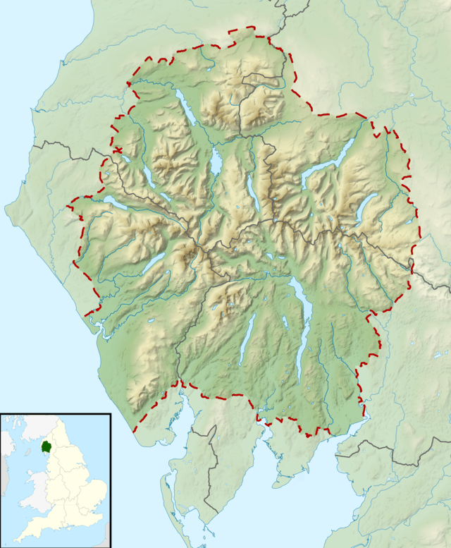 High Street Location in the Lake District | |
| Location | Cumbria, England |
| Parent range | Lake District, Far Eastern Fells |
| OS grid | NY440110 |
| Topo map | OS Explorer OL5 |
History and name
The Roman road crosses the fell on its journey between the forts at Brougham (Brocavum) near Penrith and at Ambleside (Galava).[1] Situated in one of the quieter areas of the Lakes, the High Street range has quite gentle slopes with a flat summit plateau. It was these characteristics which persuaded Roman surveyors to build their road over the fell tops rather than through the valleys which, at the time, were densely forested and marshy thus making them susceptible to ambushes.
The fell's flat summit was also used as a venue for summer fairs by the local population in the 18th and 19th centuries.[2] People from the surrounding valleys would gather every year on 12 July to return stray sheep to their owners; games and wrestling would also take place as well as horse racing. The summit of High Street is still known as Racecourse Hill,[3] and is so named on maps, and fell ponies can be found grazing occasionally on its summit. The last of the summer fairs was held in 1835.
Topography
The River Kent, which flows south through the town of Kendal before emptying into Morecambe Bay, has its source on High Street's southern slopes.[4] Dropping 300 m in 40 km (1000 feet in 25 miles), the Kent is reputed to be the fastest-flowing river in England.
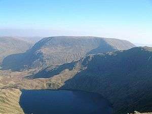
High Street's eastern side is craggy and precipitous as it falls away towards Haweswater Reservoir. There are two tarns underneath the eastern crags — Blea Water and Small Water; Blea Water stands in a classic mountain corrie and at 200 feet is the deepest tarn in the Lake District.[5]
Summit
A wall follows the ridge over the flat summit, the highest point marked by an Ordnance Survey triangulation column which has been painted white. The view stretches from the Pennines in the east to a great arc of Lakeland hills filling the western horizon. The Helvellyn range and Southern Fells are particularly striking.[6]
Ascents
The climb from Mardale is an exhilarating ridge walk,[7] with views down into Riggindale which at one time might have been supplemented by the sight of a golden eagle[8] — Riggindale had the only bird of this kind left in England, a solitary male, which had been on its own there since 2004, but has not been seen since 2016. High Street can also be climbed from Patterdale, Kentmere and Troutbeck. Other routes include a walk from Troutbeck - which follows the line of the Roman road. The full south-to-north traverse of the High Street ridge from Ings near Windermere to the Eamont valley at the northern end of Ullswater is a 30-kilometre hike over twelve summits, and should be undertaken only by experienced walkers.[6][9]
See also
References
- B Conduit, Lake District Walks (Norwich 1991) p. 65
- H Davies, A Walk around the Lakes (London 1989) p. 234
- B Conduit, Lake District Walks (Norwich 1991) p. 65
- A Wainwright, Wainwright in the Valleys of Lakeland (London 1992) p. 40
- Blair, Don: Exploring Lakeland Tarns: Lakeland Manor Press (2003): ISBN 0-9543904-1-5
- Alfred Wainwright:A Pictorial Guide to the Lakeland Fells, Book 2: ISBN 0-7112-2455-2
- B Conduit, Lake District Walks (Norwich 1991) p. 65
- A Wainwright, Wainwright in the Valleys of Lakeland (London 1992) p. 31
- Bill Birkett: Complete Lakeland Fells: Collins Willow (1994):ISBN 0-00-713629-3
| Wikimedia Commons has media related to High Street (Lake District). |
External links
- Computer generated summit panorama High * [http://www.lakedistrictwalks.net/high-street-walk Lake District Walks - High Street walk] Street index
![High * [http://www.lakedistrictwalks.net/high-street-walk Lake District Walks - High Street walk] Street](http://www.viewfinderpanoramas.org/panoramas/CUM/Highstreet.gif)
Marilyns of Northern England | ||
|---|---|---|
| 1. Northumberland |  | |
| 2. Northern Lakeland | ||
| 3. Western Lakeland | ||
| 4. Central and Southern Lakeland |
| |
| 5. Eastern Lakeland | ||
| 6. North Pennines and Durham | ||
| 7. Northern Yorkshire Dales | ||
| 8. Southern Yorkshire Dales | ||
| 9. North York Moors to the Humber | ||
| 10. Forest of Bowland |
| |