Hersfeld-Rotenburg
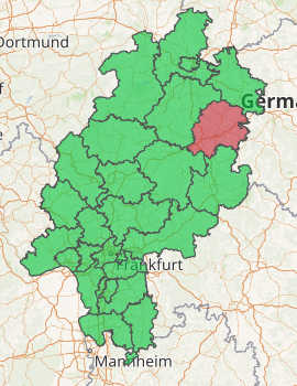
Hersfeld-Rotenburg is a Kreis (district) in the east of Hesse, Germany. Neighboring districts are Werra-Meißner, Wartburgkreis, Fulda, Vogelsbergkreis, Schwalm-Eder.
Hersfeld-Rotenburg | |
|---|---|
| |
| Country | Germany |
| State | Hesse |
| Adm. region | Kassel |
| Capital | Bad Hersfeld |
| Area | |
| • Total | 1,097.08 km2 (423.58 sq mi) |
| Population (31 December 2018)[1] | |
| • Total | 120,829 |
| • Density | 110/km2 (290/sq mi) |
| Time zone | UTC+01:00 (CET) |
| • Summer (DST) | UTC+02:00 (CEST) |
| Vehicle registration | HEF |
| Website | http://www.hef-rof.de |
History
In 1821 districts were created in Hesse, including the districts Hersfeld and Rotenburg, which stayed nearly unchanged (except a short period after the revolution of 1848 when they were dissolved) through the annexion of Hesse-Kassel (or Hesse-Cassel) by Prussia and the creation of the Hesse state. In 1972 both districts were merged into one.
Geography
The district contains the hilly landscape of Waldhessen, the mountains are of the Knüllgebirge, Stölzinger Gebirge, Richelsdorfer Gebirge and the Kuppenrhön, part of the Rhön mountains.
Coat of arms
 |
The coat of arms is a combination of the two coat of arms of the precursor districts. The cross in the left half is taken from the old arms of the Hersfeld abbey; the linden branch is taken from the city arms of Rotenburg. |
Towns and municipalities
| Towns | Municipalities | |
|---|---|---|
References
- "Bevölkerungsstand am 31.12.2018". Hessisches Statistisches Landesamt (in German). July 2019.
External links
| Wikimedia Commons has media related to Landkreis Hersfeld-Rotenburg. |
- Official website (in German)
- Touristic website (in German)
| Authority control |
|
|---|
This article is issued from Wikipedia. The text is licensed under Creative Commons - Attribution - Sharealike. Additional terms may apply for the media files.