Hepburn Avenue
Hepburn Avenue is an arterial east-west road in the northern suburbs of Perth, Western Australia. The road links Sorrento in the west with Malaga and Whiteman in the east. It also connects the residential developments that span its length with several local facilities, as well as major road routes into central Perth.
Hepburn Avenue | |
|---|---|
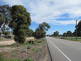 | |
Single carriageway section near Lyrebird Square, Ballajura | |

| |
| General information | |
| Type | Road |
| Length | 18 km (11 mi) |
| Route number(s) | |
| Major junctions | |
| West end | |
| |
| East end | |
| Location(s) | |
| Major suburbs | Sorrento, Padbury, Duncraig, KingsleyGreenwood, Marangaroo, Ballajura |
History
The road was built in the 1980s to meet suburban demand and was originally proposed on the Metropolitan Region Scheme as a freeway. It was named after Alistair Hepburn (1915-2004), one of the drafters of the Scheme together with Professor Gordon Stephenson (1908–1997). Subsequent additions east of Wanneroo Road, the original terminus, have been built in stages - in the late 1990s it was extended further east, reaching Alexander Drive in 2005, and extending to Beechboro Road in October 2010.[1] The opening of the extension was delayed several months due to street lighting issues.[2] Construction began on the next 1.3 kilometres (0.81 mi) extension through to Marshall Road in August 2010,[2] and was opened in June 2012.[3]
Works to upgrade Hepburn Avenue to a dual carriageway were constructed between the late 2000s to the early 2010s. The first stage was from Wanneroo Road to Giralt Road, completed in the late 2000s. Next was from Alexander Drive to Mirrabooka Avenue, completed in 2010. The remaining part between Mirrabooka Avenue and Bellerive Boulevard was upgraded in 2012. The last section to become a dual carriageway, east of Alexander Drive was completed in 2017.
During 2018-19, the eastern end of Hepburn Avenue was upgraded to link with a realigned Beechboro Road North at a grade separated roundabout interchange with Tonkin Highway as part of NorthLink WA[4]
Route description
Hepburn Avenue begins in a roundabout intersection, joining with West Coast Drive, Whitfords Avenue and Hillarys Boat Harbour carpark, and ends at a roundabout interchange at Tonkin Highway, continuing eastwards as Beechboro Road North. Hepburn Avenue provides direct access to Kingsway City shopping centre in Madeley and St Stephen's School in Duncraig, as well as the Greenwood railway station, which was constructed at the Mitchell Freeway intersection, and opened in January 2005.[5] Hepburn Avenue is a four lane dual carriageway for its entire length (an exception was the section between Beechboro Road North and Marshall Road but this was removed with the development of NorthLink WA). State Route 82 starts at the roundabout where Hepburn Avenue begins and ends at the interchange with Tonkin Highway and Beechboro Road North, until 2019 this only extended eastwards to Wanneroo Road.
Major intersections


- Gibson Avenue, Padbury
- Lilburne Road, Duncraig
- Glengarry Drive, Duncraig

- Kingsley Drive, Kingsley
- Barridale Drive, Kingsley
- Allenswood Road, Greenwood
- Moolanda Boulevard, Kingsley
- Cockman Road, Greenwood

- Hartman Dr, Madeley, Marangaroo and Darch
- Mirrabooka Avenue, Darch, Marangaroo, Landsdale and Alexander Heights


Former intersections
- Marshall Road, Malaga (removed as part of NorthLink WA)
See also
![]()
References
- "Hepburn Ave link now open". The Advocate. 14 July 2009. Archived from the original on 24 February 2014. Retrieved 17 June 2012.
- "Hepburn Ave extension plan". Eastern Reporter. 27 July 2010. Archived from the original on 24 February 2014. Retrieved 17 June 2012.
- "Community celebrates new Hepburn Avenue extension". Media Release. City of Swan. 12 June 2012. Archived from the original on 21 February 2014. Retrieved 3 July 2012.
- https://project.mainroads.wa.gov.au/northlinkwa/Pages/default.aspx
- "Services commence from Greenwood Railway Station". Ministerial Media Statements. Government of Western Australia. 29 January 2005. Archived from the original on 27 November 2012. Retrieved 3 July 2012.
| National Highways | |||
|---|---|---|---|
| National Routes | |||
| State Routes | |||
| Tourist Drives |
| ||