Heathcote, New South Wales
Heathcote is a suburb, in southern Sydney, in the state of New South Wales, Australia. Heathcote is located 36 km south of the Sydney central business district in the Sutherland Shire. Heathcote is bordered by Engadine to the north and Waterfall to the south. It is bounded by The Royal National Park to the east, and Heathcote National Park to the west.[2]
| Heathcote Sydney, New South Wales | |||||||||||||||
|---|---|---|---|---|---|---|---|---|---|---|---|---|---|---|---|
 Heathcote Bottle Forest Cottage (west heathcote) | |||||||||||||||
| Population | 6,013 (2016 census)[1] | ||||||||||||||
| Postcode(s) | 2233 | ||||||||||||||
| Elevation | 188 m (617 ft) | ||||||||||||||
| Location | 36 km (22 mi) from Sydney CBD | ||||||||||||||
| LGA(s) | Sutherland Shire | ||||||||||||||
| State electorate(s) | Heathcote | ||||||||||||||
| Federal Division(s) | Hughes | ||||||||||||||
| |||||||||||||||
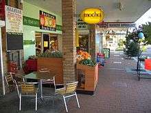
Heathcote is separated into two sections by the railway line. Heathcote East contains two of the schools and a sports oval. Heathcote West is the larger side with the majority of residents. South Metropolitan Scouts Association[3] has a camping ground and training centre in Boundary Road. A small group of shops is located on the western side, near the railway station on Princes Highway. The Sutherland Shire Emergency Services Centre is located on the eastern side, beside the railway station.
History
Heathcote was originally known as Bottle Forest. There were fourteen town allotments in Bottle Forest in 1842, in what is now Heathcote East.[4] In 1835 Surveyor-General Sir Thomas Mitchell (1792–1855) conducted a survey of the area and named it Heathcote, in honour of an officer who had fought with him during the Peninsula Wars against Napoleon.
Heathcote railway station opened in 1886. Heathcote Hall (The Hall) was built in Heathcote East in 1887 by Abel Harber, a brick manufacturer. This grand Victorian house included a tower, which was a symbol of wealth. Harber suffered heavy financial losses during the construction of the Imperial Arcade in Sydney and attempted to dispose of the property but the 1892 depression did not help. The financial institution became the house’s possessor and they arranged with George Adams of Tattersalls to organise a sweepstake with the house as a prize. The winner was Mr S. Gillett, a Sydney builder. The property was sold to Edmond Lamb Brown in 1901[5] and as of September 2014 it still stands, though in a "dilapidated" state.[6] The movie The Munsters' Scary Little Christmas was filmed at 'The Hall'.[6][7]
On 28 March 1910 at the Easter camp for military training exercises at Heathcote, Lieutenant George Augustine Taylor, an officer in the Intelligence Corps of the Militia, organised the first military wireless (radio) transmissions in Australia to demonstrate the strategic possibilities of the technology to monitor and report on enemy troop movements. As the military had no wireless capability Lt Taylor co-opted the services of 3 civilian experts who volunteered to carry out the experiments. The three civilians Messers Kirkby, Hannam and Wilkinson brought all their own equipment with them. They arrived at Heathcote by train and all their equipment was dumped on the platform. Two sites were established to conduct the tests from a station A and a station B. Station A was in a tent adjacent to the gatekeepers cottage at Heathcote Station. Station B was 2 miles to the south in a cave on a landmark 'Spion Kop' in what is now Heathcote National Park. The purpose of the demonstration was to observe enemy troop movements from the south. It was assumed that the enemy were encamped 7 miles to the south at Garrawarra. The experiments were successful and Taylor gave all credit to the civilian experts.[8]
The Heathcote to Waterfall bushwalk became popular as a day outing in the 1930s, and the many tracks in Heathcote National Park and Royal National Park are used by Scouts Australia as well as bushwalkers in general. There is a scout camping area called Camp Coutts in Heathcote National Park, adjacent to the suburb of Waterfall.[2]
The Olympic Torch was carried through the shopping centre in 2000.
From Bottle Forest to Heathcote - the Sutherland Shire's First Settlement is the history of Heathcote which was written by Patrick Kennedy in 1999.
Heritage listings
Heathcote has a number of heritage-listed sites, including:
- 1-21 Dillwynnia Grove: Heathcote Hall[9]
Population
At the 2016 census, there were 6,013 residents in Heathcote. 86.6% of people were born in Australia. The next most common country of birth was England at 3.9%. 93.3% of people spoke only English at home. The most common ancestries were English 32.5%, Australian 31.4%, Irish 9.9%, Scottish 7.9% and German 2.4%. The top responses for religious affiliation were Catholic 27.4%, No Religion 25.7%, and Anglican 24.5%. Home ownership was popular in Heathcote, with 40.5% of people owning their home outright and 42.2% paying off a mortgage.[1]
Transport


Heathcote railway station is on the Sydney Trains Eastern Suburbs & Illawarra Line.[10] A bus service also links Engadine with Heathcote.
F6 Extension that was to be built from Waterfall F6 right through to Alexandria will now not be built. Much of the land was given to the Royal National Park and now can not be used. This road is often in political small talk.
Heathcote Road meets the Princes Highway at Heathcote. Heathcote Road is a major link to the north western suburbs, while the Princes Highway links Sydney and Wollongong.
For many years several people were fatally struck by cars while crossing the Princes Highway at Heathcote. The traffic lights at the intersection are the last south-bound out of Sydney but were also the only highway crossing point for both rail commuters and high-school students from West Heathcote. In July 2006, a 13-year-old boy was killed and, in response to local concerns the speed limit was soon lowered to 50 km/h, However, in an attempt to increase traffic flow, the speed limit was subsequently re-raised to 60 km/h and, as of 2012, plans for a pedestrian overpass were put in place. In late 2014 the overpass was opened and the crossing closed.
Education
Heathcote's government schools are operated by the New South Wales Department of Education and Training.
Heathcote has three public schools: Heathcote Public School (the oldest school in the Sutherland Shire opened on the 15 November 1886), Heathcote East Public School, Heathcote High School.[11] The high school services Heathcote residents and also residents of the nearby suburbs of Engadine, Helensburgh, Waterfall, Woronora Heights and Stanwell Park. Heathcote high school is a leafy, modern high school with well educated teachers and high marks for the HSE. In 2010, a year 12 student got an outstanding mark of 99.05.[12] In 2015 a year 12 student also achieved the maximum ATAR of 99.95.[13] The school also has a very strict anti bullying policy.
Notable people
- John Meredith, Australian folklorist and musician, resided in Heathcote between 1952 and 1954 and founded the original Australian Bush band The Bushwhackers (originally "The Heathcote Bushwhackers") there in 1952
- April Letton, NSW Netball player
- Ella Nelson, Athletics, Rio Olympian in 200m, 2014 Commonwealth Games Glasgow, Scotland 200m
References
- Australian Bureau of Statistics (27 June 2017). "Heathcote (State Suburb)". 2016 Census QuickStats. Retrieved 17 February 2018.

- Sydney and Blue Mountains Bushwalks, Neil Paton, Kangaroo Press, 2004
- "Archived copy". Archived from the original on 28 July 2008. Retrieved 29 November 2008.CS1 maint: archived copy as title (link)
- "Sutherland Shire Council".
- Pollon, Frances, ed. (1990). Book of Sydney Suburbs. Angus and Robertson.
- Trembath, Murray (6 September 2014). "Historic Heathcote Hall, once a setting for a Munsters film shoot, may become retirement village". The St George and Sutherland Shire Leader. Retrieved 12 March 2015.
Plans to restore the dilapidated, historic mansion Heathcote Hall as part of a retirement village development may soon be revealed.
- The Munsters Film at 'The Hall'
- By Wireless - How we got the signals through, Lieutenant George A Taylor, cc 1910
- "Heathcote Hall". New South Wales State Heritage Register. Office of Environment and Heritage. H00191. Retrieved 18 May 2018.
- Kennedy, Patrick (1999). From Bottle Forest to Heathcote : Sutherland Shire's First Settlement. Patrick Kennedy. ISBN 0-646-38293-4.
- Kennedy, Patrick (1999). From Bottle Forest to Heathcote ; Sutherland Shire's First Settlement. Patrick Kennedy. ISBN 0-646-38293-4.
- "Heathcote High School | HSC Results 2010". www.heathcote-h.schools.nsw.edu.au. Retrieved 7 November 2016.
- "Heathcote High School | Congratulations Year 12 2015". www.heathcote-h.schools.nsw.edu.au. Retrieved 7 November 2016.
- Sources
- The Book of Sydney Suburbs, Frances Pollen, Angus & Robertson Publishers, 1990, Published in Australia. ISBN 0-207-14495-8
- From Bottle Forest to Heathcote - the Sutherland Shire's First Settlement. Written by Patrick Kennedy 1999. Reprinted 2003.ISBN 0-646-38293-4
- By Wireless - How we got the signals through Lieutenant George A Taylor, cc 1910
| Wikimedia Commons has media related to Heathcote, New South Wales. |