Hato Rey Norte
Hato Rey Norte is one of the 18 barrios of the municipality of San Juan, Puerto Rico. Hato Rey Norte was part of the former municipality of Rio Piedras, before it was merged with the municipality of San Juan in 1951.
Hato Rey Norte | |
|---|---|
Barrio | |
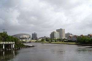 Hato Rey Norte skyline, with Martín Peña Canal and José Miguel Agrelot Coliseum | |
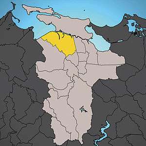 Location of Hato Rey Norte shown in yellow. | |
| Commonwealth | |
| Municipality | |
| Area | |
| • Total | 9.1 km2 (3.53 sq mi) |
| Population (2010)[1] | |
| • Total | 16,640 |
| • Density | 1,800/km2 (4,700/sq mi) |
| 2010 census | |
It is bounded by Hato Rey Central to the east, the districts of Gobernador Piñero and Hato Rey Sur to the south, and by Santurce to the north. The Caño Martín Peña separates Hato Rey Norte from Santurce.
Subbarrios
The barrio of Hato Rey Norte is further subdivided into four subbarrios.[2]
References
- "Profile of General Population and Housing Characteristics: 2010". Census.gov. Archived from the original on May 21, 2019. Retrieved November 10, 2012.
- "US Census definition of "subbarrio"". factfinder.com. US Census. Archived from the original on 12 February 2019. Retrieved 5 January 2019.
| ||
| Barrios |
| |
This article is issued from Wikipedia. The text is licensed under Creative Commons - Attribution - Sharealike. Additional terms may apply for the media files.