Haruno, Shizuoka
Haruno (春野町, Haruno-chō) was a town located in Shūchi District, Shizuoka Prefecture, Japan. Haruno was founded as a town on September 30, 1956.
Haruno 春野町 | |
|---|---|
Former municipality | |
 Flag  Emblem | |
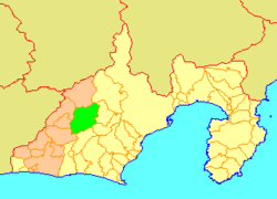 Location of Haruno in Shizuoka Prefecture | |
 Haruno Location in Japan | |
| Coordinates: 35.0022°N 137.9063°E | |
| Country | Japan |
| Region | Chūbu (Tōkai) |
| Prefecture | Shizuoka Prefecture |
| District | Shūchi |
| Merged | July 1, 2005 (now part of Tenryū-ku, Hamamatsu) |
| Area | |
| • Total | 252.17 km2 (97.36 sq mi) |
| Population (June 1, 2005) | |
| • Total | 5,953 |
| • Density | 23.6/km2 (61/sq mi) |
| Symbols | |
| • Tree | Maple |
| • Flower | Azalea |
| • Bird | Japanese bush-warbler |
| Time zone | UTC+9 (JST) |
As of June 1, 2005, the town had an estimated population of 5,953 and a density of 23.6 persons per km2. The total area was 252.17 km2. Mount Akiba was located within the town limits.
On July 1, 2005, Haruno, along with the cities of Tenryū and Hamakita, the towns of Hosoe, Inasa and Mikkabi (all from Inasa District), the towns of Misakubo and Sakuma, the village of Tatsuyama (all from Iwata District), and the towns of Maisaka and Yūtō (both from Hamana District), was merged into the expanded city of Hamamatsu, and is now part of Tenryū-ku, Hamamatsu.
External links
- Hamamatsu official website (in Japanese)
| Authority control |
|
|---|
This article is issued from Wikipedia. The text is licensed under Creative Commons - Attribution - Sharealike. Additional terms may apply for the media files.