Hamakita, Shizuoka
Hamakita (浜北市, Hamakita-shi) was a city located in western Shizuoka Prefecture, Japan.
Hamakita 浜北市 | |
|---|---|
Former municipality | |
 Flag  Emblem | |
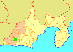 Location of Hamakita in Shizuoka Prefecture | |
 Hamakita Location in Japan | |
| Coordinates: 34°47′35″N 137°47′24″E | |
| Country | Japan |
| Region | Chūbu (Tōkai) |
| Prefecture | Shizuoka Prefecture |
| Merged | July 1, 2005 (now part of Hamakita-ku, Hamamatsu) |
| Area | |
| • Total | 66.64 km2 (25.73 sq mi) |
| Population (April 1, 2005) | |
| • Total | 86,653 |
| • Density | 1,300/km2 (3,000/sq mi) |
| Symbols | |
| • Tree | Podocarpus macrophyllus |
| • Flower | Rhododendron |
| • Bird | Japanese white-eye |
| Time zone | UTC+9 (JST) |
On April 1, 2005, the city had an estimated population of 86,653 and a density of 1,300.00 persons per km2. The total area was 66.64 km2. It is now part of ward of Hamakita when the city of Hamamatsu became a designated city on April 1, 2007.
On July 1, 2005, Hamakita, along with the city of Tenryū, the town of Haruno (from Shūchi District), the towns of Hosoe, Inasa and Mikkabi (all from Inasa District), the towns of Sakuma and Misakubo, the village of Tatsuyama (all from Iwata District), and the towns of Maisaka and Yūtō (both from Hamana District), was merged into the expanded city of Hamamatsu.
The name "Hamakita" is often mistaken to come from "North of the city of Hamamatsu" (浜松市の北). However, when the town of Hamakita was formed, the town took one letter each from the component villages of Hamana Village and Kitahama Village to form the name "Hamakita".
External links
- 天竜浜名湖地域合併評議会 (in Japanese)
| Authority control |
|
|---|