Harmony, Vernon County, Wisconsin
Harmony is a town in Vernon County, Wisconsin, United States. The population was 739 at the 2000 census. The unincorporated community of Newton is located in the town.
Harmony, Wisconsin | |
|---|---|
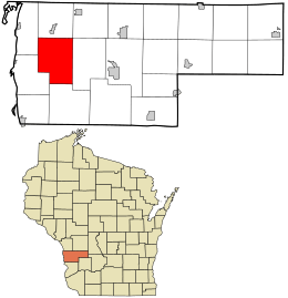 Location in Vernon County and the state of Wisconsin. | |
| Coordinates: 43°34′43″N 91°5′30″W | |
| Country | |
| State | |
| County | Vernon |
| Area | |
| • Total | 42.9 sq mi (111.1 km2) |
| • Land | 42.9 sq mi (111.1 km2) |
| • Water | 0.0 sq mi (0.0 km2) |
| Elevation | 745 ft (227 m) |
| Population (2000) | |
| • Total | 739 |
| • Density | 17.2/sq mi (6.7/km2) |
| Time zone | UTC-6 (Central (CST)) |
| • Summer (DST) | UTC-5 (CDT) |
| Area code(s) | 608 |
| FIPS code | 55-32725[2] |
| GNIS feature ID | 1583352[1] |
| Website | http://tn.harmony.wi.gov/index.html |
Geography
According to the United States Census Bureau, the town has a total area of 42.9 square miles (111.1 km²), all of it land.
Demographics
At the 2010 census there were 755 people in 266 households, including 208 families, in the town. The population density was 17.2 people per square mile (6.7/km²). There were 308 housing units at an average density of 6.5 per square mile (2.5/km²). The racial makeup of the town was 98.1% White, 0.4% Native American, 0.3% Asian, 0.5% from other races, and 1.5% from two or more races. Hispanic or Latino of any race were 1.5%.[2]
Of the 266 households 32.3% had children under the age of 18 living with them, 11% had a female householder with no husband present, and 21.8% were non-families. 16.9% of households were one person and 6% were one person aged 65 or older. The average household size was 2.84 and the average family size was 3.23.
The age distribution was 30.9% under the age of 20, 6% from 20 to 24, 18.4% from 25 to 44, 33.7% from 45 to 64, and 11.3% 65 or older. The median age was 40.6 years. For every 100 females, there were 100.8 males.
The median household income was $41,000 and the median family income was $51,417. Males had a median income of $36,375 versus $19,167 for females. The per capita income for the town was $21,556. About 18.3% of families and 33.6% of the population were below the poverty line, including 58.6% of those under age 18 and 3.1% of those age 65 or over.
Historical places
- The Tollackson Mound Group is located within the town.
References
- "US Board on Geographic Names". United States Geological Survey. 2007-10-25. Retrieved 2008-01-31.
- "U.S. Census website". United States Census Bureau. Retrieved 2008-01-31.
Municipalities and communities of Vernon County, Wisconsin, United States | ||
|---|---|---|
| Cities | 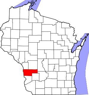 | |
| Villages | ||
| Towns | ||
| Unincorporated communities | ||
| Indian reservation | ||
| Footnotes | ‡This populated place also has portions in an adjacent county or counties | |