Hamju County
Hamju County is a county in South Hamgyong province, North Korea.
Hamju County 함주군 | |
|---|---|
| Korean transcription(s) | |
| • Chosŏn'gŭl | 함주군 |
| • Hancha | 咸州郡 |
| • McCune-Reischauer | Hamju kun |
| • Revised Romanization | Hamju-gun |
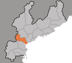 Map of South Hamgyong showing the location of Hamju | |
| Country | North Korea |
| Province | South Hamgyong Province |
| Administrative divisions | 1 ŭp, 36 ri |
Physical features
The county's highest point is Norabong. The chief river is the Sangch'ŏn River (상천강). Aside from the coastal area, Hamju is mountainous throughout. It is cold, but is distinguished by the occurrence of foehn winds in the upland areas. Due to this, the climate is milder than the Yellow Sea coastal regions.
Administrative divisions
Hamju county is divided into 1 ŭp (town) and 36 ri (villages):
|
|
Economy
Agriculture and fishery
In the level regions, a large amount of rice is produced. Most agriculture in the county is dry-field farming, with crops including Deccan millet, red beans, soybeans, potatoes, and vegetables. Silkworms and livestock are also widely raised, and fishing is carried out along the coast.
Transport
Hamju county is served by the P'yŏngra and Kŭmgol lines of the Korean State Railway, and by various roads.