Hậu Giang Province
Hậu Giang (![]()
Hậu Giang Province Tỉnh Hậu Giang | |
|---|---|
 | |
 Seal | |
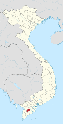 Location of Hậu Giang within Vietnam | |
| Coordinates: 9°47′N 105°28′E | |
| Country | |
| Region | Mekong Delta |
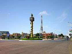
| Capital | Vị Thanh |
| Government | |
| • People's Council Chair | Huỳnh Thanh Tạo |
| • People's Committee Chair | Lữ Văn Hùng |
| Area | |
| • Total | 1,608 km2 (621 sq mi) |
| Population (2019) | |
| • Total | 974,126 |
| • Density | 610/km2 (1,600/sq mi) |
| Demographics | |
| • Ethnicities | Vietnamese, Hoa, Chăm, Khmer |
| Time zone | UTC+7 (ICT) |
| Area codes | 293 |
| ISO 3166 code | VN-73 |
| Website | www |
Until the end of the Vietnam War in 1975, the province included the city of Cần Thơ which was the provincial capital. In 1975, the province was renamed Cần Thơ Province, with the city of Cần Thơ still the capital. In late 2004, Cần Thơ and some surrounding cities became Cần Thơ Municipality (Thành Phố Cần Thơ). The remainder of Cần Thơ Province became Hậu Giang Province.
Hậu Giang has an industrial zone of 902 ha. There are 120 km of national roads: National Highway 61 (which leads to National Highway 1, going through Cần Thơ Municipality on the Hậu River to Ho Chi Minh City), and water connections by canal and river to the Hậu River.
Administrative divisions
Hậu Giang is subdivided into eight district-level sub-divisions:
- 5 districts:
- Châu Thành
- Châu Thành A
- Long Mỹ
- Phụng Hiệp
- Vị Thủy
They are further subdivided into 12 commune-level towns (or townships), 54 communes, and eight wards.
External links
| Wikimedia Commons has media related to Hau Giang. |
Places adjacent to Hậu Giang Province | ||||||||||
|---|---|---|---|---|---|---|---|---|---|---|
| ||||||||||