Guer
Guer (Breton: Gwern-Porc'hoed) is a commune in the Morbihan department in Brittany in north-western France.
Guer Gwern-Porc'hoed | |
|---|---|
 Saint Nicolas chapel near Guer | |
.svg.png) Coat of arms | |
Location of Guer 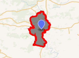
| |
 Guer  Guer | |
| Coordinates: 47°54′17″N 2°07′09″W | |
| Country | France |
| Region | Brittany |
| Department | Morbihan |
| Arrondissement | Vannes |
| Canton | Guer |
| Intercommunality | Pays de Guer |
| Government | |
| • Mayor (2008—2014) | Jean-Luc Bléher |
| Area 1 | 52.11 km2 (20.12 sq mi) |
| Population (2017-01-01)[1] | 6,192 |
| • Density | 120/km2 (310/sq mi) |
| Time zone | UTC+01:00 (CET) |
| • Summer (DST) | UTC+02:00 (CEST) |
| INSEE/Postal code | 56075 /56380 |
| Elevation | 18–155 m (59–509 ft) (avg. 50 m or 160 ft) |
| 1 French Land Register data, which excludes lakes, ponds, glaciers > 1 km2 (0.386 sq mi or 247 acres) and river estuaries. | |
It is located at the edge of the famous Brocéliande Forest, which is the setting of the Round Table novels in Brittany. It is 43 km (27 mi) southwest from Rennes, the regional capital.
Camp Coëtquidan (Camp de Coëtquidan) is located in Guer and comprises three military educational facilities:
- École Spéciale Militaire de Saint-Cyr, France's foremost military academy dedicated to the training of Army officers through direct recruitment;
- École militaire interarmes (inter-services military school), for non-commissioned officers; and
- École Militaire du Corps Technique et Administratif (military school of the technical and administrative corps).
Demographics
Inhabitants of Guer are called Guerrois.
See also
References
- "Populations légales 2017". INSEE. Retrieved 6 January 2020.
- Mayors of Morbihan Association (in French)
- INSEE commune file
External links

- Official site (in French)
- French Ministry of Culture list for Guer (in French)
| Authority control |
|
|---|
This article is issued from Wikipedia. The text is licensed under Creative Commons - Attribution - Sharealike. Additional terms may apply for the media files.